Posts

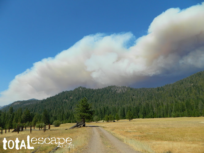
California Wildfire Affected Areas: Creek Fire

Image
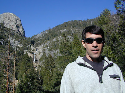
2020 Creek Fire Fresno County & Madera County 379,895 Acres burned 856 buildings destroyed Ron @ Big Creek Falls 2003 News Headlines: California National Guard rescued 242 people by helicopter from the Mammoth Pool Boat Launch throughout the night, due to a fast moving wildfire.   Central Sierra Nevada Mountains Big Creek Powerhouse Shaver Lake, CA Huntington Lake, CA Lakeshore, CA North Fork, CA Tollhouse, CA Mammoth Pool - summer 2008 Sierra Areas affected by the wildfire: California SR 168 (Highway 168) Huntington Lake Road Alder Springs Rd Dawn Road Musik Peak Rd Million Dollar Road County Road 233 County Road 2710 Minerets Road Sierra Vista Scenic Byway Sierra National Forest Ansel Adams Wilderness Kaiser Wilderness  Kaiser Pass Road Balsam Creek Balsam Forebay Balsam Meadow Balsam Meadows Sno-Park Bear Meadow Brown Cone Burrough Valley Cascadel Woods Cassidy Meadows Cedar Crest China Peak Ski Resort Chiquito Creek Chiquito Ridge Coyote Sno-Park Devils Table Edison Lake E

California Wildfire Affected Areas: Walkers Fire

Image
2021 Walkers Fire Tulare County 8,777 Acres Golden Trout Wilderness  Great Western Divide Little Kern River Sequoia National Forest Areas Affected by Wildfire: Newlywed Quinn Peak Shotgun Creek Soda Butte Soda Spring Creek South Fork Meadows Trail Tamarack Creek Hiking Trails # Affected 31E12 31E13 31E23 32E02 Walkers Fire Map JPG NOTE: There was another Walker wildfire in California called the Walker Fire 2019

California Wildfire Affected Areas: KNP Complex

Image
Colony Fire + Paradise Fire 2021 KNP Complex Tulare County 88,307 Acres Giant Forest, California Portions of Sequoia National Park have reopened but the south entrance is closed. Call ahead to find out current conditions and snow levels. DEATH RATE of Sequoias Between 10 to 14 percent of the entire Sierra Nevada population of giant sequoia trees over 4 feet in diameter were killed in the Castle Fire of 2020. Early estimates expect that on two fires in 2021, the KNP Complex and the Windy Fire, between 2,261 to 3,637 sequoias have already been killed or will die within a few years. wildfiretoday.com/tag/knp-complex/ Parks & Forests Affected by this Wildfire: Kings Canyon National Park  Sequoia National Park Generals Highway 198 Mineral King Road Buckeye Flat Campground  NPS Dorst Creek Campground NPS Potwisha Campground NPS Generals Highway Sequoia NP Areas Affected by Wildfire: Ash Mountain Big Baldy Ridge Big Tree Trail Buena Vista Creek Burnt Point Creek Cactus Point Castle Rocks

California Wildfire Affected Areas: Windy Fire

Image
2021 Windy Fire 97,528 Acres Tulare County Johnsondale, CA Ponderosa, CA Giant Sequoia National Monument Sequoia National Forest Slate Mountain Botanical Area Summit National Recreation Trail Trail of 100 Giants Sequoia Grove Tule River Indian Reservation Tule River South Fork White River Sequoia Groves Western Divide Highway (Mtn Rd 107) Lloyds Meadow Road #22S82 Belknap Campground Coy Flat Campground Frog Meadow Campground Holey Meadow Campground Long Meadow Campground Lower Peppermint Campground Peppermint Campground Redwood Meadow Campground Holey Meadow Campground Bone Creek Boondock Camp Areas Affected by Windy Wildfire: Alder Creek Baker Ridge Bear Creek Bear Meadow Berry Meadow Black Mountain Bond Creek Bone Creek Buck Slide Burnt Ridge Camp Whisett BSA Capinero Creek Capital Rock Cedar Creek Clover Meadow Cold Spring Crane Meadow Crawford Creek Cunningham Davis Canyon Deer Creek Deer Creek Mill Road Dry Meadow Creek Dome Rock Dome Rock Creek Double Bunk Creek Dunlop Meadow Fr

California Wildfire Affected Areas: Beckwourth Fire

Image
2021 Beckwourth Fire Beckwourth Complex Fires Plumas & Lassen Counties   105,670 Acres Doyle, California US Highway 395 Plumas National Forest Dixie Mountain State Game Refuge Frenchman Lake     Campgrounds affected by this fire:   Big Cove Campground Cottonwood Springs Campground Frenchman Campground Spring Creek Campground Chilcoot Campground   Areas affected by this fire:   Adams Peak Bird Hills Charles Creek Chimney Canyon Constantia Road Cannon Field Crystal Peak Diamond Mountains Dixie Mountain Dixie Valley Downing Canyon Doyle Grade Road Frenchman Cove Frenchman Creek Horton Ridge Last Chance Creek Lookout Creek Mule Ear Road Omira Ramelli Creek Reconnaissance Peak Robinson Canyon Robinson Creek Rowland Creek Spring Creek Sugarloaf Mountain Sugarloaf Road Whiskey Canyon Willow Ranch Creek   Forest Roads affected by this fire: County Road 284 Plumas Forest Road 01 Forest Rte #24N01 Forest Rte #24N02Y Forest Rte #25N34     https://en.wikipedia.org/wiki/Beckwourth_Comple

California Wildfire Affected Areas: French Fire

Image
2021 French Fire 26,535 Acres burned Kern County, California Alta Sierra, CA Wofford Heights, CA CA SR 155 (Highway 155) Cabin in Cedar Forest Sequoia National Forest  Greenhorn Mountain Park Alta Sierra Ski Resort @ Shirley Meadows Forest Roads affected by this fire: Forest Road 710 Forest Rte #24S15 Forest Rte #25S02 Forest Rte #25S15 Forest Rte #26S03 Forest Rte #26S16 Forest Rte #26S19     Campgrounds affected by this fire:   Cedar Creek Campground Evans Flat Campground Greenhorn Mountain Park Campground   Areas Affected by Wildfire: Alder Creek Barn Canyon Basket Ridge Bear Creek Black Mountain Cedar Creek Cooks Peak Evans Road (SR 155) French Gulch Greenhorn Mountains Greenhorn Summit Ice House Creek Likely Saddle Lumreau Creek Old State Road Poso Creek East Red Mountain Sawmill Road Shirley Creek Slick Rock Creek Stable Creek Tillie Creek Wagy Flat White Mill Road Willow Flat Windy Gap Woodward Creek Clouds @ Greenhorn Summit   https://en.wikipedia.org/wiki/French_Fire_(2021) F

California Wildfire Affected Areas: Dixie Fire

Image
Dixie Fire 2021    963,309 Acres burned Butte County, California Plumas County, California Lassen County, California Shasta County, California Tehama County, California Almanor, CA Belden Town, CA Bucks Lake, CA Buntingville, CA Butte Meadows, CA Canyondam, CA Chester, CA Clear Creek, CA Crescent Mills, CA Greenville, CA Jonesville, CA Keddie, CA Meadow Valley, CA Milford, CA Mill Creek, CA Old Station, CA Taylorsville, CA Tobin, CA Twain, CA Westwood, CA   CA SR 70 (Highway 70 N Feather River Canyon) CA SR 36 (Highway 36 E) CA SR 89 (Highway 89) CA SR 44 (Highway 44)   Areas affected by this wildfire: Lassen Volcanic National Park  Lassen National Forest Lassen Volcanic Wilderness Caribou Wilderness Plumas National Forest Bucks Lake Wilderness  Taylorsville County Park Mount Hough State Game Refuge PCT Pacific Crest Trail (Bucks Lake to the Hat Creek Rim) Feather River North Fork  Susan River Headwaters Bucks Lake Beach Antelope Lake Bucks Lake Butt Valley Lake Butte Lake Caribou La