Posts

Showing posts with the label mountains

California Wildfire Affected Areas: Creek Fire
Image
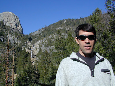
2020 Creek Fire Fresno County & Madera County 379,895 Acres burned 856 buildings destroyed Ron @ Big Creek Falls 2003 News Headlines: California National Guard rescued 242 people by helicopter from the Mammoth Pool Boat Launch throughout the night, due to a fast moving wildfire.   Central Sierra Nevada Mountains Big Creek Powerhouse Shaver Lake, CA Huntington Lake, CA Lakeshore, CA North Fork, CA Tollhouse, CA Mammoth Pool - summer 2008 Sierra Areas affected by the wildfire: California SR 168 (Highway 168) Huntington Lake Road Alder Springs Rd Dawn Road Musik Peak Rd Million Dollar Road County Road 233 County Road 2710 Minerets Road Sierra Vista Scenic Byway Sierra National Forest Ansel Adams Wilderness Kaiser Wilderness  Kaiser Pass Road Balsam Creek Balsam Forebay Balsam Meadow Balsam Meadows Sno-Park Bear Meadow Brown Cone Burrough Valley Cascadel Woods Cassidy Meadows Cedar Crest China Peak Ski Resort Chiquito Creek Chiquito Ridge Coy...

California Wildfire Affected Areas: Caldor Fire

Image
2021 Caldor Fire 221,835 Acres  El Dorado County, California Caldor, CA Grizzly Flats, CA Kirkwood, CA Kyburz, CA Meyers, CA Strawberry, CA Twin Bridges, CA Silver Lake from CA State Route 88 California SR 88 (Hwy 88 Carson Pass) US Highway 50 (Hwy 50) Eldorado National Forest Desolation Wilderness American River , Silver Fork Consumnes River, Steely Fork Consumnes River, Middle Fork Consumnes River, North Fork Wildfire Affected Areas:  Caples Lake Jenkinson Lake Kirkwood Lake Shealor Lakes Silver Lake @ Carson Twin Lakes Woods Lake Wrights Lake Kirkwood Lake Heavenly Valley Ski Resort Iron Mountain Snow Park Kirkwood Ski Resort Sierra Tahoe Ski Resort Caples Lake Campground China Flat Campground Lovers Leap Campground Kirkwood Campground Martin Meadow Campground Middle Fork Consumnes Campground PiPi Campground Sand Flat Campground Silver Fork Campground Silver Lake Campground East Silver Lake Campground West Woods Lake Campground Wrights Lake Campground Kirkwood Campgr...

California Wildfire Affected Areas: Tamarack Fire

Image
2021 Tamarack Fire 68,637 Acres burned Alpine County, California Markleeville, CA Woodfords, CA Hollbrook Highlands, NV Spring Valley, NV US Highway 395 (Hwy 395) California SR 88 (Hwy 88) California SR 89 (Hwy 89)   Meadows near Grover Hot Springs Toiyabe National Forest Turtle Rock County Park Grover Hot Springs State Park   Carson River East Fork Indian Creek Reservoir  Harvey Place Reservoir   Indian Creek Reservoir Wildfire Affected Areas:  Airport Road Barney Riley Bryant Creek Buck Creek Charity Valley Creek Haypress Flat Hot Springs Creek Indian Creek Leviathan Mine Road Little Cottonwood Canyon Millberry Canyon & Creek Mountaineer Creek Musser & Jarvis Creek Pleasant Valley Pleasant Valley Creek Poor Boy Creek Raymond Canyon Creek Sawmill Creek Sawmill Road Scossa Canyon Road Shay Creek Spratt Creek Thornburg Canyon   Markleeville, California       https://en.wikipedia.org/wiki/Tamarack_Fire TAMARACK FIRE peri...

Baja Atlas - Baja Maps - Baja Almanac

Image
Benchmark Maps has a brand new Baja topographic map for 2021 -  The BAJA CALIFORNIA Road & Recreation Atlas This Benchmark atlas showcases the diverse recreation opportunities found along the full length of the Baja California Peninsula. Regional maps provide a wider view of the region and Recreation Guides list an array of attractions for trip planning.  Publish May 2021. ISBN: 9781734315059   Finding good, accurate maps of Baja California Mexico used to be a daunting task. Online searches produced the same, old results with broken links, out-of-date forum postings where travelers exchanged information on where to obtain a decent topo of Baja California.  Amazon.com lists some of the original Baja Almanacs - used or new copies - outrageous priced around $600  Ever since cartographer Landon Crumpton died, Baja lovers have had a hard time locating quality, topographic maps of the famous and popular Mexican peninsula. However, things are again changing. ...

Closed Due to Wildfire

Image
California National Forests, State Parks, Campgrounds, Trails What is Closed off this Summer?   Last year it was multiple disasters on top of a pandemic. News about lightning caused wildfires was almost unbearable for me to watch. I knew the areas, the very best camp sites and the dirt roads.    I studied the headlines daily, scoured maps, each new area, every forests, every acre of grove in flames. The Santa Cruz redwoods burning. The helicopter rescue at the lake campground.   My head was reeling with the destruction, the toxic smoke, when it hit home - hard! We were evacuated and on the run from flames. #BearFire   Now that all smoke has cleared and I am living in the aftermath of the 6th largest fire in state history, I am trying to make a tally of what is burnt. What campgrounds and dirt roads are open, what forests were affected by wildfire and what is actually closed.    California Forests: CLOSED 2021       2021 expect tighter ca...

Water Well Tips - from a homeowner

Image
  Adjusting Your Water Well Pressure Gauge needs to be mounted vertically to prevent water intrusion. If it gets very cold and water freezes inside the gauge, the Bourdon tube will be damaged. This can cause it to add an extra 30 psi to all readings, which is confusing. Having the gauge upright is better to read and keeps the water out. Oh yeah, if it freezes, it's best if the plumbing is insulated with pipe wrap, or the like.  I learned these lessons the hard way. Well Cap should not be loose. The cap is a sandwich of steel plates with a rubber seal that gets squished and becomes wider, sealing itself in the well tube. It is possible for the cap on a new installation to become loose after the rubber forms to its new shape and takes a set. The fasteners on top (4 nuts on mine) should be evenly tightened. Don't over-tighten it, think valve cover gasket, not lug nuts. Bladder Tank Pre-charge needs to be set correctly. Properly pressurized bladder tank is adjusted to 2 psi bel...

California Lakes With Water

Image
California Lake Destinations Record low lake levels at most reservoirs & lakes! The mega drought continues. Don't be disappointed on vacation: Lack of water at your lake destination may leave you mad this season. Know before you go. Check out the California Water Information page for more specific information. Reservoirs listed below are the lakes with the most water in California (as of June 2015). Number represents percent of capacity. WHISKEYTOWN LAKE West of Redding, CA 98% full  LEWISTON LAKE Trinity County, Weaverville, CA 94%  ANTELOPE LAKE Northern Sierra, Susanville, CA 99%  ENGLEBRIGHT LAKE Yuba Gold Co, Grass Valley, CA 95%  BULLARDS BAR Reservoir Gold Country, Grass Valley, CA 59%  ICE HOUSE Reservoir Gold Country, Placerville, CA 84%  UNION VALLEY Reservoir Gold Country, Placerville, CA 81%  LAKE TULLOCH Central Valley, Modesto, CA 96%  INDEPENDENCE LAKE High Sierra, Truckee, CA 95%  PYRAMID LAKE L...

Gold Country Map

Image
Destinations Map of Gold Country All old REGION maps on DESTINATIONS will slowly be replaced this summer with new, customized GoogleMaps. Showing links to small towns, sightseeing stops, hiking trailheads, dining options, cabins and camping. The destinations and links will grow over time with more being added. Sierra Nevada Foothills, Historical Gold Rush California

Sierra Mountains Map

Image
Destinations Map of The Sierras Long ago I began compiling photos and data on remote back roads of the Sierra Nevada mountains. Now it's my (dream) job. Reworking and updating old pages every decade, whether they need it or not. All old REGION maps on DESTINATIONS will slowly be replaced this summer with new, customized GoogleMaps. Showing links to small towns, sightseeing stops, hiking trailheads, dining options, cabins and camping. The highest peaks in the nation seem like a good place to start. Sierra Nevada Mountains, California

California Fire Map

Image
California Wildfires & Fire Information Extreme drought conditions means super high wildfire dangers for all of California. As of August 1st, nearly 60% of the golden state is under EXCEPTIONAL drought, one level up from the 'extreme' classification. We are more than one years worth of water overdue. Wildfires in California are quiet common and occur annually in the later part of the year (summer - autumn)  when the natural vegetation, brush and forests are the driest. Drought.gov will show just how bad the drought conditions are currently in the Western U.S. drought.gov Southern California as well as Northern California experience wildland fires, and since Central California is backed by the Sierra Nevadas, you should expect forest fires at high elevations and lower river canyons too. California is currently experiencing extreme fire dangers, so many parks and forest areas have higher than normal restrictions. The new normal is becoming extreme, as you can im...