California Wildfire Affected Areas: Donnell Fire
Donnell Fire 2018
36,450 Acres
Tuolumne County, California
Carson Iceberg Wilderness
Donnell Lake
Arnot Creek
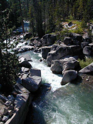
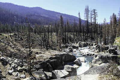
Douglas Creek
Eagle Creek
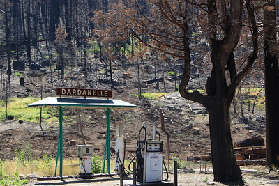
Dardanelle Resort (slowly rebuilding)
Barker Station
Double Dome Rock
 |
| County Line Trailhead |
 |
| Wheats Meadow Trailhead |
Trailheads affected by this wildfire:
Arnot Creek Trailhead
Clark Fork Trailhead
Columns of the Giants
County Line Trailhead
Disaster Creek Trailhead
Seven Pines Trailhead
Wheats Meadow Trailhead
Clark Fork Trailhead
Columns of the Giants
County Line Trailhead
Disaster Creek Trailhead
Seven Pines Trailhead
Wheats Meadow Trailhead
 |
| Meadow at end of Road #6N06 |
Trails affected by this wildfire:
19E06 Trail
19E16 Trail
19E47 Trail
19EV1208 Trail
19EV97 Trail
20E05 Trail
20E07 Trail
20E08 Trail
20E62 Trail
19E16 Trail
19E47 Trail
19EV1208 Trail
19EV97 Trail
20E05 Trail
20E07 Trail
20E08 Trail
20E62 Trail
 |
| NFS Dardanelle Campground in 2004 |
Campgrounds affected by this wildfire:
Boulder Flat Campground
Brightman Flat Campground
Camp Jack Hazard Campground
Clark Fork Campground
Dardanelle Campground
Eureka Valley Campground
Fence Creek Campground
Peaceful Pines Campground
Pigeon Flat Campground
Sand Flat Campground
Brightman Flat Campground
Camp Jack Hazard Campground
Clark Fork Campground
Dardanelle Campground
Eureka Valley Campground
Fence Creek Campground
Peaceful Pines Campground
Pigeon Flat Campground
Sand Flat Campground

Forest Routes affected by this wildfire:
Forest Rte #6N06
Forest Rte #7N83 (Clark Fork)
https://en.wikipedia.org/wiki/Donnell_Fire