Posts

Showing posts from 2010

Waterproof Maps

Image
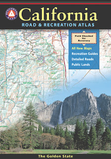
Been there, done that. Way into the outdoors . If you know someone on your holiday gift list like this, maybe they need some new local areas to explore. Grab a new waterproof map from Total Escape , NatGeo, Tom Harrison, USDA, we have 'em all. If plastic durability is not a concern, then try the wonderful, accurate, large, overview atlas (book map) for every California road trip. Benchmark brand is the best with big, detailed, dirt road, hot spring, outdoor beauty. Way better than DeLorme.

Camp Gift

Image
Need to get a gift for the outdoor person in your life, well we can show you some great, inexpensive items. Stuff that every hikers or camper could use. Waterproof maps are by far the easy choice, but deciding on a local region might be a bit difficult. Yosemite maps and Sequoia are popular choices, but so is Death Valley. TIP: pick the next place you want to vacation with them. See all CAMP GEAR here. Below are some 'outdoor gift' items that DanaMite recommends.

California Decor

Image
More Pretty Cupcakes Originally uploaded by lilraindrops Gorgeous Cupcakes. More than half of your brain is visually stimulated. California Wilderness is like the icing on the cake. If you live here in the golden state, you most likely love the outdoors, like travel and budget, local weekends too. Total Escape - this goofy California back road web site is here for you to find YOUR California. Tahoe, Mammoth, Mojave or Anza Borrego... have it all A to Z

Camping Gear Rental

Image
It is bound to happen. You travel to somewhere very cool, far away from home - and you want to camp out at least a few nights. The skies call and the scenery demands it! But you really don't wanna lug all your camp gear around with your luggage w/ the airport hassels. Renting gear locally can be done, depending of course, on where you want to rent. California is an outdoor paradise, simply said and most come here for the Wilderness views and awesome back road travels. California is a mecca for all kindsa recreation, so there are a few gear rental companies around. Make sure to tell the you found them on Total Escape too! In California, you can find rental shops for outdoor recreation, kayaking, backpacking, mountain biking. Camping Gear Rental Mountain Bike Rentals Kayak Rentals California

Pahaque

Image
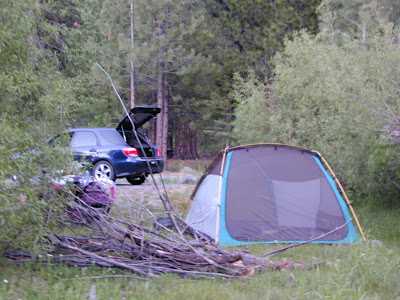
Lifetime warranties on outdoor gear are few and far between. Most supplies subjected to hard weather conditions and wilderness elevations damage quickly, unless they are designed to withstand these kinda harsh conditions. A new, non name brand, dirt cheap tent can last a year or two. There are plenty of used tents and gear on Craigslist.org.  Coleman tents usually last an average of 10 years, depending on the user frequency. Total Escape's DanaMite camps out about 20 times per year, so a more durable tent was needed. Wind-proofing is non-existant, but weather proofing and bubble designs make tents more wind resistant. Eureka tents can hold up to some mighty crazy wind gusts and many campers swear by this brand alone. Over a decade ago, a small gear company named Paha Que asked us to review a small tent of theirs. This is the 10-year-after-the-fact write-up on that product. Awesome vestibule (extra large rain fly) that allows extra space for cooking or storage Bl...

North Lake Fall Colors

Image
North Lake Fall Colors Originally uploaded by Jeff Sullivan Time is of the essence, RIGHT NOW. Autumn colors with aspen trees started changing around September  - and this fall coloring will last until the first deep freeze or snow fall, usually October. June Lake, Mammoth, Rock Creek & Twin Lakes are all awesome spots. Green Creek, Upper Summer Meadows, Virginia Lakes and Convict Lake are also worth checking out. The entire Eastern Sierra from Bishop to Tahoe is California's best for fall colors, fishing and sightseeing. OCTOBER is Autumn: take a drive on Highway 395

Kern Graffiti

Image
Kern Graffiti Originally uploaded by danamight River trash runs rampant in the Kern River Valley. Party animal campers leave their marks well into the next generation for this canyon. Kern is the closest BIG RIVER to SoCal - so the neglect and abuse are starting to really make a big impression. This popular recreation spot is often a rafters first time exploring the sport, a mountain bike haven, a backpacker or fishermen's paradise - but sadly, Kern Canyon needs help. California Wilderness boundaries are becoming less and less pristine. pris·tine –adjective 1. having its original purity; uncorrupted or unsullied. 2. of or pertaining to the earliest period or state; primitive. Origin: 1525–35; L pristinus & early; akin to primus  —Synonyms 1. undefiled, unpolluted, untouched Imagine a weekend at the river in late summer. No crowds, cuz the kids are back in school. Free camping all over the place. Hot sunny days, thunderstorms, mountain bike trails and mountain...

Dardanelle Sonora Pass

Image
Dardanelle Gas Originally uploaded by Swede1969 The alpine Sonora Highway #108 crests the Sierra Nevada mountains at 9000' elevation and usually has the deepest snow in the region. It just opened again- for the short summer season. Dardanelle is a small village in the forests of granite walls - a general store w/ gasoline, showers, RV park, cabin rentals and a National Forest Campground across the street. Stanislaus National Forest is the place. Carson Iceberg Wilderness and Emigrant Wilderness are located nearby. Find out more about this Sierra destination Dardanelle, CA Stanislaus National Forest NEW Carson Iceberg Map Emigrant Wilderness Map

OHV Recreation

Image
Los Padres National Forest spans the coastal ranges from the edges of Monterey Bay down to the mountains of Ojai California. This forest offers nearly 1000 miles of designated ORV routes and back roads. Sadly, there are also hundreds of miles of undocumented trails, most of which are the result of illegal vehicle (quad or bike) use on the Mt. Pinos & Santa Lucia Ranger Districts. Areas suffering from the most intensive use include: Mutau/Hungry Valley, Ballinger Canyon, the Highway 33 Corridor, Pozo-LaPanza, and Rockfront. Basically any OHV trails near or around Gorman, Frazier Park, Pine Mountain, Ventucopa, New Cuyama, Santa Maria & Arroyo Grande, CA. HIKERS / BIKERS / CAMPERS / OFFROADERS Total Escape list outdoor recreation for everyone, so please respect the land, the trails & keep 'em open. Simple: Stay on the trail!

Outside in Kern

Image
For those of you who haven't been out to see the wildflowers this Spring, you are missing the best show in decades! These little beauties are short lived. Certain canyons on the coast may bloom for months, but most of inland California has pockets of color, sporadically, lasting a weeks at most. You can drive past a spectacular bloom one week and the next week it's gone. Peak season means a very temporary window of opportunity for wildflower viewing . California flora blossoms, opens to glorious color during warm sunshine and then vanishes a week later. Gorman @ Tejon is about to explode very soon. Carrizo & Wind Wolves already peaked. Lower Kern is delightful. Klipstein Canyon off Hwy 166 is blooming alive. Remember the higher the elevation, the later the bloom. 1000' to 4000' (prime time now, April 2010)

Lupine Hills

Image
Lupine Hills Originally uploaded by danamight Spring is finally here and this seasons wildflowers are abundant. Central Coast hills and back roads are blooming with poppies and lupine. The lower elevations in the deserts are also showing well. Basically any terrain under 3000' is sprouting right now. Top places this month to see California Wildflowers: Anza Borrego Desert California Central Coast Gold Country California

Fishing Eastern Sierra

Image
brown eye Originally uploaded by dipperflyfishing The brown eye of Mono. A neighbor moved away several years ago, so he could ski Mammoth and work in the Eastern Sierra. A dream perhaps. Now here he is years later, working at the Mobile deli on the far reaches of Yosemite, working 3 jobs.... fly fishing, making your lunch and ski instructing his days away. Way to go buddy! (2013 update) Brandon just informed me via Facebook that he is now living in France, running a Mexican Restaurant. No joke. This guys really knows how to live an adventurous life!

Snowmobiles CA

Image
Did you know snowmobile rentals at Huntington Lake, are half the price of the ones at Mammoth rentals? Sierra Summit Resort and a bitchin' old Saloon nearby. Over 100 miles of groomed trails in the High Sierra. Let's go. Sierra Snowmobiles CA by Chris DiNenna (reposted from Spring 1998)  It was another one of those long and tiring days in the office and all I wanted to do was find myself on a open highway heading out of town. So right after the time clock struck five, I raced home, picked up my bags which were packed with my clothing and gear the night before, stopped at my girlfriends home to rescue her from the mundane existence of the apartment, we found ourselves finally on our way into snow country of the Sierra-Nevadas. Our destination was a small resort community called Lakeshore, situated on the shore of Lake Huntington between the Ansel Adams and John Muir Wildernesses in the Sierra National Forest. The drive up the mountain at dark was breath taking and clea...

Indian Mojave

Image
Indian Mojave Originally uploaded by danamight Colorado River Jet Ski The River, the sunshine, the JetSkis, the desert, the dirt roads, the canyons, the water, the fishing. Long before there was a Hoover Dam, or the casinos at Laughlin, there were people living in this desert. Surviving the harsh elements, as we cannot even comprehend in our luxurious ways. We drive by ancient locations, in our air conditioned vehicles with leather seats at 75 mph, heading for the vacation lands below. The big river. Up on the hill, a louder voice calls to me deep within a white sandy canyon. I explore, I hike, I enjoy the outdoors. I look, I find. Find more about Colorado river tribes ... See jet ski rentals on the Colorado River

California Park Map

Image
Trails in California Topanga, Truckee, Tecopa Morro Bay, Mineral King, Mount Tam Dinkey Creek, Dardanelle, Dorrington Portola, Paso Robles, Ponderosa all parks, all forests, all mountains, all deserts, all outdoors, always. Since getting lost on vacation is no fun at all, Total Escape has all the maps of California covered. Snow parks, snowmobiling, sledding spots, fishing spots, petroglyphs, hot springs, beaches, mountain biking, cabin communities. Hiking maps, topographic trails, campgrounds, off road routes, equestrian trails. Check out the new map store soon!

R.I.P. Devin Storz

Image
Tonight my meaningful post hits close to home. My neighbor was crushed to death by a huge pine tree falling on his house, this stormy, windy, winter morning. He was the sweetest boy in the neighborhood. Seriously. Devin was the first kid I met "on the mountain", late one night in 2002, walking across the baseball diamond at Lampkin Park, in Pine Mountain. Low temps in the 20's, plus some snow on the ground - and 2 teens needed some help, a ride up the hill. Rural youth, always hitch hiking back and forth between Pine Mountain and Crazier Park. Years later, Devin showed up to a party or two. Then he installed my bitchin baseboards in my purple shag, hippy love den. His dad and him worked for a week one summer, helping me with home improvements. This past weekend I thought about you, as I finally painted over the penciled in guide marks you drew on my walls. Devin you are in our thoughts tonight. About 12 hours ago, you may have heard the strong wind in your dream...

CA snow conditions

Image
This coming week is big talk. Old Man Winter is upon us (again) Let us see the snow. Cali State Snow Depths 2010 SKI conditions in California Forecast for Sierra Summit at Huntington Lake Foggy Meadows w/ Snow Originally uploaded by danamight

tour california map

Image
You can pick up any popular road atlas of California in the supermarket. These Rand McNalley's and Thomas Brothers map books will show you how to get around in the freeways and the cities of Cali. We wanna show you more, much more. The real scenic drives, the back roads and rural highways. More of REAL CALIFORNIA Total Escape has every possible wilderness map you could ever need for this golden state. The Sierra mountains, the Coast, SoCal and NorCal. We want to inspire you to be outside, to hike and explore the back roads. To fish, kayak and snow ski. To re-create in our recreation paradise called Cali-forn-ia. MAP STORE - for planning your escape