Posts

Northern California Lakes

Image
NorCal Lakes & Reservoirs Our northern California lakes region designates recreation reservoirs and lakes north of San Francisco, Sacramento and Truckee (Interstate 80 Donner Pass) California Lakes near Interstate 5 Lake Oroville Black Butte Lake Stoney Gorge Reservoir East Park Reservoir Shasta Lake Whiskeytown Reservoir Castle Lake @ Castle Crags SP Siskiyou Lake Lake Shastina West of Interstate 5 Lake Berryessa Hennessey Lake Indian Valley Reservoir Clear Lake Lake Mendocino Lake Pillsbury Ruth Lake Lewiston Lake Trinity Lake East of Interstate 5 Lake Almanor Mountain Meadows Reservoir Butt Valley Reservoir Antelope Reservoir Lake Davis @ Portola Eagle Lake @ Susanville Lake Britton @ Burney Falls Juniper Lake @ Lassen NP Iron Gate Reservoir @ Oregon border Copco Lake @ Oregon border Tule Lake Big Sage Reservoir West Valley Reservoir Northern Sierra Lakes Lake Tahoe Donner Lake Boca Reservoir Prosser Reservoir Stamp

Secluded Camping

Image
There are millions of people in California searching for that perfect weekend in the mountains. That secluded stream side camp with no one else around. Dense forest with mountain peaks, bluebirds, fresh air, total nature everywhere and maybe a view. Free firewood around every corner. No fees, no camp host and no camp fire restrictions. These awesome secret outdoor places do indeed exists, but they are not located in SoCal within an hours drive from your home. Nor are they located in the nearest State Park Campground. These rare finds are on the back roads of California, usually in the Sierra Nevada mountains or further north - in the vast spans known as Northern Cal. First off, you will need to drive (more than 3 hours) to reach these awesome wilderness retreats. Pack days ahead of time to make sure you are truly prepared and ready for serious back roads camping. Plan an early day departure from the city, so you can be at camp relaxing by sundown. Your goal that day is to

South Fork Kern River

Image
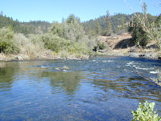
The Kern River is the biggest waterway in the southern Sierra Nevada mountains. Its headwaters start near Mount Whitney and eventually make their way down the granite gorge of the Lower Kern into the citrus groves near Bakersfield, CA. The Upper Kern is the stretch of river above Lake Isabella, north of Kernville, along the paved highway leading to the Forks of the Kern . The smaller South Fork Kern River leads into Lake Isabella from the eastern desert ranges, towering high above the north Mojave. This southern Sierra side-kick river descends down from high elevations on the Eastern Sierra, traverses through forests, meadows, granite, waterfalls and turns sharp 45 degrees to the west near at Hwy 178 @ Canebrake (jct. Chimney Peak Backcountry Byway). Kennedy Meadows, Troy Meadows, and Monache Meadows are all atop the area known as the Kern Plateau. Bakeoven Meadow is a slice of wilderness  heaven surrealism, surrounded by peaks and forest, all this beauty on the Inyo and Sequoia

Don't Frack California

Image
Petition to urge California to ban fracking. Don't Frack California

Free Lake Campsite

Image
Brewer Lake Campsite , a photo by totalescape.com on Flickr. If you still need me to spell it out - in every photo, in every forest, at each lake, enticing descriptions - every year, year after year.... just so you can be inspired to go outside and enjoy California, I will do so repeatedly. Or you could just cruise thru the years of archives on this California Back Roads Blog . Some of my suggested destinations require a 4x4 to reach, but many do not. Maps are essential. Road trip ideas and cheap travels await. Please also visit my ancient totalescape.com web site. California LAKES LIST Eastern Sierra Lakes Lassen Lakes Sequoia Lakes Shasta Lakes Sierra Nevada Lakes Wilderness Lakes Yosemite Lakes