Posts

California Park Map

Image
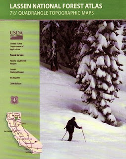
Trails in California Topanga, Truckee, Tecopa Morro Bay, Mineral King, Mount Tam Dinkey Creek, Dardanelle, Dorrington Portola, Paso Robles, Ponderosa all parks, all forests, all mountains, all deserts, all outdoors, always. Since getting lost on vacation is no fun at all, Total Escape has all the maps of California covered. Snow parks, snowmobiling, sledding spots, fishing spots, petroglyphs, hot springs, beaches, mountain biking, cabin communities. Hiking maps, topographic trails, campgrounds, off road routes, equestrian trails. Check out the new map store soon!

R.I.P. Devin Storz

Image
Tonight my meaningful post hits close to home. My neighbor was crushed to death by a huge pine tree falling on his house, this stormy, windy, winter morning. He was the sweetest boy in the neighborhood. Seriously. Devin was the first kid I met "on the mountain", late one night in 2002, walking across the baseball diamond at Lampkin Park, in Pine Mountain. Low temps in the 20's, plus some snow on the ground - and 2 teens needed some help, a ride up the hill. Rural youth, always hitch hiking back and forth between Pine Mountain and Crazier Park. Years later, Devin showed up to a party or two. Then he installed my bitchin baseboards in my purple shag, hippy love den. His dad and him worked for a week one summer, helping me with home improvements. This past weekend I thought about you, as I finally painted over the penciled in guide marks you drew on my walls. Devin you are in our thoughts tonight. About 12 hours ago, you may have heard the strong wind in your dream

CA snow conditions

Image
This coming week is big talk. Old Man Winter is upon us (again) Let us see the snow. Cali State Snow Depths 2010 SKI conditions in California Forecast for Sierra Summit at Huntington Lake Foggy Meadows w/ Snow Originally uploaded by danamight

tour california map

Image
You can pick up any popular road atlas of California in the supermarket. These Rand McNalley's and Thomas Brothers map books will show you how to get around in the freeways and the cities of Cali. We wanna show you more, much more. The real scenic drives, the back roads and rural highways. More of REAL CALIFORNIA Total Escape has every possible wilderness map you could ever need for this golden state. The Sierra mountains, the Coast, SoCal and NorCal. We want to inspire you to be outside, to hike and explore the back roads. To fish, kayak and snow ski. To re-create in our recreation paradise called Cali-forn-ia. MAP STORE - for planning your escape

Fall Color found...

Image
Fall Color found... Originally uploaded by Gotfish --= Marc =-- 2009 FALL REPORT The autumn colors are lasting in California! Some higher elevation areas hit with snow (8000' +) have naked aspens w/ shedding dead leaves, but mid altitude canyons along Hwy 395 - have aspen groves glowing. Cottonwoods and poplars are also changing rapidly in the Eastern Sierra. Mammoth is OPEN Friday, that's tomorrow - OCT 16. Early season to enjoy! YEP, Free lift tickets on opening day. mammothmountain.com

June Lake Loop Peaks

Image
June Lake Loop Sunday Originally uploaded by Jeff Sullivan (www.MyPhotoGuides.com) Autumn colors abound in the Eastern Sierra THIS WEEK. Get out to see the aspen groves changing along Highway 395 from Bridgeport down to June Lake, California. Great stream fishing on both Rush and Reverse Creeks at this time of year. Green Creek , near the Bodie ghost town turn off, should be exquisite about now . Numerous cabin rentals and lodges need your business, or you could brave the elements and camp out. Bishop lakes got a dusting of snow last weekend, so the winter has already set in above 8000' elevation. These fall colors, sunshine and temperatures will not last long. (This is a limited time offer.)

Mojave Shaken

Image
The ring of fire is moving again. While news stories bombard us on the recent earthquakes on the other side of the Pacific Ocean, we are soon reminded that here in California we are all connected via fault lines and tectonic plates. Four decent little earthquakes tonight in the Northern Mojave Desert, off Hwy 395, out near Olancha: Magnitude: 4.7 Ml Magnitude: 4.9 Ml Magnitude: 5.2 Ml Magnitude: 4.7 Ml