Posts

Showing posts with the label secluded

Usal Beach Campground
Image
Lost Coast Camping, NorCal The USA Lumber Company ran a big wood mill on this part of the redwood coast back in the early days. This camp's name gets shortened to USAL. Usal Beach Campground near Shelter Cove, California This idyllic prime yet primitive, hard-to-reach beach campground is tucked well away from the crowds along the Pacific Coastal Hwy 1.  The region is California BLM land King Range National Conservation Area, or better known as the Lost Coast of California ... a famous stretch of wilderness coastline in between Mendocino and the Humboldt Redwoods. Dense forests and steep terrain located on the county line of Mendocino & Humboldt. Sinkyone Wilderness State Park is nearby. Usal Camp is the only place for drive-up car camping on the beach front in Northern Cal. All other developed camps in the area are located further inland (with forested surroundings), or backpacking, hike-in primitive campsites. Usal Campground on Usal Creek , has several idyllic se...

Mokelumne River Canyon

Image
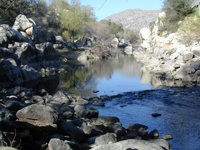
Mokelumne Peak is at a towering 9334' elevation in the High Sierra known as Mokelumne Wilderness . Granite scenery, high country, big water at high elevations. 105,165 acres straddles the crest of the central Sierra Nevada, within the Stanislaus, Eldorado, and Toiyabe National Forests; bordered by Highway 4 on the south and Highway 88 on the north. The Mokelumne River starts way up near Blue Lakes (South of Tahoe) which flows down to Salt Springs Reservoir, on the Amador & Calaveras county line. Once inside the Gold Country region the Mokelumne River drains into Pardee Reservoir, near Jackson CA . Salt Springs Reservoir has a trailhead for the Mokelumne Wilderness. Ellis Road - El Dorado National Forest Road #8N25 a signed turn off of Sierra Highway 88; a steep long, winding, hairy drive on a paved, back road that switchbacks down to river and prime camping. Minimal access and recreation at Salt Springs reservoir. Mokelumne River Campground NFS Mokelu...

Half Moon Campground

Image
Los Padres NF: Half Moon Camp 2006 Day Fire wildfire burned most of the Sespe Wilderness Piru Creek Camping Lockwood Valley, Sespe Wilderness Trailheads Late afternoon sun at uncrowded Half Moon campground   Los Padres National Forest West of Frazier Park & north of Ojai Camping - 12 camp sites on creek @ 4700' elevation vault toilet, creek, pine forest, Sespe Wilderness first come, first served camping Max Camper Length: 0 RV, motorhomes, camper trailers are not advised Access by long dirt road with creek crossings, high clearance recommended. Lockwood Ranger Station: 661-245-3731 Backpacking, car camping, fishing, hiking, horseback riding, hunting, mountain biking, off-roading. Piru Creek valley overlook on the way to Mutau Flat and Half Moon From Ojai, California take Hwy 33. Turn right (east) on Lockwood Valley. Turn right (south) on Mutau Flat Road #7N03 and continue 9 miles to the campground at junction with #7N13. From Frazier Park,...

California Tent Campgrounds

Image
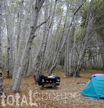
Tent Camping in California Car camping is also referred to as 'tent camping', where you drive to your destination and pitch a tent to sleep in. Minimal crowds w/ maximum scenery is what most seek. Peace and quiet all weekend is often the goal. Hiking trails, biking trails, horseback trails too. Few RV campers,  if any; Small campgrounds located on one-lane roads, or better yet - dirt roads! mountains • foothills • deserts • beaches • rivers • creeks • meadows • waterfalls • trailheads •  parks • forests • groves • lakes Whether you seek a developed campground: paved, level parking spot w/ toilets; or a primitive spot on a dirt road w/ creek and rock campfire ring... we have all of them listed on this web site. National Parks, National Forests, State Parks, county campgrounds, backpacking trailheads, free car camping, PG&E lake camps, 4x4 camp sites . Here at Total Escape we focus mainly on the secluded camping - off the beaten path, forested back roads camp sites...

Kern River Camping

Image
Camping is great here nearly year round, but campfires restrictions are often tight in dry summer months and into late fall. The Kern River draws visitors from Southern California, as well as Central Cal. It is the southern most big river of the Sierra Nevada mountain range. Located near a few big Sequoia trees, the Kern River winds thru Golden Trout Wilderness & Sequoia National Forest, dumping into Lake Isabella before heading west to the flatlands of Bako. The smaller & lesser known south fork of the Kern River is located way up top at Monache; Granite peaks, joshua trees, sage meadows & wilderness near Olancha Peak, on the very border of the North Mojave desert. Plenty cool stuff to see and do around the Lower Kern Canyon: Alta Sierra Domelands Wilderness Fairview CA Golden Trout Wilderness Kennedy Meadows Kernville CA Lake Isabella Pondersosa Remington Hot Springs Road's End Sequoia National Forest Wofford Heights CA Upper Kern is often thought ...

Camping in California

Image
California is the most epic place to live for those who love the outdoors and camp often. Terrain can be extreme like the vast deserts and higher elevation mountains. Moderate elevation forest, mountains and rural regions, such as river canyons in the gold country and Northern California. Mild and mellow landscape w/ developed campgrounds along the coast and near the urban centers. The weather is always decent somewhere in the golden state. Deserts are prime areas for wintertime camping, off-roading, old mines and ghost towns, as well as early Spring wildflowers. Wine country camping , farm-stays and recreation reservoirs are abundant all around the Central Valley and areas north of San Francisco. Coastal and beach camping is the most popular and sought-after destinations, so make your reservations if you want a guarantee spot. City camping is primarily offered by State Parks, county parks, regional parks and private RV resorts. California mountains are the place to be in the...

Free Lake Campsite

Image
Brewer Lake Campsite , a photo by totalescape.com on Flickr. If you still need me to spell it out - in every photo, in every forest, at each lake, enticing descriptions - every year, year after year.... just so you can be inspired to go outside and enjoy California, I will do so repeatedly. Or you could just cruise thru the years of archives on this California Back Roads Blog . Some of my suggested destinations require a 4x4 to reach, but many do not. Maps are essential. Road trip ideas and cheap travels await. Please also visit my ancient totalescape.com web site. California LAKES LIST Eastern Sierra Lakes Lassen Lakes Sequoia Lakes Shasta Lakes Sierra Nevada Lakes Wilderness Lakes Yosemite Lakes