Posts

Showing posts with the label mountains

Southern California Lakes

Image
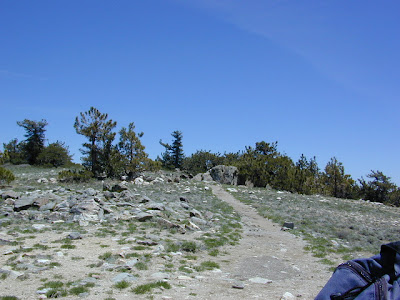
Lotsa mid-western transplants typing in Google "Southern California Lakes". Well campers, I hate to break it to ya, but California has mostly reservoirs. Man-made lakes & river dams to supply our cities & crops with valuable water. The few more natural lakes in Southern California - Henshaw , Hemet , Cuyamaca nearly dry up in late summer. California is a dry state, the whole west for that matter. Face it, inland San Diego is almost a desert. It's right next to Baja & Anza Borrego Desert . If you wanna see clear mountain water, with trees, maybe pine forest views & hear bluebirds... with big rivers flowing & decent fishing, then you are gonna need to drive. When the crowds at Big Bear & Arrowhead annoy you, then the plan B is obvious. Drive further. Drive north, about half way up the Golden State Freeway I #5. About 6 hours from the busy hub of SoCal. For recreation lakes, alpine lakes, real lakes in California. The Sierra Nevada mountains

South Fork Kern River

Image
The Kern River is the biggest waterway in the southern Sierra Nevada mountains. Its headwaters start near Mount Whitney and eventually make their way down the granite gorge of the Lower Kern into the citrus groves near Bakersfield, CA. The Upper Kern is the stretch of river above Lake Isabella, north of Kernville, along the paved highway leading to the Forks of the Kern . The smaller South Fork Kern River leads into Lake Isabella from the eastern desert ranges, towering high above the north Mojave. This southern Sierra side-kick river descends down from high elevations on the Eastern Sierra, traverses through forests, meadows, granite, waterfalls and turns sharp 45 degrees to the west near at Hwy 178 @ Canebrake (jct. Chimney Peak Backcountry Byway). Kennedy Meadows, Troy Meadows, and Monache Meadows are all atop the area known as the Kern Plateau. Bakeoven Meadow is a slice of wilderness  heaven surrealism, surrounded by peaks and forest, all this beauty on the Inyo and Sequoia

Kern River Hot Springs

Image
  We grabbed some snacks & beverages at a Bakersfield mini-mart & headed due east on Hwy 178. Into a wall of granite, a raging river filled with Sierra Nevada snow melt, the sounds of rushing water filled the air. We turned on to a dark narrow road without any guard rails. Oaks trees hung overhead, dark skies & huge cows in the middle of the road. After passing it once, we found the dirt parking area around 10:20 pm & started our hike down to the hot springs w/ flashlights. Down to the Kern River we scrambled thru muddy grasses & bushes. Candle light, river rock tubs & steaming mineral baths await. No one around, we had the whole place to ourselves..... until 1am. There are numerous natural hot springs located on the Kern River canyon, most of them on the Lower Kern in between Lake Isabella & the Bako citrus orchards. Many are closed off to the public - private property.  Lower Kern Canyon on Highway 178 is the way to Kernville California & in

Eastern Sierra for Autumn

Image
Eastern Sierra Peaks , a photo by totalescape.com on Flickr. Mammoth Mountain just announced opening day for skiing in early November 2012. Temps are dropping each night and autumn colors are the next big show. Eastern Sierra aspen groves can be seen as far south as Whitney Portal near Lone Pine, and as far north as well, Tahoe of course. Great camping and fishing near June Lake, Bridgeport, and Hope Valley. Fall is also the season for viewing meteor showers for those campers who love to stargaze. LONE PINE ASPENDELL BIG PINE BISHOP MAMMOTH JUNE LAKE LEE VINING BRIDGEPORT LAKE TAHOE top back road destinations - HORSESHOE MEADOWS NORTH LAKE SOUTH LAKE ROCK CREEK   GREEN CREEK TWIN LAKES HOPE VALLEY

Benchmark Maps

Image
Benchmark Maps are the best, full state, full featured, road map for exploring the Western US. DanaMite, founder of Total Escape, has been using hers since 2000, and has always found a place to camp, on any dirt road, even in the wee hours of the night. Imagine waking up the next morning, with stunning scenery all around, cuz you went the distance. Benchmark Atlases for the Western United States CALIFORNIA ARIZONA NEW MEXICO NEVADA UTAH WASHINGTON OREGON

Poppies and South Fork, Merced River

Image
hite cove trail poppies and South Fork of the Merced River below a photo by Mrs Rachel on Flickr. Is it happening yet? Have you seen them? Where? Zillions of web sites and pages referencing wildflowers in California. The best imagery can be found on Flickr searches, which landed me on this incredible shot by Rachel. Total Escape covers California wildflower reporting starting in March each year.

Creek Recreation

Image
creek recreation includes fishing, hiking, kayaking, rafting, tubing, gold panning, and finding swimming holes. People love secluded lakes inside alpine mountains, well away from the city. Folks also love rivers and creeks - of all sizes. Most all of the California National Forest have recreation creeks running thru them. SoCal would be seasonal creeks - which means it often dry up annually, or goes underground. In the golden west, the desert's dryness reigns, and some smaller creeks are 'seasonal' and tend to dry up every year. The flow stops completely and you are bummed, cuz your hike isn't what you had hoped it would be. There are only a select few creeks for camping in Southern California. Drought conditions are often. Call ahead, ask the field ranger about your creek destination. The best streams & creeks are located in the higher elevation mountains. If you are seeking that hidden creek with a forest to hike or bike in, or a new fly fishing spot, you

Mammoth in California

Image
Mammoth Pool Reservoir Originally uploaded by danamight Dreaming of 90 degrees and sunshine? Sick of June Gloom on the coast? Will the California mountain thunderstorms last into July? Is global warming causing season shifts & more erratic weather patterns? And what are you gonna do about it?  enjoy it while you can Who wants to play on the lake? This weekend, or next? MAMMOTH, California two Mammoths in Cali? MAMMOTH POOL RESERVOIR is a virtually unknown recreation lake, way, way back there in Sierra NF; campground and boat launch ramp on a steep dirt road; located on the western slopes of the Sierra Nevada mountains, due south of Yosemite National Park. MAMMOTH LAKES, CA  this is the well known ski mountain and upscale (bankrupt) village in the Eastern Sierra, north of Bishop, CA and south of Yosemite National Park. Fishing on Lake Mary near Mammoth Lake, California

Trail Wilderness

Image
Mount Pinos Peak 8830' elevation, Kern County We all seek a wilderness trail to hike or stroll. Wonderful weather, enveloped in scenery, a peaceful place to call our own - if only for the day or the whole weekend. Deep inside the sacred space we call nature, Mother Earth. Maybe a picnic and waterfall as the highlight of the whole day. In California we are lucky to have plenty trails to enjoy and explore. Whether you want a foot trail to a lake, a fishing trail along the river, a backpackers trail over the highest peaks, an equestrian trail, a mountain bike route, or snowmobile trails new and fresh, we just might have it on our maps - somewhere in here . California Wilderness Areas California Forest Maps California Wilderness Maps California Topo Atlas California Recreation Maps Tom Harrison Topographical Maps