Posts

Showing posts with the label mapas

Sierra Nevada Map

Image
The Sierra Nevada mountains range in elevation from 2000' - 14,494' above sea level. From rolling foothills with creek, oaks & wildflowers to tower granite peaks, alpine lakes & high country meadows of the Eastern Sierra. Imus Geographics makes a nice overview map of the Sierra Nevada mountains and this one is a hot seller on Total Escape! Over at the Total Escape map store we have an epic selection of Sierra Maps - see all Sierra Nevada Maps Eastern Sierra Map Gold Country Maps Lassen Maps Mammoth Maps Mt Whitney Maps Sequoia Maps Tahoe Maps Yosemite Maps Northern Sierra Forest Map Set Central Sierra Forest Map Set Easterm Sierra Forest Map Set Southern Sierra Forest Map Set California Sierra Wilderness Maps PCT - Pacific Crest Trail Maps  

Secluded Camping

Image
There are millions of people in California searching for that perfect weekend in the mountains. That secluded stream side camp with no one else around. Dense forest with mountain peaks, bluebirds, fresh air, total nature everywhere and maybe a view. Free firewood around every corner. No fees, no camp host and no camp fire restrictions. These awesome secret outdoor places do indeed exists, but they are not located in SoCal within an hours drive from your home. Nor are they located in the nearest State Park Campground. These rare finds are on the back roads of California, usually in the Sierra Nevada mountains or further north - in the vast spans known as Northern Cal. First off, you will need to drive (more than 3 hours) to reach these awesome wilderness retreats. Pack days ahead of time to make sure you are truly prepared and ready for serious back roads camping. Plan an early day departure from the city, so you can be at camp relaxing by sundown. Your goal that day is to ...

South Fork Kern River

Image
The Kern River is the biggest waterway in the southern Sierra Nevada mountains. Its headwaters start near Mount Whitney and eventually make their way down the granite gorge of the Lower Kern into the citrus groves near Bakersfield, CA. The Upper Kern is the stretch of river above Lake Isabella, north of Kernville, along the paved highway leading to the Forks of the Kern . The smaller South Fork Kern River leads into Lake Isabella from the eastern desert ranges, towering high above the north Mojave. This southern Sierra side-kick river descends down from high elevations on the Eastern Sierra, traverses through forests, meadows, granite, waterfalls and turns sharp 45 degrees to the west near at Hwy 178 @ Canebrake (jct. Chimney Peak Backcountry Byway). Kennedy Meadows, Troy Meadows, and Monache Meadows are all atop the area known as the Kern Plateau. Bakeoven Meadow is a slice of wilderness  heaven surrealism, surrounded by peaks and forest, all this beauty on the Inyo and Sequ...

Benchmark Maps

Image
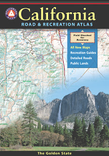
Benchmark Maps are the best, full state, full featured, road map for exploring the Western US. DanaMite, founder of Total Escape, has been using hers since 2000, and has always found a place to camp, on any dirt road, even in the wee hours of the night. Imagine waking up the next morning, with stunning scenery all around, cuz you went the distance. Benchmark Atlases for the Western United States CALIFORNIA ARIZONA NEW MEXICO NEVADA UTAH WASHINGTON OREGON

Waterproof Maps

Image
Been there, done that. Way into the outdoors . If you know someone on your holiday gift list like this, maybe they need some new local areas to explore. Grab a new waterproof map from Total Escape , NatGeo, Tom Harrison, USDA, we have 'em all. If plastic durability is not a concern, then try the wonderful, accurate, large, overview atlas (book map) for every California road trip. Benchmark brand is the best with big, detailed, dirt road, hot spring, outdoor beauty. Way better than DeLorme.

tour california map

Image
You can pick up any popular road atlas of California in the supermarket. These Rand McNalley's and Thomas Brothers map books will show you how to get around in the freeways and the cities of Cali. We wanna show you more, much more. The real scenic drives, the back roads and rural highways. More of REAL CALIFORNIA Total Escape has every possible wilderness map you could ever need for this golden state. The Sierra mountains, the Coast, SoCal and NorCal. We want to inspire you to be outside, to hike and explore the back roads. To fish, kayak and snow ski. To re-create in our recreation paradise called Cali-forn-ia. MAP STORE - for planning your escape