Posts

Showing posts with the label map

Baja Atlas - Baja Maps - Baja Almanac

Image
Benchmark Maps has a brand new Baja topographic map for 2021 -  The BAJA CALIFORNIA Road & Recreation Atlas This Benchmark atlas showcases the diverse recreation opportunities found along the full length of the Baja California Peninsula. Regional maps provide a wider view of the region and Recreation Guides list an array of attractions for trip planning.  Publish May 2021. ISBN: 9781734315059   Finding good, accurate maps of Baja California Mexico used to be a daunting task. Online searches produced the same, old results with broken links, out-of-date forum postings where travelers exchanged information on where to obtain a decent topo of Baja California.  Amazon.com lists some of the original Baja Almanacs - used or new copies - outrageous priced around $600  Ever since cartographer Landon Crumpton died, Baja lovers have had a hard time locating quality, topographic maps of the famous and popular Mexican peninsula. However, things are again changing.  Not only has Benchmark Maps

New Navigation for 2019

Image
Yes indeed, Total Escape is alive and well - and still online! the redesign is finally here 2019 October marks the 23rd year of our presence on the world wide web. Site founder, DanaMite has been redesigning the site and making it easier to find everything - over 10,000 pages on just California. This particular overhaul has been years in the making and I needed to 'hire out' on certain skills in to accomplish it. Big thanks goes to  Jamison  who helped me get CSS headers in order and looking great, and the new navigation launched last month on Total Escape. Mobile users will be pointed to the main URL  http://www.totalescape.com/index.html Desktop users can still use the classic feel http://www.totalescape.com/classic.html Search Bar is located back on top, the Outside Blog now visually matches the rest of the site, and we have created some new sub-sections of the site, which include: DESTINATIONS - http://totalescape.com/destinations/ JOURNEY - http://total

Waterproof Maps

Image
WATERPROOF TOPOGRAPHIC MAPS Paper maps are fading fast. Literally, disappearing into landfills, campfires or into the archives of map collectors. Digital maps have totally taken over our lives and you'll be hard pressed to find a decent printed local area hiking map when traveling small towns inside California . Keep in mind that many of the middle-of-nowhere, back road destinations we feature on Total Escape do not receive adequate cell phone service, much less a wireless, high speed, digital network. So plan accordingly. Old timers, frequent travelers and experienced outdoor folks still want the hard copy - a real map! Waterproof and tear resistant plastic maps are now common. Tom Harrison was one if the first to offer quality plastic hiking maps. All the  NatGeo map titles are 2-sided, full color and plastic. USDA has slowly been transitioning their National Forests maps to plastic maps over the past few years. California Wilderness area maps are only about half

Sierra Nevada Map

Image
The Sierra Nevada mountains range in elevation from 2000' - 14,494' above sea level. From rolling foothills with creek, oaks & wildflowers to tower granite peaks, alpine lakes & high country meadows of the Eastern Sierra. Imus Geographics makes a nice overview map of the Sierra Nevada mountains and this one is a hot seller on Total Escape! Over at the Total Escape map store we have an epic selection of Sierra Maps - see all Sierra Nevada Maps Eastern Sierra Map Gold Country Maps Lassen Maps Mammoth Maps Mt Whitney Maps Sequoia Maps Tahoe Maps Yosemite Maps Northern Sierra Forest Map Set Central Sierra Forest Map Set Easterm Sierra Forest Map Set Southern Sierra Forest Map Set California Sierra Wilderness Maps PCT - Pacific Crest Trail Maps  

South Fork Kern River

Image
The Kern River is the biggest waterway in the southern Sierra Nevada mountains. Its headwaters start near Mount Whitney and eventually make their way down the granite gorge of the Lower Kern into the citrus groves near Bakersfield, CA. The Upper Kern is the stretch of river above Lake Isabella, north of Kernville, along the paved highway leading to the Forks of the Kern . The smaller South Fork Kern River leads into Lake Isabella from the eastern desert ranges, towering high above the north Mojave. This southern Sierra side-kick river descends down from high elevations on the Eastern Sierra, traverses through forests, meadows, granite, waterfalls and turns sharp 45 degrees to the west near at Hwy 178 @ Canebrake (jct. Chimney Peak Backcountry Byway). Kennedy Meadows, Troy Meadows, and Monache Meadows are all atop the area known as the Kern Plateau. Bakeoven Meadow is a slice of wilderness  heaven surrealism, surrounded by peaks and forest, all this beauty on the Inyo and Sequoia

Waterproof Maps

Image
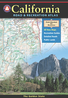
Been there, done that. Way into the outdoors . If you know someone on your holiday gift list like this, maybe they need some new local areas to explore. Grab a new waterproof map from Total Escape , NatGeo, Tom Harrison, USDA, we have 'em all. If plastic durability is not a concern, then try the wonderful, accurate, large, overview atlas (book map) for every California road trip. Benchmark brand is the best with big, detailed, dirt road, hot spring, outdoor beauty. Way better than DeLorme.