Posts

Showing posts with the label camping

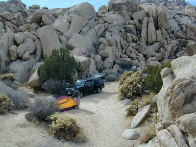
The ABC's of California

Image
Most people moved to California for the great weather, the awesome scenery & the forward thinking culture. Or maybe you just relocated here for a job, a career or college. Either way, you are here now & all the plans you had to travel have slipped by the wayside. Computers have now taken over your daily entertainment, your life and society. NOT! No matter what your excuse is the need to be outside enveloped in nature and to explore new trails is still buried deep within you. You crave the sunshine, the fresh air, the real true connection w/ the earth. Caves & caverns of Gold Country, the High Sierra peaks, the wineries to tour.. it's all still out there. Not all the forests have burned - yet. California  A to Z In case you don't already know the back roads of California like you really wanted to, DanaMite has compiled the awesome California small town list , an ever growing compilation of all small towns & some not-so-small cities. It's the perfect

Mohave Preserve

Image
Mojave Desert / Mohave Camping Mojave, one of the largest deserts in the USA. Named after the Mohave tribe of Native Americans, it contains a number of ghost towns, the old railroad depots, and nearly 2000 plants species. The Mojave Desert is crossed by major routes - Interstate 15, Interstate 40, US Highway 395 & US Highway 95. READ MORE Right in the middle of the Mojave Desert is the National Preserve. The largest joshua tree forest in the state of Cali. Summer temps can easily reach the triple digits, so camping and hiking is most favored in autumn, winter or spring months. There are many primitive style (free) camp spots inside the park and surrounding the park, and there are also a few developed campgrounds as well. Goffs schoolhouse to the east has outdoor showers. Hole in the Wall Campground Mid Hills Campground Black Canyon Corral & Group Camp Hundreds if not thousands of dirt roads network the Mojave desert This desert park is an ideal spot for "i

Kennedy Meadows California

Image
General Store at Kennedy Meadows, on the Kern Plateau, California There are 2 different places in the Sierra Nevada mountains called Kennedy Meadows. This one photographed above is on the Kern Plateau, located in the Southern Sierra in between Dome Land Wilderness & Golden Trout Wilderness . The infamous Pacific Crest Trail (the PCT) passes through this region. Sequoia National Forest spans most of the land to the south and west of Kennedy Meadows. Inyo National Forest sits directly to the east. Monache Meadow s and Olancha Peak are to the north side kennedy meadows on the kern plateau -  High elevation Sherman's Pass Road leads uphill from the west, where the steep turn off, next to the Kern River is often gated. Way north of Kernville, CA . Shermans Pass Rd is a paved back road that closes annually for snow, so call the local ranger for up to date weather & road conditions. Access to Kennedy Meadows from the east side, Inyo County Road # J41 off of Easte

Camping in California

Image
California is the most epic place to live for those who love the outdoors and camp often. Terrain can be extreme like the vast deserts and higher elevation mountains. Moderate elevation forest, mountains and rural regions, such as river canyons in the gold country and Northern California. Mild and mellow landscape w/ developed campgrounds along the coast and near the urban centers. The weather is always decent somewhere in the golden state. Deserts are prime areas for wintertime camping, off-roading, old mines and ghost towns, as well as early Spring wildflowers. Wine country camping , farm-stays and recreation reservoirs are abundant all around the Central Valley and areas north of San Francisco. Coastal and beach camping is the most popular and sought-after destinations, so make your reservations if you want a guarantee spot. City camping is primarily offered by State Parks, county parks, regional parks and private RV resorts. California mountains are the place to be in the

Lake Powell Boat Rentals

Image
Boating Powell: The Couples Choice No need for a big houseboat? Try a power boat rental instead. Cheryl and Jay rented a 21 foot power boat. This was MUCH less expensive than a houseboat rental, and a much faster way to get around the lake. It allowed them to motor deep into some of the slot canyons & find private coves for overnight stays. Obviously, they gave up a lot of the luxury of the house boats, but this power boat had a cabin that slept 2 comfortably, and it was nearly ideal for their needs. Jay brought his inflatable kayak, which worked great to get deeper into the narrowing canyons. From there, they could continued on foot, and had to wade or swim through some passages. It was a great experience! Lake Powell is located in the desert near the Grand Canyon. In the Summer shaded coves may produce relief from 100 degree days. The water temp ranged from about 80 to 86 degrees. Spring & Fall are very comfortable. Powerboat rentals start at $350 per day and

Northern California Lakes

Image
NorCal Lakes & Reservoirs Our northern California lakes region designates recreation reservoirs and lakes north of San Francisco, Sacramento and Truckee (Interstate 80 Donner Pass) California Lakes near Interstate 5 Lake Oroville Black Butte Lake Stoney Gorge Reservoir East Park Reservoir Shasta Lake Whiskeytown Reservoir Castle Lake @ Castle Crags SP Siskiyou Lake Lake Shastina West of Interstate 5 Lake Berryessa Hennessey Lake Indian Valley Reservoir Clear Lake Lake Mendocino Lake Pillsbury Ruth Lake Lewiston Lake Trinity Lake East of Interstate 5 Lake Almanor Mountain Meadows Reservoir Butt Valley Reservoir Antelope Reservoir Lake Davis @ Portola Eagle Lake @ Susanville Lake Britton @ Burney Falls Juniper Lake @ Lassen NP Iron Gate Reservoir @ Oregon border Copco Lake @ Oregon border Tule Lake Big Sage Reservoir West Valley Reservoir Northern Sierra Lakes Lake Tahoe Donner Lake Boca Reservoir Prosser Reservoir Stamp

Secluded Camping

Image
There are millions of people in California searching for that perfect weekend in the mountains. That secluded stream side camp with no one else around. Dense forest with mountain peaks, bluebirds, fresh air, total nature everywhere and maybe a view. Free firewood around every corner. No fees, no camp host and no camp fire restrictions. These awesome secret outdoor places do indeed exists, but they are not located in SoCal within an hours drive from your home. Nor are they located in the nearest State Park Campground. These rare finds are on the back roads of California, usually in the Sierra Nevada mountains or further north - in the vast spans known as Northern Cal. First off, you will need to drive (more than 3 hours) to reach these awesome wilderness retreats. Pack days ahead of time to make sure you are truly prepared and ready for serious back roads camping. Plan an early day departure from the city, so you can be at camp relaxing by sundown. Your goal that day is to

South Fork Kern River

Image
The Kern River is the biggest waterway in the southern Sierra Nevada mountains. Its headwaters start near Mount Whitney and eventually make their way down the granite gorge of the Lower Kern into the citrus groves near Bakersfield, CA. The Upper Kern is the stretch of river above Lake Isabella, north of Kernville, along the paved highway leading to the Forks of the Kern . The smaller South Fork Kern River leads into Lake Isabella from the eastern desert ranges, towering high above the north Mojave. This southern Sierra side-kick river descends down from high elevations on the Eastern Sierra, traverses through forests, meadows, granite, waterfalls and turns sharp 45 degrees to the west near at Hwy 178 @ Canebrake (jct. Chimney Peak Backcountry Byway). Kennedy Meadows, Troy Meadows, and Monache Meadows are all atop the area known as the Kern Plateau. Bakeoven Meadow is a slice of wilderness  heaven surrealism, surrounded by peaks and forest, all this beauty on the Inyo and Sequoia

California Desert Camping

Image
Winter months in California is prime desert camping time. The perfect time to plan your desert trip is November thru April. If a seasonal storm is not in the forecast, the weather is usually sunny and mild, wind is always a given & wildflowers bloom as early as February. Go enjoy the Mojave Desert , Death Valley , Anza Borrego Desert , Joshua Tree , the Lancaster Poppy Fields or the Eastern Sierra lava flows. California Desert Camping Ideas Surreal Box Canyon near Mecca, California is free camping BLM land located perfectly in between Anza Borrego Desert and Joshua Tree National Park .  This area is totally worth a hike, stretch break, or sightseeing visit, if not for an over night stay. Many superb camp spots tucked in near the cliff edges. Be prepared for late night traffic noise as semi-trucks from Interstate 10 use Box Canyon Road as a frequent through route. desert destinations Anza Borrego Desert SP Ballarat Benton Hot Springs Bodie California Borre

Map Availability

Image
Maps can save your life. Maps can get you un-lost and can show you the way. Maps are your escape route outta the city. In a digital world where we are so connected w/ internet, smartphones and GoogleMaps, it is amazing that folks can find there way to real back roads of California. Don't be shocked when your digital signal drops at the wilderness edge and you are finally "away". Most online map sources are NOT accurate beyond the city limits, much less the forest boundary. Seriously folks, THEY don't want you out there. There is no place in the Wilderness to spend any money. Many have not properly logged the back roads yet, or perhaps they just won't make it available to the general public. You'll be lucky if they get the road number correct. BACK ORDERED / BACKORDER? OUT OF PRINT, OUT OF STOCK Availability of good maps is an ongoing issue. It's a unique factor in the map selling business. Although Total Escape carries a variety of Californ

Benchmark Maps

Image
Benchmark Maps are the best, full state, full featured, road map for exploring the Western US. DanaMite, founder of Total Escape, has been using hers since 2000, and has always found a place to camp, on any dirt road, even in the wee hours of the night. Imagine waking up the next morning, with stunning scenery all around, cuz you went the distance. Benchmark Atlases for the Western United States CALIFORNIA ARIZONA NEW MEXICO NEVADA UTAH WASHINGTON OREGON

Camp Gift

Image
Need to get a gift for the outdoor person in your life, well we can show you some great, inexpensive items. Stuff that every hikers or camper could use. Waterproof maps are by far the easy choice, but deciding on a local region might be a bit difficult. Yosemite maps and Sequoia are popular choices, but so is Death Valley. TIP: pick the next place you want to vacation with them. See all CAMP GEAR here. Below are some 'outdoor gift' items that DanaMite recommends.