Posts

Showing posts with the label camping

New Eastern Sierra Map

Image
Eastern Sierra Camping - Bridgeport, CA NEW EDITION ffor 2014 -  Humboldt Toiyabe National Forest USDA recently updated most of their National Forests maps to a new plastic waterproof versions, with El Dorado being the very last of the paper maps. Front cover design takes a twist with the new retro-looking map featured here - Toiyabe's Bridgeport Ranger District . It was updated and printed in 2014   This USDA Eastern Sierra map covers places like: Mono Lake   Lee Vining   Conway Summit Bridgeport   Buckeye Hot Springs Travertine Hot Springs East Walker River Lundy Lake   Twin Lakes   Virginia Lakes  Bodie Ghost Town   Green Creek   Upper Summers Meadow Dunderberg Meadow Hoover Wilderness This rural Eastern California National Forest region is located on US Highway 395 (north of Mammoth and south of Lake Tahoe). Autumn and aspen colors are quite impressive in this area, so make plans to visit in late September or October if you like to fish. Wildflowers happen h

What's still open in California?

Image
Last week the USFS announced a dismal end to summer: California National Forests are closed due to wildfire dangers, which is the majority of the mountain areas on the inland side of California. Total Escape is here to show you what areas are STILL OPEN. With most California National Forests closed for the month and the wildfires still burning, camping options narrow considerably.  Where to go? California Deserts are still too warm, so we will be featuring a few other locations. All forests and parks listed below offer camping and additional outdoor recreation opportunities. Campfires may be banned in some locations. Only ONE National Forest inside California is still open - the Humboldt-Toiyabe National Forest in the Eastern Sierra. Toiyabe National Forest  [Mono Lake to Topaz Lake] Autumn Aspens began showing fall colors in mid to late September at higher elevations, lasting into October when the first snow falls: Twin Lakes, CA Bridgeport, CA Buckeye Hot Springs Green Creek Upper S

New Navigation for 2019

Image
Yes indeed, Total Escape is alive and well - and still online! the redesign is finally here 2019 October marks the 23rd year of our presence on the world wide web. Site founder, DanaMite has been redesigning the site and making it easier to find everything - over 10,000 pages on just California. This particular overhaul has been years in the making and I needed to 'hire out' on certain skills in to accomplish it. Big thanks goes to  Jamison  who helped me get CSS headers in order and looking great, and the new navigation launched last month on Total Escape. Mobile users will be pointed to the main URL  http://www.totalescape.com/index.html Desktop users can still use the classic feel http://www.totalescape.com/classic.html Search Bar is located back on top, the Outside Blog now visually matches the rest of the site, and we have created some new sub-sections of the site, which include: DESTINATIONS - http://totalescape.com/destinations/ JOURNEY - http://total

Half Moon Campground

Image
Los Padres NF: Half Moon Camp 2006 Day Fire wildfire burned most of the Sespe Wilderness Piru Creek Camping Lockwood Valley, Sespe Wilderness Trailheads Late afternoon sun at uncrowded Half Moon campground   Los Padres National Forest West of Frazier Park & north of Ojai Camping - 12 camp sites on creek @ 4700' elevation vault toilet, creek, pine forest, Sespe Wilderness first come, first served camping Max Camper Length: 0 RV, motorhomes, camper trailers are not advised Access by long dirt road with creek crossings, high clearance recommended. Lockwood Ranger Station: 661-245-3731 Backpacking, car camping, fishing, hiking, horseback riding, hunting, mountain biking, off-roading. Piru Creek valley overlook on the way to Mutau Flat and Half Moon From Ojai, California take Hwy 33. Turn right (east) on Lockwood Valley. Turn right (south) on Mutau Flat Road #7N03 and continue 9 miles to the campground at junction with #7N13. From Frazier Park,

Camping without a Campfire

Image
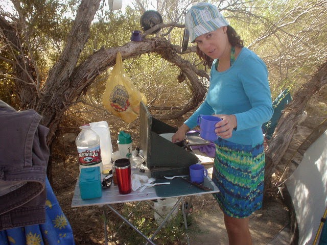
Camping without a campfire sounds like swimming without water to some people. Half the reason to go camping is to sit around the group fire at night enjoying the gorgeous night air & good conversation. Here in California we have many fire restrictions in place, especially in Southern California. With the expanding population moving in to the state, we now have less rural lands available than ever before. Current ongoing drought conditions in much of California means tight restrictions on campfires - inside and outside of campgrounds. You are responsible for knowing the campfire restrictions in the forest you are visiting, so make sure to find out ahead of time. NFS   Late Summer to Autumn season campfire restrictions can apply to backpacking in the high country, back roads dispersed camping, and sometimes even regular campgrounds. When wildfire danger is greatest no campfires are allowed anywhere in the forest, even inside developed campgrounds. Our over-managed fores

Campground Reservations with Total Escape

Image
Campground Reservations w/ Reserve America are back! just in time for summer No hurry, no worries, as you coast down the forested route to your premiere camping destination. A shady campground near an alpine lake or fishing creek is a favorite destination for many in California. Summer time is here and it seems everyone is on vacation; but alas, you have camping reservations at this perfect spot - a camp site held specifically for you. Over the past two decades Total Escape has seen numerous affiliate programs disappear, hundreds of independent lodges go out of business and recreation outfitters close shop. About 5 years ago ReserveAmerica , the nationwide campground reservation system, was acquired by Active.com. Soon after most of our campground links were null and void, so DanaMite updated them to something more relevant. Well it has taken a several years but we finally got all the new camping reservation links back up, so you can now reserve a campground through Tot

California Lakes With Water

Image
California Lake Destinations Record low lake levels at most reservoirs & lakes! The mega drought continues. Don't be disappointed on vacation: Lack of water at your lake destination may leave you mad this season. Know before you go. Check out the California Water Information page for more specific information. Reservoirs listed below are the lakes with the most water in California (as of June 2015). Number represents percent of capacity. WHISKEYTOWN LAKE West of Redding, CA 98% full  LEWISTON LAKE Trinity County, Weaverville, CA 94%  ANTELOPE LAKE Northern Sierra, Susanville, CA 99%  ENGLEBRIGHT LAKE Yuba Gold Co, Grass Valley, CA 95%  BULLARDS BAR Reservoir Gold Country, Grass Valley, CA 59%  ICE HOUSE Reservoir Gold Country, Placerville, CA 84%  UNION VALLEY Reservoir Gold Country, Placerville, CA 81%  LAKE TULLOCH Central Valley, Modesto, CA 96%  INDEPENDENCE LAKE High Sierra, Truckee, CA 95%  PYRAMID LAKE Los Angeles County, Gorman, CA 94% 

California Fire Map

Image
California Wildfires & Fire Information Extreme drought conditions means super high wildfire dangers for all of California. As of August 1st, nearly 60% of the golden state is under EXCEPTIONAL drought, one level up from the 'extreme' classification. We are more than one years worth of water overdue. Wildfires in California are quiet common and occur annually in the later part of the year (summer - autumn)  when the natural vegetation, brush and forests are the driest. Drought.gov will show just how bad the drought conditions are currently in the Western U.S. drought.gov Southern California as well as Northern California experience wildland fires, and since Central California is backed by the Sierra Nevadas, you should expect forest fires at high elevations and lower river canyons too. California is currently experiencing extreme fire dangers, so many parks and forest areas have higher than normal restrictions. The new normal is becoming extreme, as you can im

Where'd She Go?

Image
It often seems as if I have forgotten about this long standing blogger blog, leaving it for months at a time without a post (maybe while traveling for weeks or working other more pressing projects). Over this past winter, I spent much time rebuilding older pages to a new format (WordPress) Outside Blog and I will continue this throughout the year. Covering the back roads like no other! I, DanaMite , am dedicated to the whole of Total Escape, my 8000 page web site on California travel destinations, off the beaten path . Established way back in 1996, in the web 1.0 days, on a 33k modem. First and foremost that I can offer is real world content, real experiences, travel logs, photos, GPS data and research I gather while exploring the golden state. Sleeping on the ground, tent camping outside of developed campgrounds, way back there "out in the field". Lakes, Rivers, Wilderness, Outdoor Recreation, Small Towns & Unique Lodging Managing databases on California d

Sardine Lake

Image
Lake Sardine California upper sardine, lower sardine lakes One of the best camping lakes in California. Any lake near Gold Lake is prime pickens. This picturesque lake called Sardine Lake, or Sardine Lakes, is located within the Lakes Basin Recreation Area , north of Gold Country Highway 49 next to the peaks of Sierra Buttes and in between Tahoe National Forest and Plumas National Forest . A two tiered water storage in granite basin bowls, with the larger upper lake situated up above at the base of the mighty granite spires of the Sierra Buttes. Very impressive views all around the Gold Lake highway. Sardine Lake Campground , elevation 5,800' developed NFS campground near lower lake w/ fee, 29 camp sites, piped water, vault toilets. 530-862-1368 Tahoe National Forest nearest town: Sierra City California, on Historic Hwy 4. Frasier Falls, Gold Lake, Long Lake Trail, and Sierra Buttes are just a few of the area attractions. more on Sardine Lake Lake fishing,