Posts

Showing posts with the label Eastern Sierra

New Eastern Sierra Map

Image
Eastern Sierra Camping - Bridgeport, CA NEW EDITION ffor 2014 -  Humboldt Toiyabe National Forest USDA recently updated most of their National Forests maps to a new plastic waterproof versions, with El Dorado being the very last of the paper maps. Front cover design takes a twist with the new retro-looking map featured here - Toiyabe's Bridgeport Ranger District . It was updated and printed in 2014   This USDA Eastern Sierra map covers places like: Mono Lake   Lee Vining   Conway Summit Bridgeport   Buckeye Hot Springs Travertine Hot Springs East Walker River Lundy Lake   Twin Lakes   Virginia Lakes  Bodie Ghost Town   Green Creek   Upper Summers Meadow Dunderberg Meadow Hoover Wilderness This rural Eastern California National Forest region is located on US Highway 395 (north of Mammoth and south of Lake Tahoe). Autumn and aspen colors are quite impressive in this area, so make plans to visit in late September or October if you like to fish. Wildflowers happen h

California Wildfire Affected Areas: Tamarack Fire

Image
2021 Tamarack Fire 68,637 Acres burned Alpine County, California Markleeville, CA Woodfords, CA Hollbrook Highlands, NV Spring Valley, NV US Highway 395 (Hwy 395) California SR 88 (Hwy 88) California SR 89 (Hwy 89)   Meadows near Grover Hot Springs Toiyabe National Forest Turtle Rock County Park Grover Hot Springs State Park   Carson River East Fork Indian Creek Reservoir  Harvey Place Reservoir   Indian Creek Reservoir Wildfire Affected Areas:  Airport Road Barney Riley Bryant Creek Buck Creek Charity Valley Creek Haypress Flat Hot Springs Creek Indian Creek Leviathan Mine Road Little Cottonwood Canyon Millberry Canyon & Creek Mountaineer Creek Musser & Jarvis Creek Pleasant Valley Pleasant Valley Creek Poor Boy Creek Raymond Canyon Creek Sawmill Creek Sawmill Road Scossa Canyon Road Shay Creek Spratt Creek Thornburg Canyon   Markleeville, California       https://en.wikipedia.org/wiki/Tamarack_Fire TAMARACK FIRE perimeter map JPG

Fossil Falls on Hwy 395

Image
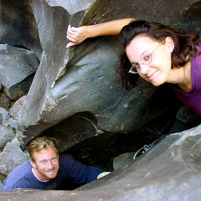
While it may be a bit hot to visit here during summer, I thought I would let everyone know about this awesome "stretch break" along US Hwy 395 , where the Mojave meets the Sierra Nevada. When you are on your way northbound toward Bishop, entering the lava corridor of the Eastern Sierra, look for a red cinder cone volcano on the right side of the highway. This easy to miss turn off is after Little Lake (which is the remains of a burnt hotel) & before Coso Junction. If you are driving over 55 mph, you may actually miss it. To find Fossil Falls (which is not a waterfall anymore) -- turn right off Highway 395, on to a well marked gravel road called CINDER ROAD. High clearance vehicle is not required. Follow road to the right w/ signs approx. 1 mile & you will be at a small primitive BLM campground & trailhead parking lot. Surrounded by a field of black lava chunks, the Sierra Nevada mountains to the west and Death Valley Park to the east. New picnic tables &

Eastern Sierra for Autumn

Image
Eastern Sierra Peaks , a photo by totalescape.com on Flickr. Mammoth Mountain just announced opening day for skiing in early November 2012. Temps are dropping each night and autumn colors are the next big show. Eastern Sierra aspen groves can be seen as far south as Whitney Portal near Lone Pine, and as far north as well, Tahoe of course. Great camping and fishing near June Lake, Bridgeport, and Hope Valley. Fall is also the season for viewing meteor showers for those campers who love to stargaze. LONE PINE ASPENDELL BIG PINE BISHOP MAMMOTH JUNE LAKE LEE VINING BRIDGEPORT LAKE TAHOE top back road destinations - HORSESHOE MEADOWS NORTH LAKE SOUTH LAKE ROCK CREEK   GREEN CREEK TWIN LAKES HOPE VALLEY

Mammoth in California

Image
Mammoth Pool Reservoir Originally uploaded by danamight Dreaming of 90 degrees and sunshine? Sick of June Gloom on the coast? Will the California mountain thunderstorms last into July? Is global warming causing season shifts & more erratic weather patterns? And what are you gonna do about it?  enjoy it while you can Who wants to play on the lake? This weekend, or next? MAMMOTH, California two Mammoths in Cali? MAMMOTH POOL RESERVOIR is a virtually unknown recreation lake, way, way back there in Sierra NF; campground and boat launch ramp on a steep dirt road; located on the western slopes of the Sierra Nevada mountains, due south of Yosemite National Park. MAMMOTH LAKES, CA  this is the well known ski mountain and upscale (bankrupt) village in the Eastern Sierra, north of Bishop, CA and south of Yosemite National Park. Fishing on Lake Mary near Mammoth Lake, California

The Road to Joy

Image
The Road to Joy Originally uploaded by danamight Outdoors is my passion & this stuff, these photos, these stories, my web site is my work, my art, for you to discover what I have seen. The back roads of California are alive with all flavors. My gift to you, the world. Enjoy. Green Creek California is a very special place I visited back in mid 2004. These Sierra Nevada photos have taken a while to upload, but here they are, for your viewing pleasure. This prime Eastern Sierra camping area is well worth the long journey. Plan to spend a minimum of a week here for the full spectrum of recreation. The graded dirt road is suitable for passenger cars & RVs too. Hiking, fishing, camping, it's all out here near Bridgeport CA; Altho most are so in a hurry to reach Bodie Ghost Town State Park, they completely ignore this area, just on the other side of Highway 395. If you have some free time, I would highly suggest this primitive camping location on the Hoover Wilderness bounda

fishaholics

Image
Many times over the years of Total Escape, I get letters such as this one below, which makes me realize just how important it is to take your kids out traveling & camping. My name is Wendy and when I was a toddler, we used to camp at Lundy Lake. It was pure wilderness then and my dad used to make whistles for us out of the birch trees I think. I just wanted to share my memories with someone that might love to hear what it was like then. I haven't been there since I was about 8 or 9, but we took our summer vacation every single year to the High Sierras & Virginia Lakes from years 1952-1971. What sweet memories! We went to Green Creek when no one hardly knew it was there. My dad and mom were fishaholics and we lived in Santa Barbara CA and we love the high Sierras.  how to find these sacred spaces - California Lakes & Reservoirs California National Forest Maps California Wilderness Maps California Cabin Rentals   California Rivers California Creek Camping C