Posts

Showing posts with the label Campground

Usal Beach Campground
Image
Lost Coast Camping, NorCal The USA Lumber Company ran a big wood mill on this part of the redwood coast back in the early days. This camp's name gets shortened to USAL. Usal Beach Campground near Shelter Cove, California This idyllic prime yet primitive, hard-to-reach beach campground is tucked well away from the crowds along the Pacific Coastal Hwy 1.  The region is California BLM land King Range National Conservation Area, or better known as the Lost Coast of California ... a famous stretch of wilderness coastline in between Mendocino and the Humboldt Redwoods. Dense forests and steep terrain located on the county line of Mendocino & Humboldt. Sinkyone Wilderness State Park is nearby. Usal Camp is the only place for drive-up car camping on the beach front in Northern Cal. All other developed camps in the area are located further inland (with forested surroundings), or backpacking, hike-in primitive campsites. Usal Campground on Usal Creek , has several idyllic se

Half Moon Campground

Image
Los Padres NF: Half Moon Camp 2006 Day Fire wildfire burned most of the Sespe Wilderness Piru Creek Camping Lockwood Valley, Sespe Wilderness Trailheads Late afternoon sun at uncrowded Half Moon campground   Los Padres National Forest West of Frazier Park & north of Ojai Camping - 12 camp sites on creek @ 4700' elevation vault toilet, creek, pine forest, Sespe Wilderness first come, first served camping Max Camper Length: 0 RV, motorhomes, camper trailers are not advised Access by long dirt road with creek crossings, high clearance recommended. Lockwood Ranger Station: 661-245-3731 Backpacking, car camping, fishing, hiking, horseback riding, hunting, mountain biking, off-roading. Piru Creek valley overlook on the way to Mutau Flat and Half Moon From Ojai, California take Hwy 33. Turn right (east) on Lockwood Valley. Turn right (south) on Mutau Flat Road #7N03 and continue 9 miles to the campground at junction with #7N13. From Frazier Park,

Sardine Lake

Image
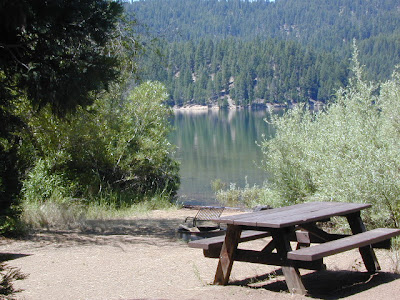
Lake Sardine California upper sardine, lower sardine lakes One of the best camping lakes in California. Any lake near Gold Lake is prime pickens. This picturesque lake called Sardine Lake, or Sardine Lakes, is located within the Lakes Basin Recreation Area , north of Gold Country Highway 49 next to the peaks of Sierra Buttes and in between Tahoe National Forest and Plumas National Forest . A two tiered water storage in granite basin bowls, with the larger upper lake situated up above at the base of the mighty granite spires of the Sierra Buttes. Very impressive views all around the Gold Lake highway. Sardine Lake Campground , elevation 5,800' developed NFS campground near lower lake w/ fee, 29 camp sites, piped water, vault toilets. 530-862-1368 Tahoe National Forest nearest town: Sierra City California, on Historic Hwy 4. Frasier Falls, Gold Lake, Long Lake Trail, and Sierra Buttes are just a few of the area attractions. more on Sardine Lake Lake fishing,

Campsites in Southern California

Image
Camping sites in Southern California While camping in California is an amazing experience overall with thousands of picture perfect settings to pitch your tent, camping in SoCal definitely has it's limitations. The primary reasons are.... Camping in SoCal is - 1. crowded (half the population is located in the lower third of the state) 2. dry terrain (minimal rivers, dry seasonal streams, few waterfalls) 3. wildfire prone (with average rainfall of only 10") 4. costly (all developed campgrounds charge fees) 5. not secluded (with suburbia spread into foothills, busy roads nearby) With the California population nearing 40 million, you will need to do your research in order to find a good, secluded, scenic camping area. Coastal camp sites are the most popular on the list and you should seek advanced reservation w/ the State Park system. City camping is mostly RV parks and a few county parks. Beyond the neighborhoods, countryside camping in the coastal footh

Trinity Alps Wilderness Topo Map

Image
Trinity Wilderness Map  new edition 2013  After 2 years outta stock status the Trinity Alps Wilderness Map is finally back in stock at Total Escape. USDA recently updated, reprinted and released this long-waited NorCal title and we expect it to be a great seller (just like the last version was). Backpacking, day hiking, horseback, high elevation camping - all campgrounds, roads, trails, waterfalls, lakes, mountain peaks and trailheads. Trinity River, Salmon River, Klamath River, Highway 96, Highway 3, Forks of the Salmon. Surrounded by Six Rivers National Forest and Trinity National Forest, both west of Interstate 5 in Northern California.   nearby towns include -  Douglas City, CA Etna, CA Fort Jones, CA French Gulch Gazelle, CA Happy Camp, CA Helena Junction City Lewiston, CA Orleans, CA Trinity Center Weaverville, CA Willow Creek Yreka, CA   Big Foot in Happy Camp, CA

Best Hidden Campsites

Image
Hidden Campsites small campgrounds, tent camping, free camping We know, we know, you want a lake to yourself and don't really wanna share a huge campground with hundreds of other folks. Picking a decent campground online is difficult enough - with the numerous managing agencies , confusing park names, long driving times, freeway routes and hefty reservation fees. Avoid reservations all together and discover travel off the beaten path. Mid week campground stays can be better than weekends, but during summertime all week long is peak season w/ maximum visitors circulating. Neighbors at camp can often mean annoyances - children, generator noise, vehicle engines, boating trailers, music and partying. Quiet time is usually 10pm to 7am, but that doesn't mean the loud garbage truck won't wake you at 6:50am. big campgrounds vs. small Big campgrounds are developed parks with more than 20 camp sites, usually found along paved roads and highways. Level tent spots, pa

Frazier Mill Campground

Image
Sequoia Camping @ Frazier Mill Mountain Home State Forest On the western slopes of the Sierra Nevada mountain range, at the base of the Western Divide (California SR 190) this campground is within Mountain Home State Forest . The unheard-of park is worth a weekend jaunt, located south of the big park, Sequoia National Park and north of Giant Sequoia National Monument & Sequoia National Forest . Frasier Mill Camp is positioned on fern-lined Bear Creek; a good size campground on a historic lumber mill site. Accessible to numerous Sequoia groves, Balch Park fishing pond, wilderness trailheads. A fork of the Tule River flows through this section of Sequoia National Forest land & there are meadows all over. Bring your mountain bike to easily explore all the dirt roads. East of Springville, CA - Sequoia Camping - 46 camp sites on creek @ 6000' elevation fee, vault toilet, piped water, hiking trailheads, creek first come, first served camping Max Camper Leng

Cold Springs Campground

Image
Mineral King Campground, Sequoia NP Sequoia National Park: Cold Springs Campground in Mineral King Area A large developed camp ground with bear lockers, a raging creek, some walk in sites, & access to the Sierra Nevada high country trails. This is the last real campground in the main valley, everything beyond this spot is pure alpine highcountry. 9000'-13,000' peaks - in the Southern Sierra Nevada mountains. Car camp, tent camping or bring a backpack and climb to pristine lakes and into the real Wilderness. Cold Springs Campground, California on the East Fork of the Kaweah River, closest campground to the hiker trailheads @ Mineral King Valley. Mineral King Road open May-October (usually, depending on snow) Atop the mighty canyon sits mountain passes, peaks and lakes above 10,000' elevation. A rocky alpine valley of wonder and water, granite, dark skies and a good night sleep. Black bears and hikers are everywhere, anytime. This sweet spot river campgrou

California Wildfires 2013

Image
Wildfires in western states are common place each summer with the typical "wildfire season" starting in mid summer and lasting into late Autumn, or until the first significant precipitation. The less rain in winter, the drier the land. The less snow in the mountains, the less water in the rivers, creeks and reservoirs. When significant drought conditions in California meet with dry springtime chaparral, wild land fires can easily be ignited.  Campfires restrictions are tighter than usual this summer 2013, so knnow the current conditions and restrictions by contacting the nearest ranger station. Remember that campfire safety is always key. NO CAMP FIRES, what?   What a way to start the summer! as of June 3, 2013 : The lower half of California is in extreme drought conditions and backcountry fire restrictions are already in place.  This means you can only legally have a campfire inside a developed campground. Severe conditions may escalate to 'no campfires anyw

California Tent Campgrounds

Image
Tent Camping in California Car camping is also referred to as 'tent camping', where you drive to your destination and pitch a tent to sleep in. Minimal crowds w/ maximum scenery is what most seek. Peace and quiet all weekend is often the goal. Hiking trails, biking trails, horseback trails too. Few RV campers,  if any; Small campgrounds located on one-lane roads, or better yet - dirt roads! mountains • foothills • deserts • beaches • rivers • creeks • meadows • waterfalls • trailheads •  parks • forests • groves • lakes Whether you seek a developed campground: paved, level parking spot w/ toilets; or a primitive spot on a dirt road w/ creek and rock campfire ring... we have all of them listed on this web site. National Parks, National Forests, State Parks, county campgrounds, backpacking trailheads, free car camping, PG&E lake camps, 4x4 camp sites . Here at Total Escape we focus mainly on the secluded camping - off the beaten path, forested back roads camp sites

Free Camping California

Image
Free camp sites may seem hard to come by in Southern California - or anywhere along the ocean on the popular west coast, but these no charge camps are quite common in the rest of the golden state. The very best camps are found inside the Sierra Nevada mountains and most any forests of Northern California. Free camping usually means remote, secluded and private. Many accessible via dirt road. Creekside, lakeside, 4x4 not required. Minimal tourists, maximum privacy. USDA rangers like to call it dispersed camping . Some parks refer to it as open camping . RV campers refer to free camp sites as boon-docking . If you wish to camp overnight outside of a developed campground , then you will avoid fees and steer clear of any crowds. Many Californians crave the seclusion and privacy of the back roads, totally saturated inside real nature with the wildlife and all. Developing your self sufficient camping techniques means you will have more options and skills to choose your perfect camp