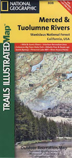
California Wildfire Affected Areas: Ferguson Fire
Ferguson Fire 2018
96,901 Acres burned
10 buildings destroyed
2 firefighter deaths
Foresta, CA
Yosemite West, CA
Highway 120
Highway 140
Highway 41

Merced River
Areas affected by the wildfire:
Foresta
Yosemite West
Eagle Peak
Cedar Lodge
Bull Creek Rd #2S05
Big Grizzly Mountain
Forest Road #20
Forest Route #1S13
Harden Pass Rd
Forest Route #1S13
Harden Pass Rd
Pilot Peak
Crocker Ridge
(lower) Glacier Point Road
Hite's Cove
Indian Flat
Jerseydale
Jerseydale Campground
Clarks Valley
Clarks Valley
Scott Road
Nutmeg Gulch
Devils Gulch
Devils Gulch
Sweetwater Ridge
Sweetwater Creek
Ferguson Ridge
Wawona Road
Wawona Campground
Wawona Campground
El Portal Trailer Court
Miller Gulch
Ned Gulch
Montgomery Gulch
Brown Peak
Pinoche Peak
 Kirby Peak
Footman Ridge
Cathewood Saddle
Chinquapin
Cathewood Saddle
Chinquapin
Eagle Peak
Buena Vista
Chowchilla Mountain
Iron Creek Trailhead
Iron Creek Trailhead
Areas that were under evacuation orders:
Anderson Valley
Foresta
Old El Portal
Old Yosemite Road
Wawona
Yosemite View Lodge
Yosemite West
All camping areas along Hwy 140
All camping areas along Hwy 140
River Road (Briceburg to last BLM Camp)
The following places & roads were closed:
Anderson Valley Road
Foresta Road
River Road @ Briceburg
Summit Road
Old Yosemite Road
Wawona Road (Highway 41)
Yosemite Valley
Wawona Mariposa Grove
https://en.wikipedia.org/wiki/Ferguson_Fire
https://inciweb.nwcg.gov/incident/5927/


