Posts

Showing posts from January, 2022

California Wildfire Affected Areas: Whaleback Fire

Image
Whaleback Fire 2018 18,703 Acres burned Lassen County, California Eagle Lake (westside) Spaulding, CA Along the road to Spaulding Eagle Lake Road 201 (also known as Road A1) Lake View Drive (to Spaulding) Lassen National Forest Rain showers at Eagle Lake in 2011 Whaleback Mountain Brockman Flat Lava Beds Lava & Western shore of Eagle Lake, CA Campgrounds affected by this wildfire: Pine Ridge Campground Prison Spring Campground Forest Routes affected by this wildfire: Forest Rte #32N02 Eagle Lake Road 201 (Road A1) Road A1 (aka 201) Eagle Lake Rd https://en.wikipedia.org/wiki/Whaleback_Fire

California Wildfire Affected Areas: Donnell Fire

Image
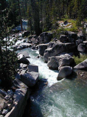
Donnell Fire 2018 36,450 Acres Tuolumne County, California Dardanelle, CA Sonora Pass CA SR 108 (Hwy 108) Stanislaus River in 2004 Areas  affected by this wildfire: Stanislaus National Forest Carson Iceberg Wilderness  Donnell Lake Spicer Meadows Reservoir Stanuslaus River Arnot Creek  Douglas Creek Eagle Creek Dardanelle Resort  (slowly rebuilding) Barker Station Clark Fork Double Dome Rock County Line Trailhead Wheats Meadow Trailhead Trailheads  affected by this wildfire: Arnot Creek Trailhead Clark Fork Trailhead Columns of the Giants County Line Trailhead Disaster Creek Trailhead Seven Pines Trailhead Wheats Meadow Trailhead Meadow at end of Road # 6N06 Trails  affected by this wildfire: 19E06 Trail 19E16 Trail 19E47 Trail 19EV1208 Trail 19EV97 Trail 20E05 Trail 20E07 Trail 20E08 Trail 20E62 Trail NFS Dardanelle Campground in 2004 Campgrounds affected by this wildfire: Boulder Flat Campground Brightman Flat Campground Camp Jack Hazard Campground Clark Fork Campground Dardanelle C