Posts

California Gear

Image
Camp diva DanaMite is totally re-working the GEAR store on Total Escape this summer, building new product pages and working them into the map store for ease of shopping and a place for ever expanding inventory. Kayaks to camp stoves, bear canisters to BBQs, we have your outdoor gear covered. totalescape.com/gear/ camp gear GPS units camp storage camp lighting outdoor radios camp tents camp chairs camp soaps campfire pits outdoor stoves sleeping bags

Snowpack melts in the Sierra

Image
The rivers and creeks are all flowing extremely well this season, as snow is still melting in the higher elevations. Some folks have lost their lives recently because of the wild water, so be VERY careful around all water sources this summer. Just got back form a week exploring Plumas County back roads in the Northern Sierra Nevada. From Donner Pass to Downieville, Susanville to Lake Almanor, Total Escape R&D camped, GPSed and photographed some great camping sites, amazing lakes and some fierce waters. Lassen National Park was still closed on the south entrance due to snow. Mill Creek (shown above) is a small river this summer. Not the clear mellow stream we are accustom to seeing. You can expect mud or snow above 7000' elevation well into late summer. And be warned many developed Campgrounds are still closed.

2011 California Wildflowers

Image
Cottonwood Canyon , a photo by totalescape.com on Flickr. Cottonwood Canyon on Hwy 166, between the Central Coast & the Tejon Ranch Hills. Kern County is getting more rain tonight. Old man winter is still moving thru this Spring in California. Hang loose & hold tight for spectacular wildflowers EVERYWHERE. Share your wildflower finds w/ Total Escape on Facebook

Vote for Total Escape

Would love to expand and offer you more information on all back roads around the entire SouthWest, but technology is expensive. After 14 years online, I can safely says I need to hire some help. Intuit is offering a hiring grant and we need your vote to make it happen.

Poppies and South Fork, Merced River

Image
hite cove trail poppies and South Fork of the Merced River below a photo by Mrs Rachel on Flickr. Is it happening yet? Have you seen them? Where? Zillions of web sites and pages referencing wildflowers in California. The best imagery can be found on Flickr searches, which landed me on this incredible shot by Rachel. Total Escape covers California wildflower reporting starting in March each year.

California Snow Destination

Get the California Ski & Snow Report widget and many other great free widgets at Widgetbox ! Not seeing a widget? ( More info )

Waterproof Maps

Image
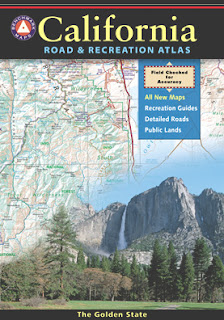
Been there, done that. Way into the outdoors . If you know someone on your holiday gift list like this, maybe they need some new local areas to explore. Grab a new waterproof map from Total Escape , NatGeo, Tom Harrison, USDA, we have 'em all. If plastic durability is not a concern, then try the wonderful, accurate, large, overview atlas (book map) for every California road trip. Benchmark brand is the best with big, detailed, dirt road, hot spring, outdoor beauty. Way better than DeLorme.