Posts

Autumn in California

Image
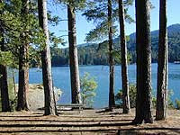
Autumn along North Lake Originally uploaded by danamight Do not wait until the last minute to see the autumn colors. The change can be gradual or fast; one week to one month, the weather is warm and then cold the next. The best places to check out fall colors in California is the Eastern Sierra, the North Gold Country & areas around Mount Shasta. Below are FALL DESTINATIONS for California: ASPENDELL BRIDGEPORT DOWNIEVILLE JUNE LAKE LEE VINING MAMMOTH LAKES MOUNT SHASTA OJAI PINE MOUNTAIN PONDEROSA REDDING

Creek Recreation

Image
creek recreation includes fishing, hiking, kayaking, rafting, tubing, gold panning, and finding swimming holes. People love secluded lakes inside alpine mountains, well away from the city. Folks also love rivers and creeks - of all sizes. Most all of the California National Forest have recreation creeks running thru them. SoCal would be seasonal creeks - which means it often dry up annually, or goes underground. In the golden west, the desert's dryness reigns, and some smaller creeks are 'seasonal' and tend to dry up every year. The flow stops completely and you are bummed, cuz your hike isn't what you had hoped it would be. There are only a select few creeks for camping in Southern California. Drought conditions are often. Call ahead, ask the field ranger about your creek destination. The best streams & creeks are located in the higher elevation mountains. If you are seeking that hidden creek with a forest to hike or bike in, or a new fly fishing spot, you...

Mt Whitney Route

Image
Mount Whitney CALIFORNIA Mt Whitney hiking can only be done half the year, when the snow is minimal. All other seasons this is considered a 'mountaineering route' with ice crampons, snow axes, hard core mountain climbers. Not for the average hiker. Whitney is the tallest peak in the lower 48 states, so the demand for these trails is very high. So if you wanna hike this are, please check with the local rangers in Lone Pine or Whitney Portal for the availability, plus the permits needed. Mt Whitney Permits Weather Mt Whitney WHITNEY MAPS: topo trail maps Mount Whitney High Country Map Mount Whitney Zone Map Inyo National Forest Map Inyo National Forest Atlas Mt Whitney as seen from Alabama Hills. Lone Pine, CA

Wilderness Mountains

Image
Santa Barbara coast is 40 miles away, but it's on fire again , so we usually bolt up to the Sierra Nevada mountains. Big rivers, hot springs, granite wall and zillions of dirt roads . Pieces of an email spawn new topics, spanning fresh ideas, friends sharing groceries today. Online, in the wild. Pretty much. My life, a silly hi-tech dream sometimes, is me working from a remote mountain village in SoCal, but too often in front of a computer -- on beautiful sunny days. Cool mountain breezes still make their way into my small office. My big dead line daily is to mail your maps, priority . Away from the city, deep in the woods. Minimal facilities, the mail leaves the hill at 3pm, sharp. No good restaurants, a small golf course, one crappy local pub w/ classic rock, black ice, winter snows and often, stuck on slow dial up (old skool, 56k internet connection, slow as molasses). This is what I do. I type, nearly every day or night, many 4 hour shifts...just to tell you abo...

California places to live

Image
Most residents of California migrate to the west coast. Like 90% of the population.Native Californians are harder and harder to find. The direction has always been westbound in our nations history. Diverse people, places, food, cities, great weather, plus tons of outdoor recreation and natural beauty to be enjoyed. San Diego, Los Angeles & San Francisco are the big 3 cities that folks gravitate to. If you are looking to move into the suburban or urban grind, we wish you well. If you seek a new rural residence in wine country, or the lost coast, or wanna buy a mountain cabin or live on a river, then you best start here with Total Escape. Get your own travel ideas and get inspired on real California. We've been doing the back roads of Cali for decades! California A to Z Population, California 36,756,666

California Bass Lake

Image
Bass is one the the top sought-after fish to catch in the California sport of fishing. While golden trout dominate the Sierra Nevada back-country, bass can be found in numerous lakes and most reservoirs in the west. The Dept of Fish & Game stock or 'plant' California lakes with bass that are raised in fish hatcheries. Largemouth Bass, Smallmouth Bass and Spotted Bass. Below are just a few of the lakes that are regularly supplied with 'planted' bass: These are the best waterways & lakes for bass fishing - The California Delta Gold Country Reservoirs (like Don Pedro, Millerton Lake, New Melones) Lake Almanor Lake Berryessa Big Bear Lake Bullards Bar Reservoir Lake Castaic Clear Lake Folsom Lake Lake Nacimiento Lake Oroville Lower Otay Lake Pine Flat Lake Pyramid Lake Lake Shasta Silverwood Reservoir Trinity Lake Looking for BASS LAKE near Yosemite National Park ? Check our list of Lake Campground CA

Lake in California

Image
Camping Lake Originally uploaded by danamight Amazing weekends in the High Sierra. Crisp, clean air, incredible mountain scenery in the alpine country. July 4th was not-so-crowded at Highland Lakes. Although all 35 campsites were filled, the nights were silent & you could hear the frogs. Very few boats on the lakes overall. Plenty people fishing. Kayaks & canoes, a dream location. Wildflowers just starting in mid July. Snow melt was all around us at 9000' elevation. Deep in the Stanislaus National Forest , Hwy 4/ Ebbetts Pass.