Posts

Showing posts with the label trailheads

Mokelumne River Canyon

Image
Mokelumne Peak is at a towering 9334' elevation in the High Sierra known as Mokelumne Wilderness . Granite scenery, high country, big water at high elevations. 105,165 acres straddles the crest of the central Sierra Nevada, within the Stanislaus, Eldorado, and Toiyabe National Forests; bordered by Highway 4 on the south and Highway 88 on the north. The Mokelumne River starts way up near Blue Lakes (South of Tahoe) which flows down to Salt Springs Reservoir, on the Amador & Calaveras county line. Once inside the Gold Country region the Mokelumne River drains into Pardee Reservoir, near Jackson CA . Salt Springs Reservoir has a trailhead for the Mokelumne Wilderness. Ellis Road - El Dorado National Forest Road #8N25 a signed turn off of Sierra Highway 88; a steep long, winding, hairy drive on a paved, back road that switchbacks down to river and prime camping. Minimal access and recreation at Salt Springs reservoir. Mokelumne River Campground NFS Mokelu...

Cold Springs Campground

Image
Mineral King Campground, Sequoia NP Sequoia National Park: Cold Springs Campground in Mineral King Area A large developed camp ground with bear lockers, a raging creek, some walk in sites, & access to the Sierra Nevada high country trails. This is the last real campground in the main valley, everything beyond this spot is pure alpine highcountry. 9000'-13,000' peaks - in the Southern Sierra Nevada mountains. Car camp, tent camping or bring a backpack and climb to pristine lakes and into the real Wilderness. Cold Springs Campground, California on the East Fork of the Kaweah River, closest campground to the hiker trailheads @ Mineral King Valley. Mineral King Road open May-October (usually, depending on snow) Atop the mighty canyon sits mountain passes, peaks and lakes above 10,000' elevation. A rocky alpine valley of wonder and water, granite, dark skies and a good night sleep. Black bears and hikers are everywhere, anytime. This sweet spot river campgrou...

Sierra Nevada Map

Image
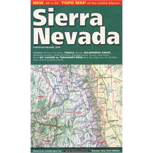
The Sierra Nevada mountains range in elevation from 2000' - 14,494' above sea level. From rolling foothills with creek, oaks & wildflowers to tower granite peaks, alpine lakes & high country meadows of the Eastern Sierra. Imus Geographics makes a nice overview map of the Sierra Nevada mountains and this one is a hot seller on Total Escape! Over at the Total Escape map store we have an epic selection of Sierra Maps - see all Sierra Nevada Maps Eastern Sierra Map Gold Country Maps Lassen Maps Mammoth Maps Mt Whitney Maps Sequoia Maps Tahoe Maps Yosemite Maps Northern Sierra Forest Map Set Central Sierra Forest Map Set Easterm Sierra Forest Map Set Southern Sierra Forest Map Set California Sierra Wilderness Maps PCT - Pacific Crest Trail Maps  

Eastern Sierra for Autumn

Image
Eastern Sierra Peaks , a photo by totalescape.com on Flickr. Mammoth Mountain just announced opening day for skiing in early November 2012. Temps are dropping each night and autumn colors are the next big show. Eastern Sierra aspen groves can be seen as far south as Whitney Portal near Lone Pine, and as far north as well, Tahoe of course. Great camping and fishing near June Lake, Bridgeport, and Hope Valley. Fall is also the season for viewing meteor showers for those campers who love to stargaze. LONE PINE ASPENDELL BIG PINE BISHOP MAMMOTH JUNE LAKE LEE VINING BRIDGEPORT LAKE TAHOE top back road destinations - HORSESHOE MEADOWS NORTH LAKE SOUTH LAKE ROCK CREEK   GREEN CREEK TWIN LAKES HOPE VALLEY

Map Availability

Image
Maps can save your life. Maps can get you un-lost and can show you the way. Maps are your escape route outta the city. In a digital world where we are so connected w/ internet, smartphones and GoogleMaps, it is amazing that folks can find there way to real back roads of California. Don't be shocked when your digital signal drops at the wilderness edge and you are finally "away". Most online map sources are NOT accurate beyond the city limits, much less the forest boundary. Seriously folks, THEY don't want you out there. There is no place in the Wilderness to spend any money. Many have not properly logged the back roads yet, or perhaps they just won't make it available to the general public. You'll be lucky if they get the road number correct. BACK ORDERED / BACKORDER? OUT OF PRINT, OUT OF STOCK Availability of good maps is an ongoing issue. It's a unique factor in the map selling business. Although Total Escape carries a variety of Californ...

Benchmark Maps

Image
Benchmark Maps are the best, full state, full featured, road map for exploring the Western US. DanaMite, founder of Total Escape, has been using hers since 2000, and has always found a place to camp, on any dirt road, even in the wee hours of the night. Imagine waking up the next morning, with stunning scenery all around, cuz you went the distance. Benchmark Atlases for the Western United States CALIFORNIA ARIZONA NEW MEXICO NEVADA UTAH WASHINGTON OREGON