Posts

Showing posts with the label river

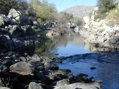
Mokelumne River Canyon

Image
Mokelumne Peak is at a towering 9334' elevation in the High Sierra known as Mokelumne Wilderness . Granite scenery, high country, big water at high elevations. 105,165 acres straddles the crest of the central Sierra Nevada, within the Stanislaus, Eldorado, and Toiyabe National Forests; bordered by Highway 4 on the south and Highway 88 on the north. The Mokelumne River starts way up near Blue Lakes (South of Tahoe) which flows down to Salt Springs Reservoir, on the Amador & Calaveras county line. Once inside the Gold Country region the Mokelumne River drains into Pardee Reservoir, near Jackson CA . Salt Springs Reservoir has a trailhead for the Mokelumne Wilderness. Ellis Road - El Dorado National Forest Road #8N25 a signed turn off of Sierra Highway 88; a steep long, winding, hairy drive on a paved, back road that switchbacks down to river and prime camping. Minimal access and recreation at Salt Springs reservoir. Mokelumne River Campground NFS Mokelu...

Cabins for Rent

Image
Huntington Lake, Sierra National Forest Alpine Cabin Homes, Soda Springs near Donner Pass I-80 Cabins to Rent California has some amazing locations for cabin rentals. Gorgeous scenery in so many places, nearby hiking, mountain biking and fishing. Cabins in the redwoods, cabins on the coast, cabins on rivers, or in the mountains and rustic cabins in the desert. Cabin Communities in California Alta Sierra Bass Lake Ben Lomond Big Bear Big Sur Dardanelle Downieville Fawnskin Huntington Lake Gold Lake Idyllwild Julian June Lake Kernville Lake Almanor Lake Arrowhead Lake Tahoe Mount Laguna Nipton Panamint Springs Pine Mountain Pinecrest Ponderosa Shaver Lake Silver City Truckee Willow Creek  Wrightwood Rental Cabins in California North Coast Shasta/Cascade Gold Country The Sierras San Francisco Central Valley Central Coast The Deserts Los Angeles Orange County Inland Empire San Diego  

Kern River Camping

Image
Camping is great here nearly year round, but campfires restrictions are often tight in dry summer months and into late fall. The Kern River draws visitors from Southern California, as well as Central Cal. It is the southern most big river of the Sierra Nevada mountain range. Located near a few big Sequoia trees, the Kern River winds thru Golden Trout Wilderness & Sequoia National Forest, dumping into Lake Isabella before heading west to the flatlands of Bako. The smaller & lesser known south fork of the Kern River is located way up top at Monache; Granite peaks, joshua trees, sage meadows & wilderness near Olancha Peak, on the very border of the North Mojave desert. Plenty cool stuff to see and do around the Lower Kern Canyon: Alta Sierra Domelands Wilderness Fairview CA Golden Trout Wilderness Kennedy Meadows Kernville CA Lake Isabella Pondersosa Remington Hot Springs Road's End Sequoia National Forest Wofford Heights CA Upper Kern is often thought ...

Kern River Hot Springs

Image
  We grabbed some snacks & beverages at a Bakersfield mini-mart & headed due east on Hwy 178. Into a wall of granite, a raging river filled with Sierra Nevada snow melt, the sounds of rushing water filled the air. We turned on to a dark narrow road without any guard rails. Oaks trees hung overhead, dark skies & huge cows in the middle of the road. After passing it once, we found the dirt parking area around 10:20 pm & started our hike down to the hot springs w/ flashlights. Down to the Kern River we scrambled thru muddy grasses & bushes. Candle light, river rock tubs & steaming mineral baths await. No one around, we had the whole place to ourselves..... until 1am. There are numerous natural hot springs located on the Kern River canyon, most of them on the Lower Kern in between Lake Isabella & the Bako citrus orchards. Many are closed off to the public - private property.  Lower Kern Canyon on Highway 178 is the way to Kernville California ...

Sequoia Forest Update

Image
Update for Sequoia Forest, 2012 Southern Sierra areas include - Sequoia National Forest, Kern River Canyon, Kernville, Tehachapi, Kennedy Meadows, Golden Trout, Domeland, Western Divide, Giant Sequoia National Monument. Further north, there is a small chunk of National Forest land smack dab in between Sequoia & Kings Canyon National Parks, some of the best, free Sequoia car camping anywhere . new: USDA National Forest waterproof map, updated and printed in late 2011 . The Wilderness areas of the Southern Sierra Nevada, known as SEQUOIA, has renamed their ranger districts too. Kern river & Sequoia ranger offices What was once Greenhorn Ranger District is now called Kern River Ranger District - one office in Kernville and one office on Lake Isabella .  Sequoia Hot Springs Ranger District in California Hot Springs is gone and a new Western Divide Ranger District is located in Springville, CA . Giant Sequoia...