Posts

Showing posts with the label mountains

California Meteor Shower

Image
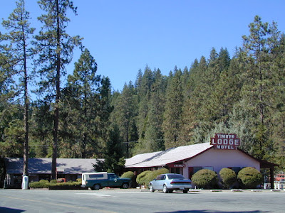
Vermilion Resort Originally uploaded by danamight meteor showers and comets Fair weather means anytime is a good time to watch the sky. totalescape.com/outside/event/perseid-meteor-shower The high Sierra Nevada is the place to really enjoy the show in summer camping out, but winter means snow is likely and a cabin rental might be a better choice, or grab a guest room at a rustic lodge like this one photographed above. Meteor showers are best viewed after 2AM, so you first need to decide if you are "a stay up late", or "wake up early" kinda person. Partying and drinking in the early evening means the excitement will be worn off and you will be dozing after midnight, missing the entire possibility of seeing any grazers. Taking a nap in the early afternoon before might help your odd sleep schedule adjust but be prepared to kick up the caffeine when you want to take in the awesome night views. Mount Pinos and Mount Abel are both popular SoCal spots f

Dirt Biking Trails

Image
California has the most amazing and diverse terrain you can imagine. Ancient lava beds to dense forests, giant boulder rock outcroppings to sand dunes. Off road motorcycles, otherwise known as 'dirt bikes' can find riding trails near home or across the state, in far away locations. dirt bike routes dirt bike camping dirt bike trails Dirt biking off road trails can be found outside of nearly any urban city in California. In National Forests, on BLM lands, all across the many deserts and in a good portion of the mountains. The Sierra Nevada mountains located in the middle of the state has many high elevation OHV routes to small alpine lakes and primitive camp sites. SoCal has the winter prime-time desert warmth, Central Cal has coastal dunes, steep canyons, and rugged foothills, plus the giant Mojave desert which stretches from Joshua Tree area to Vegas. NorCal has the endless forests, solitude and rivers you seek. SoCal Off Road Areas Imperial Sand Dunes Heber Dunes

Campsites in Southern California

Image
Camping sites in Southern California While camping in California is an amazing experience overall with thousands of picture perfect settings to pitch your tent, camping in SoCal definitely has it's limitations. The primary reasons are.... Camping in SoCal is - 1. crowded (half the population is located in the lower third of the state) 2. dry terrain (minimal rivers, dry seasonal streams, few waterfalls) 3. wildfire prone (with average rainfall of only 10") 4. costly (all developed campgrounds charge fees) 5. not secluded (with suburbia spread into foothills, busy roads nearby) With the California population nearing 40 million, you will need to do your research in order to find a good, secluded, scenic camping area. Coastal camp sites are the most popular on the list and you should seek advanced reservation w/ the State Park system. City camping is mostly RV parks and a few county parks. Beyond the neighborhoods, countryside camping in the coastal footh

Watershed Lake

Image
lake in ca watershed: mountain ridge lines dividing two drainage areas; water parting; divide. the region or area drained by a river, stream, or drainage area. Many Sierra Nevada lakes are considered watersheds, due to the heavy snow pack found in this high elevation region of Cali. To name them all would be ridiculous, since most are in remote Wilderness locales - only accessible by foot or on horseback. Several rare and special ones are accessible by vehicle; 4WD might be required. Camping is sometimes primitive style, but there are a few with awesome small developed Campgrounds, usually run by the National Forest. Be very eco-conscience while visiting such areas and always practice good outdoor ethics in these extremely sensitive environments . Yep, that mean you too! COURTRIGHT COYOTE LAKE EDISON LAKE GOLD LAKE JUNIPER LAKE RED LAKE Lakes in California are often located inside or next to protected wilderness areas. The impressive Sierra Nevada wilderness with lak

Frazier Mill Campground

Image
Sequoia Camping @ Frazier Mill Mountain Home State Forest On the western slopes of the Sierra Nevada mountain range, at the base of the Western Divide (California SR 190) this campground is within Mountain Home State Forest . The unheard-of park is worth a weekend jaunt, located south of the big park, Sequoia National Park and north of Giant Sequoia National Monument & Sequoia National Forest . Frasier Mill Camp is positioned on fern-lined Bear Creek; a good size campground on a historic lumber mill site. Accessible to numerous Sequoia groves, Balch Park fishing pond, wilderness trailheads. A fork of the Tule River flows through this section of Sequoia National Forest land & there are meadows all over. Bring your mountain bike to easily explore all the dirt roads. East of Springville, CA - Sequoia Camping - 46 camp sites on creek @ 6000' elevation fee, vault toilet, piped water, hiking trailheads, creek first come, first served camping Max Camper Leng

California Wildfires 2013

Image
Wildfires in western states are common place each summer with the typical "wildfire season" starting in mid summer and lasting into late Autumn, or until the first significant precipitation. The less rain in winter, the drier the land. The less snow in the mountains, the less water in the rivers, creeks and reservoirs. When significant drought conditions in California meet with dry springtime chaparral, wild land fires can easily be ignited.  Campfires restrictions are tighter than usual this summer 2013, so knnow the current conditions and restrictions by contacting the nearest ranger station. Remember that campfire safety is always key. NO CAMP FIRES, what?   What a way to start the summer! as of June 3, 2013 : The lower half of California is in extreme drought conditions and backcountry fire restrictions are already in place.  This means you can only legally have a campfire inside a developed campground. Severe conditions may escalate to 'no campfires anyw

California Tent Campgrounds

Image
Tent Camping in California Car camping is also referred to as 'tent camping', where you drive to your destination and pitch a tent to sleep in. Minimal crowds w/ maximum scenery is what most seek. Peace and quiet all weekend is often the goal. Hiking trails, biking trails, horseback trails too. Few RV campers,  if any; Small campgrounds located on one-lane roads, or better yet - dirt roads! mountains • foothills • deserts • beaches • rivers • creeks • meadows • waterfalls • trailheads •  parks • forests • groves • lakes Whether you seek a developed campground: paved, level parking spot w/ toilets; or a primitive spot on a dirt road w/ creek and rock campfire ring... we have all of them listed on this web site. National Parks, National Forests, State Parks, county campgrounds, backpacking trailheads, free car camping, PG&E lake camps, 4x4 camp sites . Here at Total Escape we focus mainly on the secluded camping - off the beaten path, forested back roads camp sites

Cabins for Rent

Image
Huntington Lake, Sierra National Forest Alpine Cabin Homes, Soda Springs near Donner Pass I-80 Cabins to Rent California has some amazing locations for cabin rentals. Gorgeous scenery in so many places, nearby hiking, mountain biking and fishing. Cabins in the redwoods, cabins on the coast, cabins on rivers, or in the mountains and rustic cabins in the desert. Cabin Communities in California Alta Sierra Bass Lake Ben Lomond Big Bear Big Sur Dardanelle Downieville Fawnskin Huntington Lake Gold Lake Idyllwild Julian June Lake Kernville Lake Almanor Lake Arrowhead Lake Tahoe Mount Laguna Nipton Panamint Springs Pine Mountain Pinecrest Ponderosa Shaver Lake Silver City Truckee Willow Creek  Wrightwood Rental Cabins in California North Coast Shasta/Cascade Gold Country The Sierras San Francisco Central Valley Central Coast The Deserts Los Angeles Orange County Inland Empire San Diego  

The ABC's of California

Image
Most people moved to California for the great weather, the awesome scenery & the forward thinking culture. Or maybe you just relocated here for a job, a career or college. Either way, you are here now & all the plans you had to travel have slipped by the wayside. Computers have now taken over your daily entertainment, your life and society. NOT! No matter what your excuse is the need to be outside enveloped in nature and to explore new trails is still buried deep within you. You crave the sunshine, the fresh air, the real true connection w/ the earth. Caves & caverns of Gold Country, the High Sierra peaks, the wineries to tour.. it's all still out there. Not all the forests have burned - yet. California  A to Z In case you don't already know the back roads of California like you really wanted to, DanaMite has compiled the awesome California small town list , an ever growing compilation of all small towns & some not-so-small cities. It's the perfect

Kennedy Meadows California

Image
General Store at Kennedy Meadows, on the Kern Plateau, California There are 2 different places in the Sierra Nevada mountains called Kennedy Meadows. This one photographed above is on the Kern Plateau, located in the Southern Sierra in between Dome Land Wilderness & Golden Trout Wilderness . The infamous Pacific Crest Trail (the PCT) passes through this region. Sequoia National Forest spans most of the land to the south and west of Kennedy Meadows. Inyo National Forest sits directly to the east. Monache Meadow s and Olancha Peak are to the north side kennedy meadows on the kern plateau -  High elevation Sherman's Pass Road leads uphill from the west, where the steep turn off, next to the Kern River is often gated. Way north of Kernville, CA . Shermans Pass Rd is a paved back road that closes annually for snow, so call the local ranger for up to date weather & road conditions. Access to Kennedy Meadows from the east side, Inyo County Road # J41 off of Easte

Sierra Nevada Map

Image
The Sierra Nevada mountains range in elevation from 2000' - 14,494' above sea level. From rolling foothills with creek, oaks & wildflowers to tower granite peaks, alpine lakes & high country meadows of the Eastern Sierra. Imus Geographics makes a nice overview map of the Sierra Nevada mountains and this one is a hot seller on Total Escape! Over at the Total Escape map store we have an epic selection of Sierra Maps - see all Sierra Nevada Maps Eastern Sierra Map Gold Country Maps Lassen Maps Mammoth Maps Mt Whitney Maps Sequoia Maps Tahoe Maps Yosemite Maps Northern Sierra Forest Map Set Central Sierra Forest Map Set Easterm Sierra Forest Map Set Southern Sierra Forest Map Set California Sierra Wilderness Maps PCT - Pacific Crest Trail Maps