Posts

Showing posts with the label maps

Baja Atlas - Baja Maps - Baja Almanac

Image
Benchmark Maps has a brand new Baja topographic map for 2021 -  The BAJA CALIFORNIA Road & Recreation Atlas This Benchmark atlas showcases the diverse recreation opportunities found along the full length of the Baja California Peninsula. Regional maps provide a wider view of the region and Recreation Guides list an array of attractions for trip planning.  Publish May 2021. ISBN: 9781734315059   Finding good, accurate maps of Baja California Mexico used to be a daunting task. Online searches produced the same, old results with broken links, out-of-date forum postings where travelers exchanged information on where to obtain a decent topo of Baja California.  Amazon.com lists some of the original Baja Almanacs - used or new copies - outrageous priced around $600  Ever since cartographer Landon Crumpton died, Baja lovers have had a hard time locating quality, topographic maps of the famous and popular Mexican peninsula. However, things are again changing. ...

Where'd She Go?

Image
It often seems as if I have forgotten about this long standing blogger blog, leaving it for months at a time without a post (maybe while traveling for weeks or working other more pressing projects). Over this past winter, I spent much time rebuilding older pages to a new format (WordPress) Outside Blog and I will continue this throughout the year. Covering the back roads like no other! I, DanaMite , am dedicated to the whole of Total Escape, my 8000 page web site on California travel destinations, off the beaten path . Established way back in 1996, in the web 1.0 days, on a 33k modem. First and foremost that I can offer is real world content, real experiences, travel logs, photos, GPS data and research I gather while exploring the golden state. Sleeping on the ground, tent camping outside of developed campgrounds, way back there "out in the field". Lakes, Rivers, Wilderness, Outdoor Recreation, Small Towns & Unique Lodging Managing databases on California d...

Waterproof Maps

Image
WATERPROOF TOPOGRAPHIC MAPS Paper maps are fading fast. Literally, disappearing into landfills, campfires or into the archives of map collectors. Digital maps have totally taken over our lives and you'll be hard pressed to find a decent printed local area hiking map when traveling small towns inside California . Keep in mind that many of the middle-of-nowhere, back road destinations we feature on Total Escape do not receive adequate cell phone service, much less a wireless, high speed, digital network. So plan accordingly. Old timers, frequent travelers and experienced outdoor folks still want the hard copy - a real map! Waterproof and tear resistant plastic maps are now common. Tom Harrison was one if the first to offer quality plastic hiking maps. All the  NatGeo map titles are 2-sided, full color and plastic. USDA has slowly been transitioning their National Forests maps to plastic maps over the past few years. California Wilderness area maps are only about...

Kennedy Meadows California

Image
General Store at Kennedy Meadows, on the Kern Plateau, California There are 2 different places in the Sierra Nevada mountains called Kennedy Meadows. This one photographed above is on the Kern Plateau, located in the Southern Sierra in between Dome Land Wilderness & Golden Trout Wilderness . The infamous Pacific Crest Trail (the PCT) passes through this region. Sequoia National Forest spans most of the land to the south and west of Kennedy Meadows. Inyo National Forest sits directly to the east. Monache Meadow s and Olancha Peak are to the north side kennedy meadows on the kern plateau -  High elevation Sherman's Pass Road leads uphill from the west, where the steep turn off, next to the Kern River is often gated. Way north of Kernville, CA . Shermans Pass Rd is a paved back road that closes annually for snow, so call the local ranger for up to date weather & road conditions. Access to Kennedy Meadows from the east side, Inyo County Road # J41 off of Easte...

Sierra Nevada Map

Image
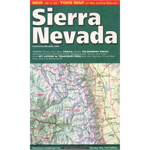
The Sierra Nevada mountains range in elevation from 2000' - 14,494' above sea level. From rolling foothills with creek, oaks & wildflowers to tower granite peaks, alpine lakes & high country meadows of the Eastern Sierra. Imus Geographics makes a nice overview map of the Sierra Nevada mountains and this one is a hot seller on Total Escape! Over at the Total Escape map store we have an epic selection of Sierra Maps - see all Sierra Nevada Maps Eastern Sierra Map Gold Country Maps Lassen Maps Mammoth Maps Mt Whitney Maps Sequoia Maps Tahoe Maps Yosemite Maps Northern Sierra Forest Map Set Central Sierra Forest Map Set Easterm Sierra Forest Map Set Southern Sierra Forest Map Set California Sierra Wilderness Maps PCT - Pacific Crest Trail Maps  

Secluded Camping

Image
There are millions of people in California searching for that perfect weekend in the mountains. That secluded stream side camp with no one else around. Dense forest with mountain peaks, bluebirds, fresh air, total nature everywhere and maybe a view. Free firewood around every corner. No fees, no camp host and no camp fire restrictions. These awesome secret outdoor places do indeed exists, but they are not located in SoCal within an hours drive from your home. Nor are they located in the nearest State Park Campground. These rare finds are on the back roads of California, usually in the Sierra Nevada mountains or further north - in the vast spans known as Northern Cal. First off, you will need to drive (more than 3 hours) to reach these awesome wilderness retreats. Pack days ahead of time to make sure you are truly prepared and ready for serious back roads camping. Plan an early day departure from the city, so you can be at camp relaxing by sundown. Your goal that day is to ...

California Desert Camping

Image
Winter months in California is prime desert camping time. The perfect time to plan your desert trip is November thru April. If a seasonal storm is not in the forecast, the weather is usually sunny and mild, wind is always a given & wildflowers bloom as early as February. Go enjoy the Mojave Desert , Death Valley , Anza Borrego Desert , Joshua Tree , the Lancaster Poppy Fields or the Eastern Sierra lava flows. California Desert Camping Ideas Surreal Box Canyon near Mecca, California is free camping BLM land located perfectly in between Anza Borrego Desert and Joshua Tree National Park .  This area is totally worth a hike, stretch break, or sightseeing visit, if not for an over night stay. Many superb camp spots tucked in near the cliff edges. Be prepared for late night traffic noise as semi-trucks from Interstate 10 use Box Canyon Road as a frequent through route. desert destinations Anza Borrego Desert SP Ballarat Benton Hot Springs Bodie California B...

Map Availability

Image
Maps can save your life. Maps can get you un-lost and can show you the way. Maps are your escape route outta the city. In a digital world where we are so connected w/ internet, smartphones and GoogleMaps, it is amazing that folks can find there way to real back roads of California. Don't be shocked when your digital signal drops at the wilderness edge and you are finally "away". Most online map sources are NOT accurate beyond the city limits, much less the forest boundary. Seriously folks, THEY don't want you out there. There is no place in the Wilderness to spend any money. Many have not properly logged the back roads yet, or perhaps they just won't make it available to the general public. You'll be lucky if they get the road number correct. BACK ORDERED / BACKORDER? OUT OF PRINT, OUT OF STOCK Availability of good maps is an ongoing issue. It's a unique factor in the map selling business. Although Total Escape carries a variety of Californ...

Benchmark Maps

Image
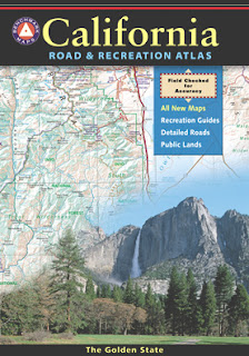
Benchmark Maps are the best, full state, full featured, road map for exploring the Western US. DanaMite, founder of Total Escape, has been using hers since 2000, and has always found a place to camp, on any dirt road, even in the wee hours of the night. Imagine waking up the next morning, with stunning scenery all around, cuz you went the distance. Benchmark Atlases for the Western United States CALIFORNIA ARIZONA NEW MEXICO NEVADA UTAH WASHINGTON OREGON

Waterproof Maps

Image
Been there, done that. Way into the outdoors . If you know someone on your holiday gift list like this, maybe they need some new local areas to explore. Grab a new waterproof map from Total Escape , NatGeo, Tom Harrison, USDA, we have 'em all. If plastic durability is not a concern, then try the wonderful, accurate, large, overview atlas (book map) for every California road trip. Benchmark brand is the best with big, detailed, dirt road, hot spring, outdoor beauty. Way better than DeLorme.

tour california map

Image
You can pick up any popular road atlas of California in the supermarket. These Rand McNalley's and Thomas Brothers map books will show you how to get around in the freeways and the cities of Cali. We wanna show you more, much more. The real scenic drives, the back roads and rural highways. More of REAL CALIFORNIA Total Escape has every possible wilderness map you could ever need for this golden state. The Sierra mountains, the Coast, SoCal and NorCal. We want to inspire you to be outside, to hike and explore the back roads. To fish, kayak and snow ski. To re-create in our recreation paradise called Cali-forn-ia. MAP STORE - for planning your escape

Creek Recreation

Image
creek recreation includes fishing, hiking, kayaking, rafting, tubing, gold panning, and finding swimming holes. People love secluded lakes inside alpine mountains, well away from the city. Folks also love rivers and creeks - of all sizes. Most all of the California National Forest have recreation creeks running thru them. SoCal would be seasonal creeks - which means it often dry up annually, or goes underground. In the golden west, the desert's dryness reigns, and some smaller creeks are 'seasonal' and tend to dry up every year. The flow stops completely and you are bummed, cuz your hike isn't what you had hoped it would be. There are only a select few creeks for camping in Southern California. Drought conditions are often. Call ahead, ask the field ranger about your creek destination. The best streams & creeks are located in the higher elevation mountains. If you are seeking that hidden creek with a forest to hike or bike in, or a new fly fishing spot, you...

Trail Wilderness

Image
Mount Pinos Peak 8830' elevation, Kern County We all seek a wilderness trail to hike or stroll. Wonderful weather, enveloped in scenery, a peaceful place to call our own - if only for the day or the whole weekend. Deep inside the sacred space we call nature, Mother Earth. Maybe a picnic and waterfall as the highlight of the whole day. In California we are lucky to have plenty trails to enjoy and explore. Whether you want a foot trail to a lake, a fishing trail along the river, a backpackers trail over the highest peaks, an equestrian trail, a mountain bike route, or snowmobile trails new and fresh, we just might have it on our maps - somewhere in here . California Wilderness Areas California Forest Maps California Wilderness Maps California Topo Atlas California Recreation Maps Tom Harrison Topographical Maps

Sequoia Map

Image
  If you are searching for maps on the mighty Sequoia region of California, we may be able to help here at Total Escape. First, decide what park or forest. There are up more than 6 'agencies' managing our Giant Sequoia Trees in the Sierra Nevada Mountains. See the list below w/ maps. Big, Old, Huge, Tall Trees : overview page for the Redwoods on the California North Coast, the Sequoia of the Sierra Nevada mountains and the oldest trees, the Ancient Bristlecone Pines over on the east side. Sierra Nevada SEQUOIA GROVES can be found in: Sequoia National Forest Sequoia National Park Kings Canyon National Park Yosemite National Park Mountain Home State Forest Calaveras Big Trees State Park Giant Sequoia National Monument SEQUOIA MAPS below: printed on polypropylene plastic, waterproof maps, tear-resistant, recyclable Sequoia National Forest Map USDA Sequoia National Park Map (NatGeo) Sequoia / Kings Canyon Map (Tom Harrison) Sierra National Forest M...

fishaholics

Image
Many times over the years of Total Escape, I get letters such as this one below, which makes me realize just how important it is to take your kids out traveling & camping. My name is Wendy and when I was a toddler, we used to camp at Lundy Lake. It was pure wilderness then and my dad used to make whistles for us out of the birch trees I think. I just wanted to share my memories with someone that might love to hear what it was like then. I haven't been there since I was about 8 or 9, but we took our summer vacation every single year to the High Sierras & Virginia Lakes from years 1952-1971. What sweet memories! We went to Green Creek when no one hardly knew it was there. My dad and mom were fishaholics and we lived in Santa Barbara CA and we love the high Sierras.  how to find these sacred spaces - California Lakes & Reservoirs California National Forest Maps California Wilderness Maps California Cabin Rentals   California Rivers California Creek Campi...