Posts

Showing posts with the label hiking

What's still open in California?

Image
Last week the USFS announced a dismal end to summer: California National Forests are closed due to wildfire dangers, which is the majority of the mountain areas on the inland side of California. Total Escape is here to show you what areas are STILL OPEN. With most California National Forests closed for the month and the wildfires still burning, camping options narrow considerably.  Where to go? California Deserts are still too warm, so we will be featuring a few other locations. All forests and parks listed below offer camping and additional outdoor recreation opportunities. Campfires may be banned in some locations. Only ONE National Forest inside California is still open - the Humboldt-Toiyabe National Forest in the Eastern Sierra. Toiyabe National Forest  [Mono Lake to Topaz Lake] Autumn Aspens began showing fall colors in mid to late September at higher elevations, lasting into October when the first snow falls: Twin Lakes, CA Bridgeport, CA Buckeye Hot Springs Green Creek Upper S

California Lakes With Water

Image
California Lake Destinations Record low lake levels at most reservoirs & lakes! The mega drought continues. Don't be disappointed on vacation: Lack of water at your lake destination may leave you mad this season. Know before you go. Check out the California Water Information page for more specific information. Reservoirs listed below are the lakes with the most water in California (as of June 2015). Number represents percent of capacity. WHISKEYTOWN LAKE West of Redding, CA 98% full  LEWISTON LAKE Trinity County, Weaverville, CA 94%  ANTELOPE LAKE Northern Sierra, Susanville, CA 99%  ENGLEBRIGHT LAKE Yuba Gold Co, Grass Valley, CA 95%  BULLARDS BAR Reservoir Gold Country, Grass Valley, CA 59%  ICE HOUSE Reservoir Gold Country, Placerville, CA 84%  UNION VALLEY Reservoir Gold Country, Placerville, CA 81%  LAKE TULLOCH Central Valley, Modesto, CA 96%  INDEPENDENCE LAKE High Sierra, Truckee, CA 95%  PYRAMID LAKE Los Angeles County, Gorman, CA 94% 

California Tent Campgrounds

Image
Tent Camping in California Car camping is also referred to as 'tent camping', where you drive to your destination and pitch a tent to sleep in. Minimal crowds w/ maximum scenery is what most seek. Peace and quiet all weekend is often the goal. Hiking trails, biking trails, horseback trails too. Few RV campers,  if any; Small campgrounds located on one-lane roads, or better yet - dirt roads! mountains • foothills • deserts • beaches • rivers • creeks • meadows • waterfalls • trailheads •  parks • forests • groves • lakes Whether you seek a developed campground: paved, level parking spot w/ toilets; or a primitive spot on a dirt road w/ creek and rock campfire ring... we have all of them listed on this web site. National Parks, National Forests, State Parks, county campgrounds, backpacking trailheads, free car camping, PG&E lake camps, 4x4 camp sites . Here at Total Escape we focus mainly on the secluded camping - off the beaten path, forested back roads camp sites

Bass Lake Camping

Image
Bass Lake is a very popular outdoor recreation area in Gold Country California. Lake Camping, due mainly to the fact that it is next to Yosemite National Park 's south entrance, Hwy 41. Bass Lake has good fishing, boating, plenty campgrounds & this pine forested lake is close to the Central Valley, north of Fresno, CA. aka - Crane Valley Reservoir  Crane Valley Dam Bass Lake offers outdoor recreation: marinas, fishing, permits, public boat launches, boat rentals, kayak rentals, jet ski rentals, horseback rides, horseback and hiking trails. Residential cabins, homes and condo neighborhoods surround the lake on all sides. There are numerous Sequoia Groves tucked way back near Yosemite, behind Bass Lake in Sierra National Forest. Miles and miles of forest roads to explore will lead to secluded, primitive camp sites (free), small campgrounds, creek fishing, lake fishing and recreation, higher elevations, backpacker trailheads, hiking trails, kayaking creeks and rock cli

The ABC's of California

Image
Most people moved to California for the great weather, the awesome scenery & the forward thinking culture. Or maybe you just relocated here for a job, a career or college. Either way, you are here now & all the plans you had to travel have slipped by the wayside. Computers have now taken over your daily entertainment, your life and society. NOT! No matter what your excuse is the need to be outside enveloped in nature and to explore new trails is still buried deep within you. You crave the sunshine, the fresh air, the real true connection w/ the earth. Caves & caverns of Gold Country, the High Sierra peaks, the wineries to tour.. it's all still out there. Not all the forests have burned - yet. California  A to Z In case you don't already know the back roads of California like you really wanted to, DanaMite has compiled the awesome California small town list , an ever growing compilation of all small towns & some not-so-small cities. It's the perfect

Map Availability

Image
Maps can save your life. Maps can get you un-lost and can show you the way. Maps are your escape route outta the city. In a digital world where we are so connected w/ internet, smartphones and GoogleMaps, it is amazing that folks can find there way to real back roads of California. Don't be shocked when your digital signal drops at the wilderness edge and you are finally "away". Most online map sources are NOT accurate beyond the city limits, much less the forest boundary. Seriously folks, THEY don't want you out there. There is no place in the Wilderness to spend any money. Many have not properly logged the back roads yet, or perhaps they just won't make it available to the general public. You'll be lucky if they get the road number correct. BACK ORDERED / BACKORDER? OUT OF PRINT, OUT OF STOCK Availability of good maps is an ongoing issue. It's a unique factor in the map selling business. Although Total Escape carries a variety of Californ

Benchmark Maps

Image
Benchmark Maps are the best, full state, full featured, road map for exploring the Western US. DanaMite, founder of Total Escape, has been using hers since 2000, and has always found a place to camp, on any dirt road, even in the wee hours of the night. Imagine waking up the next morning, with stunning scenery all around, cuz you went the distance. Benchmark Atlases for the Western United States CALIFORNIA ARIZONA NEW MEXICO NEVADA UTAH WASHINGTON OREGON

Camp Gift

Image
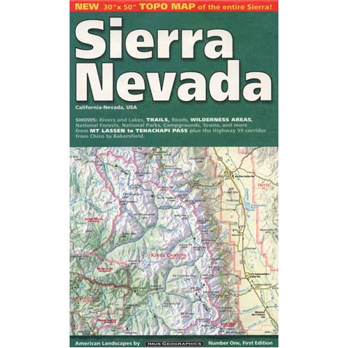
Need to get a gift for the outdoor person in your life, well we can show you some great, inexpensive items. Stuff that every hikers or camper could use. Waterproof maps are by far the easy choice, but deciding on a local region might be a bit difficult. Yosemite maps and Sequoia are popular choices, but so is Death Valley. TIP: pick the next place you want to vacation with them. See all CAMP GEAR here. Below are some 'outdoor gift' items that DanaMite recommends.