Posts

Showing posts with the label camping

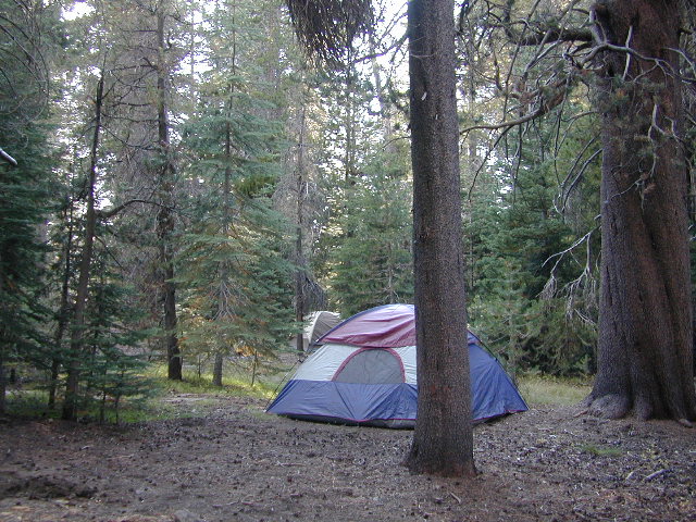
Campsites in Southern California

Image
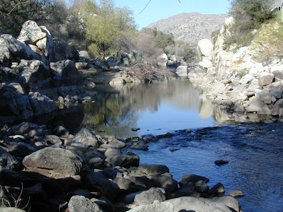
Camping sites in Southern California While camping in California is an amazing experience overall with thousands of picture perfect settings to pitch your tent, camping in SoCal definitely has it's limitations. The primary reasons are.... Camping in SoCal is - 1. crowded (half the population is located in the lower third of the state) 2. dry terrain (minimal rivers, dry seasonal streams, few waterfalls) 3. wildfire prone (with average rainfall of only 10") 4. costly (all developed campgrounds charge fees) 5. not secluded (with suburbia spread into foothills, busy roads nearby) With the California population nearing 40 million, you will need to do your research in order to find a good, secluded, scenic camping area. Coastal camp sites are the most popular on the list and you should seek advanced reservation w/ the State Park system. City camping is mostly RV parks and a few county parks. Beyond the neighborhoods, countryside camping in the coastal footh

Pismo Beach Camping

Image
Pismo Beach California is the big beach oriented tourist destination along the Central Coast of California & just south of San Luis Obispo . Ocean front sand dunes is the primary draw here at Pismo. The Oceano State Vehicular Recreation Area (aka Pismo Dunes) is a seaside haven for off-roaders wanting cooler temps & coastal breezes. This off road park is actually located between Grover Beach and the town of Oceano, miles south of Pismo Pier. You can actually drive your vehicle on the beach sand & set up camp on the shore. Pismo also has a State Park Beach Campground as well & that is more suited for RVs, family camping & tent camping. Downtown Pismo has several private RV parks, which are walking distance from the popular pier and  many restaurants. Oceano has a county run campground near a lagoon and close to the beach too. Pismo State Beach Oceano SVRA Oceano County Campground Inland from Grover Beach is Arroyo Grande Lake Lopez, for those wi

Trinity Alps Wilderness Topo Map

Image
Trinity Wilderness Map  new edition 2013  After 2 years outta stock status the Trinity Alps Wilderness Map is finally back in stock at Total Escape. USDA recently updated, reprinted and released this long-waited NorCal title and we expect it to be a great seller (just like the last version was). Backpacking, day hiking, horseback, high elevation camping - all campgrounds, roads, trails, waterfalls, lakes, mountain peaks and trailheads. Trinity River, Salmon River, Klamath River, Highway 96, Highway 3, Forks of the Salmon. Surrounded by Six Rivers National Forest and Trinity National Forest, both west of Interstate 5 in Northern California.   nearby towns include -  Douglas City, CA Etna, CA Fort Jones, CA French Gulch Gazelle, CA Happy Camp, CA Helena Junction City Lewiston, CA Orleans, CA Trinity Center Weaverville, CA Willow Creek Yreka, CA   Big Foot in Happy Camp, CA

Hume Lake & 2 National Parks

Image
If you are searching for an alpine lake near a National Park to visit - that is driving distance from Southern California, the dual region of Kings Canyon & Sequoia National Park are easy access. These 2 popular parks are located in the southern most sections of the Sierra Nevada. Hume Lake is located in between both of these parks & offers a variety of camping options - cabins, campgrounds, primitive camping, backpacking and horse packs. Giant Sequoia groves are to the south via Highway 198, which leads down the hill to Mineral King Road & the riverside village of Three Rivers. Big Meadows Road #14S11 is a prime choice for folks who want to camp away from the National Parks, but still be within driving distance. The further back on this narrow road you drive, the better it gets. The wilderness boundary is 12 miles back, becoming dirt roads forking off in many directions. Great horse camping near a big meadow too. Buck Rock Fire Lookout is worth a hike up with s

Frazier Mill Campground

Image
Sequoia Camping @ Frazier Mill Mountain Home State Forest On the western slopes of the Sierra Nevada mountain range, at the base of the Western Divide (California SR 190) this campground is within Mountain Home State Forest . The unheard-of park is worth a weekend jaunt, located south of the big park, Sequoia National Park and north of Giant Sequoia National Monument & Sequoia National Forest . Frasier Mill Camp is positioned on fern-lined Bear Creek; a good size campground on a historic lumber mill site. Accessible to numerous Sequoia groves, Balch Park fishing pond, wilderness trailheads. A fork of the Tule River flows through this section of Sequoia National Forest land & there are meadows all over. Bring your mountain bike to easily explore all the dirt roads. East of Springville, CA - Sequoia Camping - 46 camp sites on creek @ 6000' elevation fee, vault toilet, piped water, hiking trailheads, creek first come, first served camping Max Camper Leng

Cold Springs Campground

Image
Mineral King Campground, Sequoia NP Sequoia National Park: Cold Springs Campground in Mineral King Area A large developed camp ground with bear lockers, a raging creek, some walk in sites, & access to the Sierra Nevada high country trails. This is the last real campground in the main valley, everything beyond this spot is pure alpine highcountry. 9000'-13,000' peaks - in the Southern Sierra Nevada mountains. Car camp, tent camping or bring a backpack and climb to pristine lakes and into the real Wilderness. Cold Springs Campground, California on the East Fork of the Kaweah River, closest campground to the hiker trailheads @ Mineral King Valley. Mineral King Road open May-October (usually, depending on snow) Atop the mighty canyon sits mountain passes, peaks and lakes above 10,000' elevation. A rocky alpine valley of wonder and water, granite, dark skies and a good night sleep. Black bears and hikers are everywhere, anytime. This sweet spot river campgrou

Lily Pad Campground

Image
Lilypad Campground @ Lake Wishon Reservoir Sierra National Forest, California The long journey up the mountain into the Sierra National Forest is only for the true adventure seekers. First off, get a good forest map . Second, plan several days if not a full week off of work to explore this region in depth. It is a long drive from most anywhere in California, and this spot is way, way tucked back in there right up against the High Sierra peaks and wildness. East of in Fresno, historic village of Clovis is a good lunch stop in route. Drive up mountain on Hwy. 168, turn right at Shaver Lake on to Dinkey Creek Rd. Now you will clock the mileage 28.7 miles to the camp. Drive past McKinley Grove and past Dinkey Creek. Follow signs to Wishon Reservoir. This campground is located adjacent to the road before you reach the dam. All this travel time will have you asking 'is it worth it'? The answer is 'yes'..... if you want an uncrowded lake with plenty of wi

Picacho River Campground

Image
California Desert RV Camping Colorado River Camping Picacho SRA: Picacho State Recreation Area not to be confused with Picacho Peak State Park on Arizona side of the Colorado River. This riverside Picacho Camp is also not the "Paso Picacho Campground" inside Cuyamaca Rancho State Park , in the neighboring San Diego mountains. Picacho Campground Southern California Desert Camping - 54 camp sites on the Colorado River @ 100' elevation first-come first-served camping Max Camper Length: 35' and Max Trailer Length: 30' 3 boat launches; day use areas and campground open all day and all night. Park Office: 760-996-2963 Long, graded dirt road leads to desert campground centrally located north of Interstate 8 on California - Arizona state border near Yuma, AZ. Lower Colorado River campground has adequate space for tent camping as well as motorhomes. Vegetation makes for privacy at most sites. Tall tamarisk trees provide shade at some sites and sky

California Wildfires 2013

Image
Wildfires in western states are common place each summer with the typical "wildfire season" starting in mid summer and lasting into late Autumn, or until the first significant precipitation. The less rain in winter, the drier the land. The less snow in the mountains, the less water in the rivers, creeks and reservoirs. When significant drought conditions in California meet with dry springtime chaparral, wild land fires can easily be ignited.  Campfires restrictions are tighter than usual this summer 2013, so knnow the current conditions and restrictions by contacting the nearest ranger station. Remember that campfire safety is always key. NO CAMP FIRES, what?   What a way to start the summer! as of June 3, 2013 : The lower half of California is in extreme drought conditions and backcountry fire restrictions are already in place.  This means you can only legally have a campfire inside a developed campground. Severe conditions may escalate to 'no campfires anyw

California Tent Campgrounds

Image
Tent Camping in California Car camping is also referred to as 'tent camping', where you drive to your destination and pitch a tent to sleep in. Minimal crowds w/ maximum scenery is what most seek. Peace and quiet all weekend is often the goal. Hiking trails, biking trails, horseback trails too. Few RV campers,  if any; Small campgrounds located on one-lane roads, or better yet - dirt roads! mountains • foothills • deserts • beaches • rivers • creeks • meadows • waterfalls • trailheads •  parks • forests • groves • lakes Whether you seek a developed campground: paved, level parking spot w/ toilets; or a primitive spot on a dirt road w/ creek and rock campfire ring... we have all of them listed on this web site. National Parks, National Forests, State Parks, county campgrounds, backpacking trailheads, free car camping, PG&E lake camps, 4x4 camp sites . Here at Total Escape we focus mainly on the secluded camping - off the beaten path, forested back roads camp sites

Free Camping California

Image
Free camp sites may seem hard to come by in Southern California - or anywhere along the ocean on the popular west coast, but these no charge camps are quite common in the rest of the golden state. The very best camps are found inside the Sierra Nevada mountains and most any forests of Northern California. Free camping usually means remote, secluded and private. Many accessible via dirt road. Creekside, lakeside, 4x4 not required. Minimal tourists, maximum privacy. USDA rangers like to call it dispersed camping . Some parks refer to it as open camping . RV campers refer to free camp sites as boon-docking . If you wish to camp overnight outside of a developed campground , then you will avoid fees and steer clear of any crowds. Many Californians crave the seclusion and privacy of the back roads, totally saturated inside real nature with the wildlife and all. Developing your self sufficient camping techniques means you will have more options and skills to choose your perfect camp

Kern River Camping

Image
Camping is great here nearly year round, but campfires restrictions are often tight in dry summer months and into late fall. The Kern River draws visitors from Southern California, as well as Central Cal. It is the southern most big river of the Sierra Nevada mountain range. Located near a few big Sequoia trees, the Kern River winds thru Golden Trout Wilderness & Sequoia National Forest, dumping into Lake Isabella before heading west to the flatlands of Bako. The smaller & lesser known south fork of the Kern River is located way up top at Monache; Granite peaks, joshua trees, sage meadows & wilderness near Olancha Peak, on the very border of the North Mojave desert. Plenty cool stuff to see and do around the Lower Kern Canyon: Alta Sierra Domelands Wilderness Fairview CA Golden Trout Wilderness Kennedy Meadows Kernville CA Lake Isabella Pondersosa Remington Hot Springs Road's End Sequoia National Forest Wofford Heights CA Upper Kern is often thought