Posts

Showing posts with the label backpacking

Lily Pad Campground

Image
Lilypad Campground @ Lake Wishon Reservoir Sierra National Forest, California The long journey up the mountain into the Sierra National Forest is only for the true adventure seekers. First off, get a good forest map . Second, plan several days if not a full week off of work to explore this region in depth. It is a long drive from most anywhere in California, and this spot is way, way tucked back in there right up against the High Sierra peaks and wildness. East of in Fresno, historic village of Clovis is a good lunch stop in route. Drive up mountain on Hwy. 168, turn right at Shaver Lake on to Dinkey Creek Rd. Now you will clock the mileage 28.7 miles to the camp. Drive past McKinley Grove and past Dinkey Creek. Follow signs to Wishon Reservoir. This campground is located adjacent to the road before you reach the dam. All this travel time will have you asking 'is it worth it'? The answer is 'yes'..... if you want an uncrowded lake with plenty of wi

California Wildfires 2013

Image
Wildfires in western states are common place each summer with the typical "wildfire season" starting in mid summer and lasting into late Autumn, or until the first significant precipitation. The less rain in winter, the drier the land. The less snow in the mountains, the less water in the rivers, creeks and reservoirs. When significant drought conditions in California meet with dry springtime chaparral, wild land fires can easily be ignited.  Campfires restrictions are tighter than usual this summer 2013, so knnow the current conditions and restrictions by contacting the nearest ranger station. Remember that campfire safety is always key. NO CAMP FIRES, what?   What a way to start the summer! as of June 3, 2013 : The lower half of California is in extreme drought conditions and backcountry fire restrictions are already in place.  This means you can only legally have a campfire inside a developed campground. Severe conditions may escalate to 'no campfires anyw

Eastern Sierra for Autumn

Image
Eastern Sierra Peaks , a photo by totalescape.com on Flickr. Mammoth Mountain just announced opening day for skiing in early November 2012. Temps are dropping each night and autumn colors are the next big show. Eastern Sierra aspen groves can be seen as far south as Whitney Portal near Lone Pine, and as far north as well, Tahoe of course. Great camping and fishing near June Lake, Bridgeport, and Hope Valley. Fall is also the season for viewing meteor showers for those campers who love to stargaze. LONE PINE ASPENDELL BIG PINE BISHOP MAMMOTH JUNE LAKE LEE VINING BRIDGEPORT LAKE TAHOE top back road destinations - HORSESHOE MEADOWS NORTH LAKE SOUTH LAKE ROCK CREEK   GREEN CREEK TWIN LAKES HOPE VALLEY

Map Availability

Image
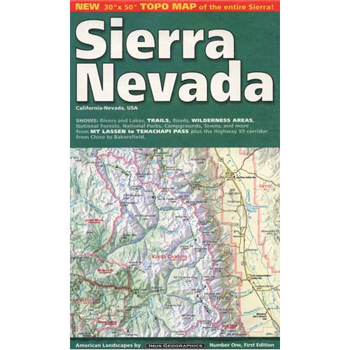
Maps can save your life. Maps can get you un-lost and can show you the way. Maps are your escape route outta the city. In a digital world where we are so connected w/ internet, smartphones and GoogleMaps, it is amazing that folks can find there way to real back roads of California. Don't be shocked when your digital signal drops at the wilderness edge and you are finally "away". Most online map sources are NOT accurate beyond the city limits, much less the forest boundary. Seriously folks, THEY don't want you out there. There is no place in the Wilderness to spend any money. Many have not properly logged the back roads yet, or perhaps they just won't make it available to the general public. You'll be lucky if they get the road number correct. BACK ORDERED / BACKORDER? OUT OF PRINT, OUT OF STOCK Availability of good maps is an ongoing issue. It's a unique factor in the map selling business. Although Total Escape carries a variety of Californ

Camp Gift

Image
Need to get a gift for the outdoor person in your life, well we can show you some great, inexpensive items. Stuff that every hikers or camper could use. Waterproof maps are by far the easy choice, but deciding on a local region might be a bit difficult. Yosemite maps and Sequoia are popular choices, but so is Death Valley. TIP: pick the next place you want to vacation with them. See all CAMP GEAR here. Below are some 'outdoor gift' items that DanaMite recommends.

Sequoia Map

Image
  If you are searching for maps on the mighty Sequoia region of California, we may be able to help here at Total Escape. First, decide what park or forest. There are up more than 6 'agencies' managing our Giant Sequoia Trees in the Sierra Nevada Mountains. See the list below w/ maps. Big, Old, Huge, Tall Trees : overview page for the Redwoods on the California North Coast, the Sequoia of the Sierra Nevada mountains and the oldest trees, the Ancient Bristlecone Pines over on the east side. Sierra Nevada SEQUOIA GROVES can be found in: Sequoia National Forest Sequoia National Park Kings Canyon National Park Yosemite National Park Mountain Home State Forest Calaveras Big Trees State Park Giant Sequoia National Monument SEQUOIA MAPS below: printed on polypropylene plastic, waterproof maps, tear-resistant, recyclable Sequoia National Forest Map USDA Sequoia National Park Map (NatGeo) Sequoia / Kings Canyon Map (Tom Harrison) Sierra National Forest M