Posts

Showing posts with the label National Forest

New Eastern Sierra Map

Image
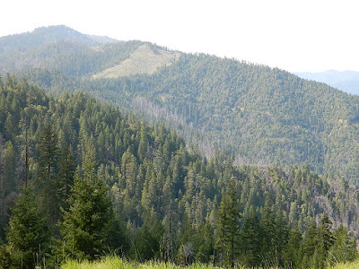
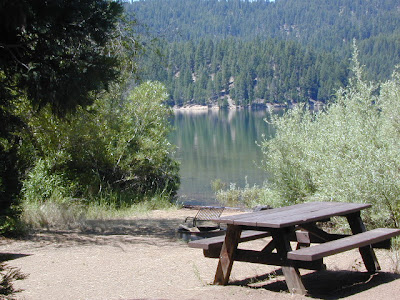
Eastern Sierra Camping - Bridgeport, CA NEW EDITION ffor 2014 -  Humboldt Toiyabe National Forest USDA recently updated most of their National Forests maps to a new plastic waterproof versions, with El Dorado being the very last of the paper maps. Front cover design takes a twist with the new retro-looking map featured here - Toiyabe's Bridgeport Ranger District . It was updated and printed in 2014   This USDA Eastern Sierra map covers places like: Mono Lake   Lee Vining   Conway Summit Bridgeport   Buckeye Hot Springs Travertine Hot Springs East Walker River Lundy Lake   Twin Lakes   Virginia Lakes  Bodie Ghost Town   Green Creek   Upper Summers Meadow Dunderberg Meadow Hoover Wilderness This rural Eastern California National Forest region is located on US Highway 395 (north of Mammoth and south of Lake Tahoe). Autumn and aspen colors are quite impressive in this area, so make plans to visit in late September or October if you like to fish. Wildflowers happen h

California Wildfire Affected Areas: Monument Fire

Image
2021 Monument Fire Panther Fire Trinity County, California 223,124 Acres burned 52 structures destroyed Lightning strike fire that lasted 3 months, until full containment  Communities & Towns near this wildfire: Big Bar, CA Big Flat Burnt Ranch, CA Cedar Flat Coffee Creek Del Loma Hawkins Bar Hayfork, CA Helena, CA Hyampom, CA Junction City, CA Trinity Center, CA Trinity Pines Trinity Village Willow Creek, CA Highway 299 West Shasta Trinity National Forest Trinity Alps Wilderness New River Trinity River Bell Creek Bear Creek Bidden Creek Big Bar Creek Buckhorn Creek Canadian Creek Cedar Flat Creek Conner Creek Don Juan Creek Donaldson Creek Dutch Creek Dyer Creek Eagle Creek Farmer Ridge French Creek Hayfork Creek Hayshed Creek Italian Creek Jud Creek Love Letter Springs Maple Creek Mill Creek Miller Creek Miners Creek Packers Creek Panther Creek Price Creek Rowdy Bar Creek Rusch Creek Sailor Bar Creek Sandy Bar Creek Smoky Camp Creek Stetson Creek Swede Creek Tule Creek Whites Bar

Mokelumne River Canyon

Image
Mokelumne Peak is at a towering 9334' elevation in the High Sierra known as Mokelumne Wilderness . Granite scenery, high country, big water at high elevations. 105,165 acres straddles the crest of the central Sierra Nevada, within the Stanislaus, Eldorado, and Toiyabe National Forests; bordered by Highway 4 on the south and Highway 88 on the north. The Mokelumne River starts way up near Blue Lakes (South of Tahoe) which flows down to Salt Springs Reservoir, on the Amador & Calaveras county line. Once inside the Gold Country region the Mokelumne River drains into Pardee Reservoir, near Jackson CA . Salt Springs Reservoir has a trailhead for the Mokelumne Wilderness. Ellis Road - El Dorado National Forest Road #8N25 a signed turn off of Sierra Highway 88; a steep long, winding, hairy drive on a paved, back road that switchbacks down to river and prime camping. Minimal access and recreation at Salt Springs reservoir. Mokelumne River Campground NFS Mokelu

Camping without a Campfire

Image
Camping without a campfire sounds like swimming without water to some people. Half the reason to go camping is to sit around the group fire at night enjoying the gorgeous night air & good conversation. Here in California we have many fire restrictions in place, especially in Southern California. With the expanding population moving in to the state, we now have less rural lands available than ever before. Current ongoing drought conditions in much of California means tight restrictions on campfires - inside and outside of campgrounds. You are responsible for knowing the campfire restrictions in the forest you are visiting, so make sure to find out ahead of time. NFS   Late Summer to Autumn season campfire restrictions can apply to backpacking in the high country, back roads dispersed camping, and sometimes even regular campgrounds. When wildfire danger is greatest no campfires are allowed anywhere in the forest, even inside developed campgrounds. Our over-managed fores

Dirt Biking Trails

Image
California has the most amazing and diverse terrain you can imagine. Ancient lava beds to dense forests, giant boulder rock outcroppings to sand dunes. Off road motorcycles, otherwise known as 'dirt bikes' can find riding trails near home or across the state, in far away locations. dirt bike routes dirt bike camping dirt bike trails Dirt biking off road trails can be found outside of nearly any urban city in California. In National Forests, on BLM lands, all across the many deserts and in a good portion of the mountains. The Sierra Nevada mountains located in the middle of the state has many high elevation OHV routes to small alpine lakes and primitive camp sites. SoCal has the winter prime-time desert warmth, Central Cal has coastal dunes, steep canyons, and rugged foothills, plus the giant Mojave desert which stretches from Joshua Tree area to Vegas. NorCal has the endless forests, solitude and rivers you seek. SoCal Off Road Areas Imperial Sand Dunes Heber Dunes

Campsites in Southern California

Image
Camping sites in Southern California While camping in California is an amazing experience overall with thousands of picture perfect settings to pitch your tent, camping in SoCal definitely has it's limitations. The primary reasons are.... Camping in SoCal is - 1. crowded (half the population is located in the lower third of the state) 2. dry terrain (minimal rivers, dry seasonal streams, few waterfalls) 3. wildfire prone (with average rainfall of only 10") 4. costly (all developed campgrounds charge fees) 5. not secluded (with suburbia spread into foothills, busy roads nearby) With the California population nearing 40 million, you will need to do your research in order to find a good, secluded, scenic camping area. Coastal camp sites are the most popular on the list and you should seek advanced reservation w/ the State Park system. City camping is mostly RV parks and a few county parks. Beyond the neighborhoods, countryside camping in the coastal footh

Best Hidden Campsites

Image
Hidden Campsites small campgrounds, tent camping, free camping We know, we know, you want a lake to yourself and don't really wanna share a huge campground with hundreds of other folks. Picking a decent campground online is difficult enough - with the numerous managing agencies , confusing park names, long driving times, freeway routes and hefty reservation fees. Avoid reservations all together and discover travel off the beaten path. Mid week campground stays can be better than weekends, but during summertime all week long is peak season w/ maximum visitors circulating. Neighbors at camp can often mean annoyances - children, generator noise, vehicle engines, boating trailers, music and partying. Quiet time is usually 10pm to 7am, but that doesn't mean the loud garbage truck won't wake you at 6:50am. big campgrounds vs. small Big campgrounds are developed parks with more than 20 camp sites, usually found along paved roads and highways. Level tent spots, pa

Watershed Lake

Image
lake in ca watershed: mountain ridge lines dividing two drainage areas; water parting; divide. the region or area drained by a river, stream, or drainage area. Many Sierra Nevada lakes are considered watersheds, due to the heavy snow pack found in this high elevation region of Cali. To name them all would be ridiculous, since most are in remote Wilderness locales - only accessible by foot or on horseback. Several rare and special ones are accessible by vehicle; 4WD might be required. Camping is sometimes primitive style, but there are a few with awesome small developed Campgrounds, usually run by the National Forest. Be very eco-conscience while visiting such areas and always practice good outdoor ethics in these extremely sensitive environments . Yep, that mean you too! COURTRIGHT COYOTE LAKE EDISON LAKE GOLD LAKE JUNIPER LAKE RED LAKE Lakes in California are often located inside or next to protected wilderness areas. The impressive Sierra Nevada wilderness with lak