Posts

Showing posts from February, 2009

50% Increase from Last Winter

Image
Yeah, I know you've heard it. America is in a recession or a depression. But that doesn't stop you from wanting to travel. Needing to get away from your daily grind. Can you expect to escape your hurried life for a weekend, for under $100? What bout a $200 limit? No seriously. You would spend that much or more just staying home & hanging out in the city. Really! Think about it. Shopping, dinner at a restaurant, coffee afterwards, or a concert, some drinks during, plus the parking. It adds up super fast as you already know. Total Escape web site traffic is WAY up -- 50% from last winter, cuz people are realizing they gotta travel locally & inexpensively. This goes for the maps store at the dot net & our main site at dot com . DanaMite has the ideas for cheap road trips all over the golden state. Thanks goes to all the newcomers & the avid Escapers. The new residents in Cali, the transplants, the native, the locals, anyone who uses Total Escape on a regul...

The Road to Joy

Image
The Road to Joy Originally uploaded by danamight Outdoors is my passion & this stuff, these photos, these stories, my web site is my work, my art, for you to discover what I have seen. The back roads of California are alive with all flavors. My gift to you, the world. Enjoy. Green Creek California is a very special place I visited back in mid 2004. These Sierra Nevada photos have taken a while to upload, but here they are, for your viewing pleasure. This prime Eastern Sierra camping area is well worth the long journey. Plan to spend a minimum of a week here for the full spectrum of recreation. The graded dirt road is suitable for passenger cars & RVs too. Hiking, fishing, camping, it's all out here near Bridgeport CA; Altho most are so in a hurry to reach Bodie Ghost Town State Park, they completely ignore this area, just on the other side of Highway 395. If you have some free time, I would highly suggest this primitive camping location on the Hoover Wilderness bounda...

Trail Wilderness

Image
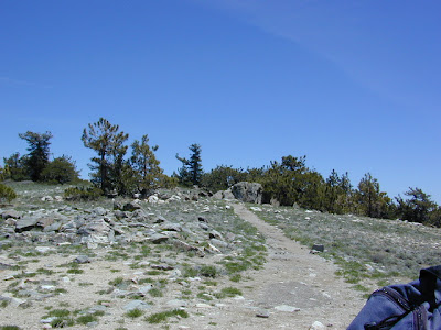
Mount Pinos Peak 8830' elevation, Kern County We all seek a wilderness trail to hike or stroll. Wonderful weather, enveloped in scenery, a peaceful place to call our own - if only for the day or the whole weekend. Deep inside the sacred space we call nature, Mother Earth. Maybe a picnic and waterfall as the highlight of the whole day. In California we are lucky to have plenty trails to enjoy and explore. Whether you want a foot trail to a lake, a fishing trail along the river, a backpackers trail over the highest peaks, an equestrian trail, a mountain bike route, or snowmobile trails new and fresh, we just might have it on our maps - somewhere in here . California Wilderness Areas California Forest Maps California Wilderness Maps California Topo Atlas California Recreation Maps Tom Harrison Topographical Maps