Posts

Showing posts from July, 2007

the survey

Image
Howdy all you fun lovin' Escapers! I know many of you have been out camping with Total Escape Adventures in the last decade & plenty more were planning to. Now, in the midst of summer - we are offering NO TRIPS? What, why? Let's just say we needed a break. We are restructuring the company & in the future all the guided trips will be lead by BajaLory. Now we need to hear from you, the newbies & the regulars, on what kinda trips you want us to lead. Please click the link above to take our very short survey, so we can get a better idea of what you wanna see, where you wanna go & what kinda recreation you want us to provide. Exploring caves in the Sierra Nevada, Baja Kayaking & Off-Roading, or Houseboats on Lake Shasta.... we will let you determine the direction.

California Hot Springs

The 3 words together make you dream of secluded natural beauty, star gilled skies, candle light & real naked hot people. "California Hot Springs" is one of the most widely searched terms for entry into the site, Total Escape. California has numerous hot springs (like over 300) - from luxury resorts near the Palm Springs desert to primitive rock tubs overlooking the lower Kern River, each unique to it's own surroundings. Many are capped for geothermal use & others are hike-in only in the Wilderness. High Sierra hike-in tubs to remote bed & breakfasts, to palm canyon desert oasis, clothing optional is the norm. Hey now, we are in California. Live a little. If you're uncomfortable with public nudity, too bad! You are the one missing out. Grover Hot Springs is more of a family friendly (clothing required) kinda park. The facilities at each location vary greatly depending on terrain, land ownership & the flow of the hot water. Some hot springs are no more ...

Hillbilly Off-Roaders

This term above is actually a mental state, not a geographic location. Although you are more likely to find these guys on the back roads in rural regions. CB radios & all. Exactly one week ago, at sundown I was calmly working online & watering flowers. Then HE called. The sexy boy, who I cannot say no to. "Where's my car?" I asked. "It's fine, it's in my driveway at home". Your stuck, stranded, wheeling where? Off Miller, shit! After I pinpointed their location on my Los Padres topo atlas, I am now in the process of rescuing some local off-roader pals - in my AWD Saab? How many rednecks in town can you get to do this right now? (Can't you call some male friends to help?) Hint: These are not the same 4x4 dudes that showed for the Quatal Canyon CleanUp. NO, go pick up the Amigo in Frazier & here's the long list of supplies. Since I haven't been on a 4WD rescue in 3 years, I jump at the chance to see the Sespe at night in th...

Lake Almanor Camping & Boating

Image
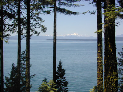
Northern Plumas, where the forests meets the Feather River & Lassen peaks; near Chester California is recreation mecca Lake Almanor, another popular lake of Northern Sierra. Pine trees line the lakeshores & a real grocery store is nearby. There is plenty developed RV campground along the shorelines. Fish, bike, hike, kayak, float in a tube, lay in a hammock, reading all day. Boat rentals, jet skis, family camping, marinas all around. PLUMAS NATIONAL FOREST MAP PLUMAS FOREST TOPO ATLAS LASSEN NATIONAL FOREST MAP LASSEN FOREST TOPO ATLAS

California: Map of Mountains

Image
The beauty of the California mountains has called people to the west coast for centuries. From the Gold Rush of the 1800's to the mountaineering routes of the tallest peak Mount Whitney, the golden state offers so much abundance of high elevation. Ancient Bristlecone Pines , recreation lakes of Northern California & the granite peaks of the High Sierra. Total Escape specializes in the back roads of California & the majority of those roads are located around the Sierra & Shasta region. If you are looking for that special place far away from the crowds , we have you covered. From swimming holes to fishing spots, waterfalls to river tubing, we have all the National Forest maps of California, all 20 of them, plus the Tom Harrison waterproof plastic hiking maps . A few California forests now offer the 7 minute topo maps in a spiral bound atlas book. When it comes to California Maps & mountains - you can count on Total Escape to help chose your perfect destination. Find...

Orleans California

Image
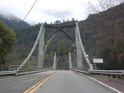
This is the Klamath River, running parallel to the coast inland and behind the redwood forests of Northern California. Impressive views from every ridge line, riverside fishing resorts, deep canyon, small town wilderness charm. They call Highway 96 the Bigfoot Scenic Byway & for great reason, the wildlife is abundant all over this region. Salmon & steelhead fishing are excellent. Marble Mountains Wilderness is closeby. Horseback, bike, hike, camp, fish, raft, kayak. Relax for a full week & really let go of the grind!