Posts

Rock the Earth

Image
William (Will), who I met in Baja in 2005 , relocated to Tahoe CA from the east coast recently. He admits California is awesome, especially the Sierra Nevada. This summer he is traveling & volunteering w/ the Rock the Earth crew. Check out their voice via the web site.

Lowest Gas Prices in CA

Lowest Gas Prices in  California California  Gas Prices  provided by GasBuddy.com Paid $4.39 @ Flying J on the Grapevine yesterday. Only $75 to fill up the old Isuzu Amigo . Maybe this tank full can last most of the summer if I am a good girl & walk or bike to the post office daily.

How often do you camp?

Image
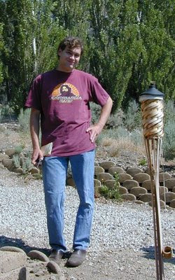
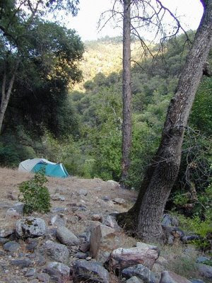
A question you might not hear often. But as a professional camper I get it all the time. When I was in the midst of my stressful city career, I would escape Los Angeles every chance I got, which was usually every weekend. Several times per month I would be off exploring some Sierra dirt roads, playing in the Wilderness, waiting until the last possible moment to return home (SUNDAY night 10pm). Many choose their addictions carelessly. I consider myself a camp-o-holic, as my love for outdoors is so strong, that I created an entire business around it. At the peak of my adventure days I was camping about 20 trips per year. Deserts in the winters, mountains in the summer. Total Escape Adventures , the guided trips division, has lead up to 280 people per year out camping Baja or California. We took a break in 2007, but now we are offering road trips again .

How do you find these places?

Image
This is one of the top questions I get when discussing my travels. That rare secluded beach camp with whole sand dollars at the shore; the private wildflower meadow at the end of the dirt road in the High Sierra; the fern lined, boulder creek camp with swimming hole & a perfect hammock spot. For the past decade I have driven around the state of California (& some Baja) researching & visiting unheard of destinations, taking notes, taking photos, way pointing my GPS, and serving it up to you, my loyal Escapers. My passion is outdoors and I want you to experience the best way possible. You need to understand a few things about me, DanaMite . I have more free time to browse photos and study topo maps than your average American, due to the fact that I: a.) am not a mother b.) am not someones wife c.) do not own a television d.) am obsessed w/ outdoors While the first 2 items amaze common folk, the third really sends them into a frenzy. No T.V. yes, you heard right

Pine Mountain Lilac Festival

Image
Mountain Lilac in White Originally uploaded by danamight Looking for something to do - close to L.A., next weekend? It's springtime in the mountains of California. Hike, bike, picnic. California Wilderness Festivals are few & far in between. The warmth of May brings new energy as the growth cycle continues. Pine Mountain Club host yet another mountain festival, the popular Lilac Festival will be next weekend. SAT/SUN - MAY 17th & 18th Live music, arts, crafts, food & greasy fair food outdoors. Car clubs always welcomed. 4x4 trail run on Quatal Canyon Sunday @ Sundown. Meet: Toad Springs Camp. Drive Los Padres back roads: Cerro Noroeste Road , Hwy 33, Highway 166 & beyond

Sequoia Map

Image
  If you are searching for maps on the mighty Sequoia region of California, we may be able to help here at Total Escape. First, decide what park or forest. There are up more than 6 'agencies' managing our Giant Sequoia Trees in the Sierra Nevada Mountains. See the list below w/ maps. Big, Old, Huge, Tall Trees : overview page for the Redwoods on the California North Coast, the Sequoia of the Sierra Nevada mountains and the oldest trees, the Ancient Bristlecone Pines over on the east side. Sierra Nevada SEQUOIA GROVES can be found in: Sequoia National Forest Sequoia National Park Kings Canyon National Park Yosemite National Park Mountain Home State Forest Calaveras Big Trees State Park Giant Sequoia National Monument SEQUOIA MAPS below: printed on polypropylene plastic, waterproof maps, tear-resistant, recyclable Sequoia National Forest Map USDA Sequoia National Park Map (NatGeo) Sequoia / Kings Canyon Map (Tom Harrison) Sierra National Forest M

How does Total Escape make money online?

Image
Total Escape receives income from a variety of sources online & off. The web site has been live for 12 full years (come OCT 2008). DanaMite's first approach was to create a 'mobile web site design' service for small lodges within California. After a 1998 direct mailing to 800 California innkeepers, I soon realized that I was ahead of my time. Most inns did not even have a web site prior to 2000. Neither did the government agencies - like the State Parks & National Forests. But Total Escape was there, way back when, with real California content, camping options & plenty photos. Mainly, Total Escape sells California maps to get you inspired , off the couch & outta the house. We list independent lodges & recreation businesses, so you can find out what to do & where to stay. Innkeepers can get lodges featured : standard links & photo deluxe. Amazon sells tons of great camping gear. If you buy it thru our site we get a few cents on referral