Posts

Gualala Kayak

Image
The Gualala River meets the Pacific Ocean on the North Coast of California. This is an excellent area for kayaking & camping. There are plenty small hotels for those wishing not to rough it. Redwood forests, coastal cafes, village shops, makes Gualala California a tourists destination along Highway 1. Hendy Woods State Park, Manchester State Park & Salt Point State Park are all close by. The County Park at Gualala Point is dog friendly & has camping too.

California Beach Camping

Image
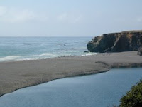
California has the best beaches on the west coast & they draw millions of tourists here each year. From RV camping on the beaches of San Diego to Northern California's rural Lost Coast, we have a variety of public & private Campgrounds along the coastline for every style of camping. The best coast camping is along the scenic Central Coast of California, also known as Big Sur CA . A 100 mile stretch of natural beauty that spans from Carmel to Cayucos . Partington Cove is a great day hike with redwood forest & rocky coves; just north of Julia Pfeiffer State Park. At the southern end of the Big Sur coast, Sand Dollar Beach is a great dog friendly beach w/ Plaskett Creek Campground is directly across the street. There are camp sites in: oak canyons, on dirt roads, on ridges, on rocky bluffs, or inside dense redwood groves. Primitive camping on ridges via forest dirt roads. Walk in camps at Andrew Molera , drive in RV camps at Big Sur State Park & backpacking in the

Dillon Beach California

Image
This is a coastal paradise. Wide beaches, cliffs, views of the northern tip of Point Reyes . This coast can get foggy several months out of the year. One of those town names that sometimes gets misspelled (as Dillion Beach), has a big tourist following with surfers & RVers. Private vacation homes, some for rent over look the Pacific Ocean & small resort down at the beach. The beach is scenic, wide & often secluded for long walks. Dillon Beach California could be your next weekend get-away.

Twin Lakes California

Image
Eastern Sierra Camping: Twin Lakes , near Bridgeport California has some of the best fishing & camping in the Eastern Sierra region. The area gets buried in snow sometimes, but by late Spring the RVs start rolling in. Campground reservations are recommended for mid-summer. Robinson Creek, Honeymoon Flat & Paha. Buckeye Hot Springs, Hoover Wilderness trailheads, historic Bodie ghost town.

Pacific Crest Trail Maps

Image
The PCT is the 2650 mile national scenic hiking trail that stretches from Mexico to Canada & thousands of backpackers use it every year. The Pacific Crest trail starts near Tecate & Campo California , heads north thru SoCal mountains & desert terrain, then up to Big Bear Lake. Eventually it'll end up in the High Sierra, the most majestic & desirable part of the journey. The newest waterproof maps are available for the whole stretch of the long journey. The PCT#1 covers SoCal & the PCT#2 map focuses on the area south of Tehachapi. The #3 deals with the Southern Sierra and so on, all the way north to Washington State and the Canadian border. If you're planning on hiking the whole thing, take more than a year off of work, get physically conditioned way ahead of time & start your research here .  Lake Edison in the High Sierra, California South Lake near Bishop, CA Hiking trails in Lakes Basin Recreation Area near Gold