Posts

Showing posts with the label wildfire

California Wildfire Affected Areas: Monument Fire

Image
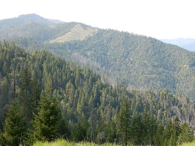
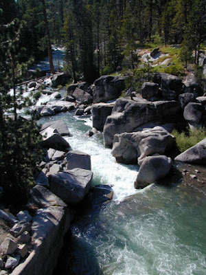
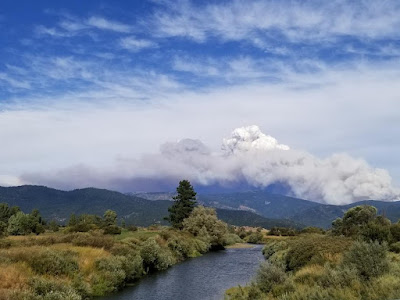
2021 Monument Fire Panther Fire Trinity County, California 223,124 Acres burned 52 structures destroyed Lightning strike fire that lasted 3 months, until full containment  Communities & Towns near this wildfire: Big Bar, CA Big Flat Burnt Ranch, CA Cedar Flat Coffee Creek Del Loma Hawkins Bar Hayfork, CA Helena, CA Hyampom, CA Junction City, CA Trinity Center, CA Trinity Pines Trinity Village Willow Creek, CA Highway 299 West Shasta Trinity National Forest Trinity Alps Wilderness New River Trinity River Bell Creek Bear Creek Bidden Creek Big Bar Creek Buckhorn Creek Canadian Creek Cedar Flat Creek Conner Creek Don Juan Creek Donaldson Creek Dutch Creek Dyer Creek Eagle Creek Farmer Ridge French Creek Hayfork Creek Hayshed Creek Italian Creek Jud Creek Love Letter Springs Maple Creek Mill Creek Miller Creek Miners Creek Packers Creek Panther Creek Price Creek Rowdy Bar Creek Rusch Creek Sailor Bar Creek Sandy Bar Creek Smoky Camp Creek Stetson Creek Swede Creek Tule Creek Whites Bar

California Wildfire Affected Areas: Donnell Fire

Image
Donnell Fire 2018 36,450 Acres Tuolumne County, California Dardanelle, CA Sonora Pass CA SR 108 (Hwy 108) Stanislaus River in 2004 Areas  affected by this wildfire: Stanislaus National Forest Carson Iceberg Wilderness  Donnell Lake Spicer Meadows Reservoir Stanuslaus River Arnot Creek  Douglas Creek Eagle Creek Dardanelle Resort  (slowly rebuilding) Barker Station Clark Fork Double Dome Rock County Line Trailhead Wheats Meadow Trailhead Trailheads  affected by this wildfire: Arnot Creek Trailhead Clark Fork Trailhead Columns of the Giants County Line Trailhead Disaster Creek Trailhead Seven Pines Trailhead Wheats Meadow Trailhead Meadow at end of Road # 6N06 Trails  affected by this wildfire: 19E06 Trail 19E16 Trail 19E47 Trail 19EV1208 Trail 19EV97 Trail 20E05 Trail 20E07 Trail 20E08 Trail 20E62 Trail NFS Dardanelle Campground in 2004 Campgrounds affected by this wildfire: Boulder Flat Campground Brightman Flat Campground Camp Jack Hazard Campground Clark Fork Campground Dardanelle C

California Wildfire Affected Areas: Carr Fire

Image
2018 Carr Fire Whiskeytown 229,651 Acres burned 1604 buildings destroyed 8 deaths Shasta County Trinity County Centerville, CA French Gulch, CA Igo, CA Keswick, CA Kett, CA Lewiston, CA Matheson, CA Old Shasta, CA West Redding, CA CA SR 299 - Hwy 299 (Eureka Way) French Gulch County Park Keswick Reservoir Rainbow Lake Shasta State Historic Park Spring Creek Reservoir Whiskeytown National Recreation Area Whiskeytown Lake Boulder Creek Brandy Creek Cannonball Creek Clear Creek Cottonwood Creek Crystal Creek Dodge Creek Indian Creek Mill Creek Papoose Creek Spring Creek Squaw Creek Whiskey Creek Whiskeytown NRA in 2002 Areas affected by thus wildfire: Barleyfield Peak Blue Mountain Buckhorn Bally Buckhorn Summit Bully Choop  Carr Powerhouse Chappie OHV Deadwood Highland Ridge Hoadley Peaks Iron Mountain Joes Peak Kanaka Peak Mad Mule Mountain Merry Mountain Mikes Peak Monarch Mountain Oak Bottom Marina Paradise Peak Shasta Bally Shirttail Peak Shoemaker Bally Shoemaker Gulch South Fork Mo

California Wildfire Affected Areas: Walker Fire

Image
2019 Walker Fire Plumas County 54,608 Acres burned Antelope Lake, California Genesee Valley  East Plumas National Forest Antelope Lake Road Beckwourth - Genesee Road 70 Beckwourth - Genesee Road 111 Genesee Valley Road, east of Taylosville, CA Indian Creek Road 43 Babcock Meadow Babcock Peak Clarks Creek Elephants Playground Flournoy Bridge Franks Valley Frazier Cabin Indian Creek Last Chance Creek Murdock Crossing Notson Bridge Squaw Queen Creek Campgrounds affected by this fire:  [all located at Antelope Lake] Boulder Creek Campground Lone Rock Campground Long Point Campground Forest Roads affected by this fire:  Antelope Lake Road Beckwourth - Genesee Road 70 Beckwourth - Genesee Road 111 Genesee Valley Road Forest Rte #26N07 Forest Rte #26N13 Forest Rte #26N45 Forest Rte #26N54 Forest Rte #27N02Y Forest Rte #27N03 Forest Rte #27N07 Forest Rte #27N09 Forest Rte #27N10 Franks Valley Forest Rte #27N16Y (4WD) Forest Rte #27N41 Frasier Cabin Forest Rte #27N48 Forest Rte #27N51 Forest

California Wildfire Affected Areas: Walkers Fire

Image
2021 Walkers Fire Tulare County 8,777 Acres Golden Trout Wilderness  Great Western Divide Little Kern River Sequoia National Forest Areas Affected by Wildfire: Newlywed Quinn Peak Shotgun Creek Soda Butte Soda Spring Creek South Fork Meadows Trail Tamarack Creek Hiking Trails # Affected 31E12 31E13 31E23 32E02 Walkers Fire Map JPG NOTE: There was another Walker wildfire in California called the Walker Fire 2019

California Wildfire Affected Areas: KNP Complex

Image
Colony Fire + Paradise Fire 2021 KNP Complex Tulare County 88,307 Acres Giant Forest, California Portions of Sequoia National Park have reopened but the south entrance is closed. Call ahead to find out current conditions and snow levels. DEATH RATE of Sequoias Between 10 to 14 percent of the entire Sierra Nevada population of giant sequoia trees over 4 feet in diameter were killed in the Castle Fire of 2020. Early estimates expect that on two fires in 2021, the KNP Complex and the Windy Fire, between 2,261 to 3,637 sequoias have already been killed or will die within a few years. wildfiretoday.com/tag/knp-complex/ Parks & Forests Affected by this Wildfire: Kings Canyon National Park  Sequoia National Park Generals Highway 198 Mineral King Road Buckeye Flat Campground  NPS Dorst Creek Campground NPS Potwisha Campground NPS Generals Highway Sequoia NP Areas Affected by Wildfire: Ash Mountain Big Baldy Ridge Big Tree Trail Buena Vista Creek Burnt Point Creek Cactus Point Castle Rocks

California Wildfire Affected Areas: French Fire

Image
2021 French Fire 26,535 Acres burned Kern County, California Alta Sierra, CA Wofford Heights, CA CA SR 155 (Highway 155) Cabin in Cedar Forest Sequoia National Forest  Greenhorn Mountain Park Alta Sierra Ski Resort @ Shirley Meadows Forest Roads affected by this fire: Forest Road 710 Forest Rte #24S15 Forest Rte #25S02 Forest Rte #25S15 Forest Rte #26S03 Forest Rte #26S16 Forest Rte #26S19     Campgrounds affected by this fire:   Cedar Creek Campground Evans Flat Campground Greenhorn Mountain Park Campground   Areas Affected by Wildfire: Alder Creek Barn Canyon Basket Ridge Bear Creek Black Mountain Cedar Creek Cooks Peak Evans Road (SR 155) French Gulch Greenhorn Mountains Greenhorn Summit Ice House Creek Likely Saddle Lumreau Creek Old State Road Poso Creek East Red Mountain Sawmill Road Shirley Creek Slick Rock Creek Stable Creek Tillie Creek Wagy Flat White Mill Road Willow Flat Windy Gap Woodward Creek Clouds @ Greenhorn Summit   https://en.wikipedia.org/wiki/French_Fire_(2021) F

California Wildfire Affected Areas: Caldor Fire

Image
2021 Caldor Fire 221,835 Acres  El Dorado County, California Caldor, CA Grizzly Flats, CA Kirkwood, CA Kyburz, CA Meyers, CA Strawberry, CA Twin Bridges, CA Silver Lake from CA State Route 88 California SR 88 (Hwy 88 Carson Pass) US Highway 50 (Hwy 50) Eldorado National Forest Desolation Wilderness American River , Silver Fork Consumnes River, Steely Fork Consumnes River, Middle Fork Consumnes River, North Fork Wildfire Affected Areas:  Caples Lake Jenkinson Lake Kirkwood Lake Shealor Lakes Silver Lake @ Carson Twin Lakes Woods Lake Wrights Lake Kirkwood Lake Heavenly Valley Ski Resort Iron Mountain Snow Park Kirkwood Ski Resort Sierra Tahoe Ski Resort Caples Lake Campground China Flat Campground Lovers Leap Campground Kirkwood Campground Martin Meadow Campground Middle Fork Consumnes Campground PiPi Campground Sand Flat Campground Silver Fork Campground Silver Lake Campground East Silver Lake Campground West Woods Lake Campground Wrights Lake Campground Kirkwood Campground Forest Ro