Posts

Showing posts with the label trails

Dirt Biking Trails

Image
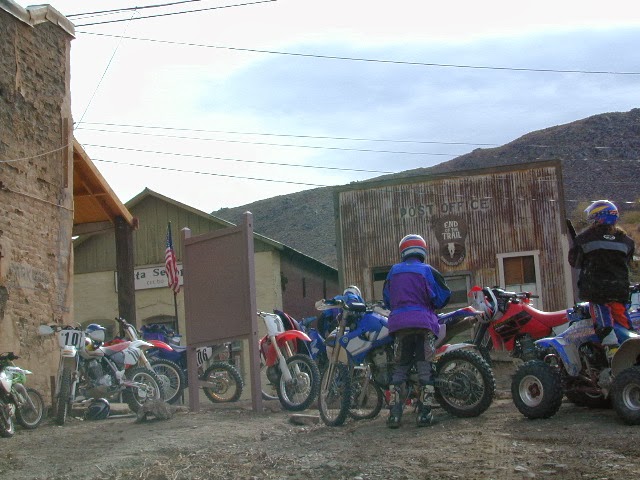
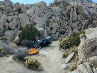
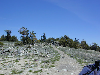
California has the most amazing and diverse terrain you can imagine. Ancient lava beds to dense forests, giant boulder rock outcroppings to sand dunes. Off road motorcycles, otherwise known as 'dirt bikes' can find riding trails near home or across the state, in far away locations. dirt bike routes dirt bike camping dirt bike trails Dirt biking off road trails can be found outside of nearly any urban city in California. In National Forests, on BLM lands, all across the many deserts and in a good portion of the mountains. The Sierra Nevada mountains located in the middle of the state has many high elevation OHV routes to small alpine lakes and primitive camp sites. SoCal has the winter prime-time desert warmth, Central Cal has coastal dunes, steep canyons, and rugged foothills, plus the giant Mojave desert which stretches from Joshua Tree area to Vegas. NorCal has the endless forests, solitude and rivers you seek. SoCal Off Road Areas Imperial Sand Dunes Heber Dunes

Trinity Alps Wilderness Topo Map

Image
Trinity Wilderness Map  new edition 2013  After 2 years outta stock status the Trinity Alps Wilderness Map is finally back in stock at Total Escape. USDA recently updated, reprinted and released this long-waited NorCal title and we expect it to be a great seller (just like the last version was). Backpacking, day hiking, horseback, high elevation camping - all campgrounds, roads, trails, waterfalls, lakes, mountain peaks and trailheads. Trinity River, Salmon River, Klamath River, Highway 96, Highway 3, Forks of the Salmon. Surrounded by Six Rivers National Forest and Trinity National Forest, both west of Interstate 5 in Northern California.   nearby towns include -  Douglas City, CA Etna, CA Fort Jones, CA French Gulch Gazelle, CA Happy Camp, CA Helena Junction City Lewiston, CA Orleans, CA Trinity Center Weaverville, CA Willow Creek Yreka, CA   Big Foot in Happy Camp, CA

Bike Paths

Image
 Bike Trails in California / Beach Bike Paths California has some amazing scenery, small towns to big cities and what better way to enjoy it then by bike. Numerous bike paths, a couple of miles of beach or a full day cycling journey. Paved, level, leisurely bicycle routes near marinas, beaches, city bays, connecting villages small towns, redwood forest, some in the country, some along rivers and several within National Parks! Town links listed below will lead to several prime biking destinations where you can browse bike routes, hiking trails, museums, parks, campgrounds, cafes, coffee shops, restaurants, farmers markets, lodging, bike rentals and surf shops. San Diego Bike Paths Coronado to Imperial Beach (12 mi. oceanside) Mission Beach San Diego (14 mi. bay side) Mission Beach to Pacific Beach (3 mi. oceanside) Lake MiraMar, E of La Jolla (5 mi. loop on lake) Los Angeles Biking Paths Santa Monica Pier to Venice Beach (8 miles) Manhattan Beach - The Stra

Mohave Preserve

Image
Mojave Desert / Mohave Camping Mojave, one of the largest deserts in the USA. Named after the Mohave tribe of Native Americans, it contains a number of ghost towns, the old railroad depots, and nearly 2000 plants species. The Mojave Desert is crossed by major routes - Interstate 15, Interstate 40, US Highway 395 & US Highway 95. READ MORE Right in the middle of the Mojave Desert is the National Preserve. The largest joshua tree forest in the state of Cali. Summer temps can easily reach the triple digits, so camping and hiking is most favored in autumn, winter or spring months. There are many primitive style (free) camp spots inside the park and surrounding the park, and there are also a few developed campgrounds as well. Goffs schoolhouse to the east has outdoor showers. Hole in the Wall Campground Mid Hills Campground Black Canyon Corral & Group Camp Hundreds if not thousands of dirt roads network the Mojave desert This desert park is an ideal spot for "i

Kennedy Meadows California

Image
General Store at Kennedy Meadows, on the Kern Plateau, California There are 2 different places in the Sierra Nevada mountains called Kennedy Meadows. This one photographed above is on the Kern Plateau, located in the Southern Sierra in between Dome Land Wilderness & Golden Trout Wilderness . The infamous Pacific Crest Trail (the PCT) passes through this region. Sequoia National Forest spans most of the land to the south and west of Kennedy Meadows. Inyo National Forest sits directly to the east. Monache Meadow s and Olancha Peak are to the north side kennedy meadows on the kern plateau -  High elevation Sherman's Pass Road leads uphill from the west, where the steep turn off, next to the Kern River is often gated. Way north of Kernville, CA . Shermans Pass Rd is a paved back road that closes annually for snow, so call the local ranger for up to date weather & road conditions. Access to Kennedy Meadows from the east side, Inyo County Road # J41 off of Easte

Sierra Nevada Map

Image
The Sierra Nevada mountains range in elevation from 2000' - 14,494' above sea level. From rolling foothills with creek, oaks & wildflowers to tower granite peaks, alpine lakes & high country meadows of the Eastern Sierra. Imus Geographics makes a nice overview map of the Sierra Nevada mountains and this one is a hot seller on Total Escape! Over at the Total Escape map store we have an epic selection of Sierra Maps - see all Sierra Nevada Maps Eastern Sierra Map Gold Country Maps Lassen Maps Mammoth Maps Mt Whitney Maps Sequoia Maps Tahoe Maps Yosemite Maps Northern Sierra Forest Map Set Central Sierra Forest Map Set Easterm Sierra Forest Map Set Southern Sierra Forest Map Set California Sierra Wilderness Maps PCT - Pacific Crest Trail Maps  

Southern California Lakes

Image
Lotsa mid-western transplants typing in Google "Southern California Lakes". Well campers, I hate to break it to ya, but California has mostly reservoirs. Man-made lakes & river dams to supply our cities & crops with valuable water. The few more natural lakes in Southern California - Henshaw , Hemet , Cuyamaca nearly dry up in late summer. California is a dry state, the whole west for that matter. Face it, inland San Diego is almost a desert. It's right next to Baja & Anza Borrego Desert . If you wanna see clear mountain water, with trees, maybe pine forest views & hear bluebirds... with big rivers flowing & decent fishing, then you are gonna need to drive. When the crowds at Big Bear & Arrowhead annoy you, then the plan B is obvious. Drive further. Drive north, about half way up the Golden State Freeway I #5. About 6 hours from the busy hub of SoCal. For recreation lakes, alpine lakes, real lakes in California. The Sierra Nevada mountains

Map Availability

Image
Maps can save your life. Maps can get you un-lost and can show you the way. Maps are your escape route outta the city. In a digital world where we are so connected w/ internet, smartphones and GoogleMaps, it is amazing that folks can find there way to real back roads of California. Don't be shocked when your digital signal drops at the wilderness edge and you are finally "away". Most online map sources are NOT accurate beyond the city limits, much less the forest boundary. Seriously folks, THEY don't want you out there. There is no place in the Wilderness to spend any money. Many have not properly logged the back roads yet, or perhaps they just won't make it available to the general public. You'll be lucky if they get the road number correct. BACK ORDERED / BACKORDER? OUT OF PRINT, OUT OF STOCK Availability of good maps is an ongoing issue. It's a unique factor in the map selling business. Although Total Escape carries a variety of Californ

Benchmark Maps

Image
Benchmark Maps are the best, full state, full featured, road map for exploring the Western US. DanaMite, founder of Total Escape, has been using hers since 2000, and has always found a place to camp, on any dirt road, even in the wee hours of the night. Imagine waking up the next morning, with stunning scenery all around, cuz you went the distance. Benchmark Atlases for the Western United States CALIFORNIA ARIZONA NEW MEXICO NEVADA UTAH WASHINGTON OREGON

Poppies and South Fork, Merced River

Image
hite cove trail poppies and South Fork of the Merced River below a photo by Mrs Rachel on Flickr. Is it happening yet? Have you seen them? Where? Zillions of web sites and pages referencing wildflowers in California. The best imagery can be found on Flickr searches, which landed me on this incredible shot by Rachel. Total Escape covers California wildflower reporting starting in March each year.

Outside in Kern

Image
For those of you who haven't been out to see the wildflowers this Spring, you are missing the best show in decades! These little beauties are short lived. Certain canyons on the coast may bloom for months, but most of inland California has pockets of color, sporadically, lasting a weeks at most. You can drive past a spectacular bloom one week and the next week it's gone. Peak season means a very temporary window of opportunity for wildflower viewing . California flora blossoms, opens to glorious color during warm sunshine and then vanishes a week later. Gorman @ Tejon is about to explode very soon. Carrizo & Wind Wolves already peaked. Lower Kern is delightful. Klipstein Canyon off Hwy 166 is blooming alive. Remember the higher the elevation, the later the bloom. 1000' to 4000' (prime time now, April 2010)

The Road to Joy

Image
The Road to Joy Originally uploaded by danamight Outdoors is my passion & this stuff, these photos, these stories, my web site is my work, my art, for you to discover what I have seen. The back roads of California are alive with all flavors. My gift to you, the world. Enjoy. Green Creek California is a very special place I visited back in mid 2004. These Sierra Nevada photos have taken a while to upload, but here they are, for your viewing pleasure. This prime Eastern Sierra camping area is well worth the long journey. Plan to spend a minimum of a week here for the full spectrum of recreation. The graded dirt road is suitable for passenger cars & RVs too. Hiking, fishing, camping, it's all out here near Bridgeport CA; Altho most are so in a hurry to reach Bodie Ghost Town State Park, they completely ignore this area, just on the other side of Highway 395. If you have some free time, I would highly suggest this primitive camping location on the Hoover Wilderness bounda

Trail Wilderness

Image
Mount Pinos Peak 8830' elevation, Kern County We all seek a wilderness trail to hike or stroll. Wonderful weather, enveloped in scenery, a peaceful place to call our own - if only for the day or the whole weekend. Deep inside the sacred space we call nature, Mother Earth. Maybe a picnic and waterfall as the highlight of the whole day. In California we are lucky to have plenty trails to enjoy and explore. Whether you want a foot trail to a lake, a fishing trail along the river, a backpackers trail over the highest peaks, an equestrian trail, a mountain bike route, or snowmobile trails new and fresh, we just might have it on our maps - somewhere in here . California Wilderness Areas California Forest Maps California Wilderness Maps California Topo Atlas California Recreation Maps Tom Harrison Topographical Maps

Walkway of Redding

Image
Walkway of Redding Originally uploaded by danamight My impromptu holiday road trip to NorCal was wet, very wet, to say the least. A full solid week of rain & wind, totally drenched. Camping in the mud, not so fun. Meeting locals in Redding & Willow Creek were the highlights. Pinnacles National Monument off of Hwy 101 & King City - was my first stop, where I paid a whopping $27 to camp. The most expensive overnight in a park I can ever recall. Motel 6 might have been a better choice, since the temps dipped to 26 degrees that night. Up in Redding I opted for a cheap hotel, downtown. Walked in the drizzle to find an open restaurant & Sunday night is not a big out-to-dinner night up here, so I had trouble locating a meal. Johnnie's Bar was lit up with neon, looked new & had a Santa ping pong tournament going on. I stopped in for a bite & met Larry, a local who introduced me to his whole crew. A blues/jazz band set up around 7pm & they were pretty de

Hillbilly Off-Roaders

This term above is actually a mental state, not a geographic location. Although you are more likely to find these guys on the back roads in rural regions. CB radios & all. Exactly one week ago, at sundown I was calmly working online & watering flowers. Then HE called. The sexy boy, who I cannot say no to. "Where's my car?" I asked. "It's fine, it's in my driveway at home". Your stuck, stranded, wheeling where? Off Miller, shit! After I pinpointed their location on my Los Padres topo atlas, I am now in the process of rescuing some local off-roader pals - in my AWD Saab? How many rednecks in town can you get to do this right now? (Can't you call some male friends to help?) Hint: These are not the same 4x4 dudes that showed for the Quatal Canyon CleanUp. NO, go pick up the Amigo in Frazier & here's the long list of supplies. Since I haven't been on a 4WD rescue in 3 years, I jump at the chance to see the Sespe at night in th