Posts

Showing posts with the label hikes

Sardine Lake

Image
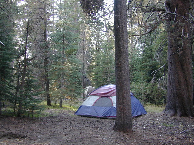
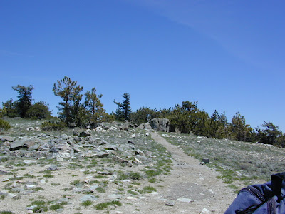
Lake Sardine California upper sardine, lower sardine lakes One of the best camping lakes in California. Any lake near Gold Lake is prime pickens. This picturesque lake called Sardine Lake, or Sardine Lakes, is located within the Lakes Basin Recreation Area , north of Gold Country Highway 49 next to the peaks of Sierra Buttes and in between Tahoe National Forest and Plumas National Forest . A two tiered water storage in granite basin bowls, with the larger upper lake situated up above at the base of the mighty granite spires of the Sierra Buttes. Very impressive views all around the Gold Lake highway. Sardine Lake Campground , elevation 5,800' developed NFS campground near lower lake w/ fee, 29 camp sites, piped water, vault toilets. 530-862-1368 Tahoe National Forest nearest town: Sierra City California, on Historic Hwy 4. Frasier Falls, Gold Lake, Long Lake Trail, and Sierra Buttes are just a few of the area attractions. more on Sardine Lake Lake fishing,

Trinity Alps Wilderness Topo Map

Image
Trinity Wilderness Map  new edition 2013  After 2 years outta stock status the Trinity Alps Wilderness Map is finally back in stock at Total Escape. USDA recently updated, reprinted and released this long-waited NorCal title and we expect it to be a great seller (just like the last version was). Backpacking, day hiking, horseback, high elevation camping - all campgrounds, roads, trails, waterfalls, lakes, mountain peaks and trailheads. Trinity River, Salmon River, Klamath River, Highway 96, Highway 3, Forks of the Salmon. Surrounded by Six Rivers National Forest and Trinity National Forest, both west of Interstate 5 in Northern California.   nearby towns include -  Douglas City, CA Etna, CA Fort Jones, CA French Gulch Gazelle, CA Happy Camp, CA Helena Junction City Lewiston, CA Orleans, CA Trinity Center Weaverville, CA Willow Creek Yreka, CA   Big Foot in Happy Camp, CA

Hume Lake & 2 National Parks

Image
If you are searching for an alpine lake near a National Park to visit - that is driving distance from Southern California, the dual region of Kings Canyon & Sequoia National Park are easy access. These 2 popular parks are located in the southern most sections of the Sierra Nevada. Hume Lake is located in between both of these parks & offers a variety of camping options - cabins, campgrounds, primitive camping, backpacking and horse packs. Giant Sequoia groves are to the south via Highway 198, which leads down the hill to Mineral King Road & the riverside village of Three Rivers. Big Meadows Road #14S11 is a prime choice for folks who want to camp away from the National Parks, but still be within driving distance. The further back on this narrow road you drive, the better it gets. The wilderness boundary is 12 miles back, becoming dirt roads forking off in many directions. Great horse camping near a big meadow too. Buck Rock Fire Lookout is worth a hike up with s

Bass Lake Camping

Image
Bass Lake is a very popular outdoor recreation area in Gold Country California. Lake Camping, due mainly to the fact that it is next to Yosemite National Park 's south entrance, Hwy 41. Bass Lake has good fishing, boating, plenty campgrounds & this pine forested lake is close to the Central Valley, north of Fresno, CA. aka - Crane Valley Reservoir  Crane Valley Dam Bass Lake offers outdoor recreation: marinas, fishing, permits, public boat launches, boat rentals, kayak rentals, jet ski rentals, horseback rides, horseback and hiking trails. Residential cabins, homes and condo neighborhoods surround the lake on all sides. There are numerous Sequoia Groves tucked way back near Yosemite, behind Bass Lake in Sierra National Forest. Miles and miles of forest roads to explore will lead to secluded, primitive camp sites (free), small campgrounds, creek fishing, lake fishing and recreation, higher elevations, backpacker trailheads, hiking trails, kayaking creeks and rock cli

Kern River Hot Springs

Image
  We grabbed some snacks & beverages at a Bakersfield mini-mart & headed due east on Hwy 178. Into a wall of granite, a raging river filled with Sierra Nevada snow melt, the sounds of rushing water filled the air. We turned on to a dark narrow road without any guard rails. Oaks trees hung overhead, dark skies & huge cows in the middle of the road. After passing it once, we found the dirt parking area around 10:20 pm & started our hike down to the hot springs w/ flashlights. Down to the Kern River we scrambled thru muddy grasses & bushes. Candle light, river rock tubs & steaming mineral baths await. No one around, we had the whole place to ourselves..... until 1am. There are numerous natural hot springs located on the Kern River canyon, most of them on the Lower Kern in between Lake Isabella & the Bako citrus orchards. Many are closed off to the public - private property.  Lower Kern Canyon on Highway 178 is the way to Kernville California & in

Poppies and South Fork, Merced River

Image
hite cove trail poppies and South Fork of the Merced River below a photo by Mrs Rachel on Flickr. Is it happening yet? Have you seen them? Where? Zillions of web sites and pages referencing wildflowers in California. The best imagery can be found on Flickr searches, which landed me on this incredible shot by Rachel. Total Escape covers California wildflower reporting starting in March each year.

Outside in Kern

Image
For those of you who haven't been out to see the wildflowers this Spring, you are missing the best show in decades! These little beauties are short lived. Certain canyons on the coast may bloom for months, but most of inland California has pockets of color, sporadically, lasting a weeks at most. You can drive past a spectacular bloom one week and the next week it's gone. Peak season means a very temporary window of opportunity for wildflower viewing . California flora blossoms, opens to glorious color during warm sunshine and then vanishes a week later. Gorman @ Tejon is about to explode very soon. Carrizo & Wind Wolves already peaked. Lower Kern is delightful. Klipstein Canyon off Hwy 166 is blooming alive. Remember the higher the elevation, the later the bloom. 1000' to 4000' (prime time now, April 2010)

Trail Wilderness

Image
Mount Pinos Peak 8830' elevation, Kern County We all seek a wilderness trail to hike or stroll. Wonderful weather, enveloped in scenery, a peaceful place to call our own - if only for the day or the whole weekend. Deep inside the sacred space we call nature, Mother Earth. Maybe a picnic and waterfall as the highlight of the whole day. In California we are lucky to have plenty trails to enjoy and explore. Whether you want a foot trail to a lake, a fishing trail along the river, a backpackers trail over the highest peaks, an equestrian trail, a mountain bike route, or snowmobile trails new and fresh, we just might have it on our maps - somewhere in here . California Wilderness Areas California Forest Maps California Wilderness Maps California Topo Atlas California Recreation Maps Tom Harrison Topographical Maps

Hillbilly Off-Roaders

This term above is actually a mental state, not a geographic location. Although you are more likely to find these guys on the back roads in rural regions. CB radios & all. Exactly one week ago, at sundown I was calmly working online & watering flowers. Then HE called. The sexy boy, who I cannot say no to. "Where's my car?" I asked. "It's fine, it's in my driveway at home". Your stuck, stranded, wheeling where? Off Miller, shit! After I pinpointed their location on my Los Padres topo atlas, I am now in the process of rescuing some local off-roader pals - in my AWD Saab? How many rednecks in town can you get to do this right now? (Can't you call some male friends to help?) Hint: These are not the same 4x4 dudes that showed for the Quatal Canyon CleanUp. NO, go pick up the Amigo in Frazier & here's the long list of supplies. Since I haven't been on a 4WD rescue in 3 years, I jump at the chance to see the Sespe at night in th