Posts

Showing posts with the label camp

Usal Beach Campground
Image
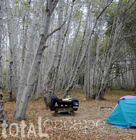
Lost Coast Camping, NorCal The USA Lumber Company ran a big wood mill on this part of the redwood coast back in the early days. This camp's name gets shortened to USAL. Usal Beach Campground near Shelter Cove, California This idyllic prime yet primitive, hard-to-reach beach campground is tucked well away from the crowds along the Pacific Coastal Hwy 1.  The region is California BLM land King Range National Conservation Area, or better known as the Lost Coast of California ... a famous stretch of wilderness coastline in between Mendocino and the Humboldt Redwoods. Dense forests and steep terrain located on the county line of Mendocino & Humboldt. Sinkyone Wilderness State Park is nearby. Usal Camp is the only place for drive-up car camping on the beach front in Northern Cal. All other developed camps in the area are located further inland (with forested surroundings), or backpacking, hike-in primitive campsites. Usal Campground on Usal Creek , has several idyllic se

Trinity Alps Wilderness Topo Map

Image
Trinity Wilderness Map  new edition 2013  After 2 years outta stock status the Trinity Alps Wilderness Map is finally back in stock at Total Escape. USDA recently updated, reprinted and released this long-waited NorCal title and we expect it to be a great seller (just like the last version was). Backpacking, day hiking, horseback, high elevation camping - all campgrounds, roads, trails, waterfalls, lakes, mountain peaks and trailheads. Trinity River, Salmon River, Klamath River, Highway 96, Highway 3, Forks of the Salmon. Surrounded by Six Rivers National Forest and Trinity National Forest, both west of Interstate 5 in Northern California.   nearby towns include -  Douglas City, CA Etna, CA Fort Jones, CA French Gulch Gazelle, CA Happy Camp, CA Helena Junction City Lewiston, CA Orleans, CA Trinity Center Weaverville, CA Willow Creek Yreka, CA   Big Foot in Happy Camp, CA

Best Hidden Campsites

Image
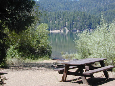
Hidden Campsites small campgrounds, tent camping, free camping We know, we know, you want a lake to yourself and don't really wanna share a huge campground with hundreds of other folks. Picking a decent campground online is difficult enough - with the numerous managing agencies , confusing park names, long driving times, freeway routes and hefty reservation fees. Avoid reservations all together and discover travel off the beaten path. Mid week campground stays can be better than weekends, but during summertime all week long is peak season w/ maximum visitors circulating. Neighbors at camp can often mean annoyances - children, generator noise, vehicle engines, boating trailers, music and partying. Quiet time is usually 10pm to 7am, but that doesn't mean the loud garbage truck won't wake you at 6:50am. big campgrounds vs. small Big campgrounds are developed parks with more than 20 camp sites, usually found along paved roads and highways. Level tent spots, pa

Lily Pad Campground

Image
Lilypad Campground @ Lake Wishon Reservoir Sierra National Forest, California The long journey up the mountain into the Sierra National Forest is only for the true adventure seekers. First off, get a good forest map . Second, plan several days if not a full week off of work to explore this region in depth. It is a long drive from most anywhere in California, and this spot is way, way tucked back in there right up against the High Sierra peaks and wildness. East of in Fresno, historic village of Clovis is a good lunch stop in route. Drive up mountain on Hwy. 168, turn right at Shaver Lake on to Dinkey Creek Rd. Now you will clock the mileage 28.7 miles to the camp. Drive past McKinley Grove and past Dinkey Creek. Follow signs to Wishon Reservoir. This campground is located adjacent to the road before you reach the dam. All this travel time will have you asking 'is it worth it'? The answer is 'yes'..... if you want an uncrowded lake with plenty of wi

Fossil Falls on Hwy 395

Image
While it may be a bit hot to visit here during summer, I thought I would let everyone know about this awesome "stretch break" along US Hwy 395 , where the Mojave meets the Sierra Nevada. When you are on your way northbound toward Bishop, entering the lava corridor of the Eastern Sierra, look for a red cinder cone volcano on the right side of the highway. This easy to miss turn off is after Little Lake (which is the remains of a burnt hotel) & before Coso Junction. If you are driving over 55 mph, you may actually miss it. To find Fossil Falls (which is not a waterfall anymore) -- turn right off Highway 395, on to a well marked gravel road called CINDER ROAD. High clearance vehicle is not required. Follow road to the right w/ signs approx. 1 mile & you will be at a small primitive BLM campground & trailhead parking lot. Surrounded by a field of black lava chunks, the Sierra Nevada mountains to the west and Death Valley Park to the east. New picnic tables &

Free Lake Campsite

Image
Brewer Lake Campsite , a photo by totalescape.com on Flickr. If you still need me to spell it out - in every photo, in every forest, at each lake, enticing descriptions - every year, year after year.... just so you can be inspired to go outside and enjoy California, I will do so repeatedly. Or you could just cruise thru the years of archives on this California Back Roads Blog . Some of my suggested destinations require a 4x4 to reach, but many do not. Maps are essential. Road trip ideas and cheap travels await. Please also visit my ancient totalescape.com web site. California LAKES LIST Eastern Sierra Lakes Lassen Lakes Sequoia Lakes Shasta Lakes Sierra Nevada Lakes Wilderness Lakes Yosemite Lakes

Map Availability

Image
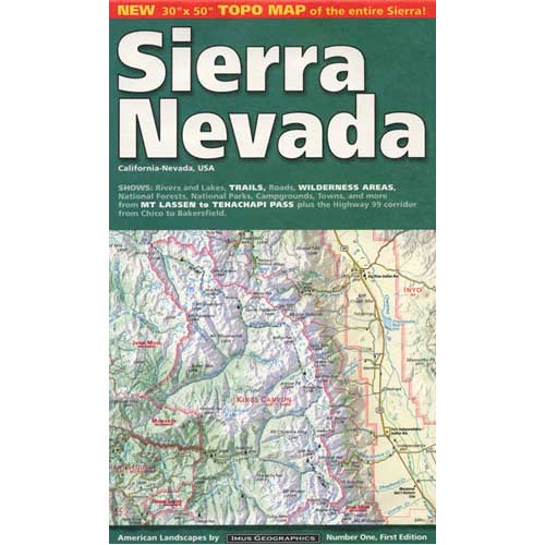
Maps can save your life. Maps can get you un-lost and can show you the way. Maps are your escape route outta the city. In a digital world where we are so connected w/ internet, smartphones and GoogleMaps, it is amazing that folks can find there way to real back roads of California. Don't be shocked when your digital signal drops at the wilderness edge and you are finally "away". Most online map sources are NOT accurate beyond the city limits, much less the forest boundary. Seriously folks, THEY don't want you out there. There is no place in the Wilderness to spend any money. Many have not properly logged the back roads yet, or perhaps they just won't make it available to the general public. You'll be lucky if they get the road number correct. BACK ORDERED / BACKORDER? OUT OF PRINT, OUT OF STOCK Availability of good maps is an ongoing issue. It's a unique factor in the map selling business. Although Total Escape carries a variety of Californ

California Gear

Image
Camp diva DanaMite is totally re-working the GEAR store on Total Escape this summer, building new product pages and working them into the map store for ease of shopping and a place for ever expanding inventory. Kayaks to camp stoves, bear canisters to BBQs, we have your outdoor gear covered. totalescape.com/gear/ camp gear GPS units camp storage camp lighting outdoor radios camp tents camp chairs camp soaps campfire pits outdoor stoves sleeping bags

Camp Gift

Image
Need to get a gift for the outdoor person in your life, well we can show you some great, inexpensive items. Stuff that every hikers or camper could use. Waterproof maps are by far the easy choice, but deciding on a local region might be a bit difficult. Yosemite maps and Sequoia are popular choices, but so is Death Valley. TIP: pick the next place you want to vacation with them. See all CAMP GEAR here. Below are some 'outdoor gift' items that DanaMite recommends.