Posts

Showing posts with the label National Park

California Wildfire Affected Areas: Dixie Fire

Image
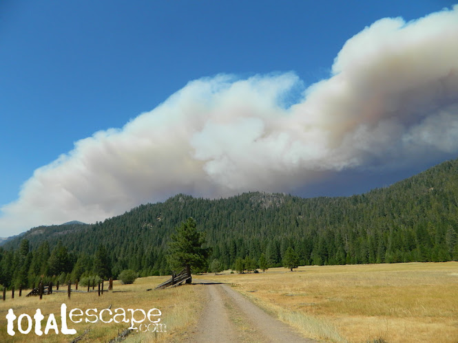
Dixie Fire 2021    963,309 Acres burned Butte County, California Plumas County, California Lassen County, California Shasta County, California Tehama County, California Almanor, CA Belden Town, CA Bucks Lake, CA Buntingville, CA Butte Meadows, CA Canyondam, CA Chester, CA Clear Creek, CA Crescent Mills, CA Greenville, CA Jonesville, CA Keddie, CA Meadow Valley, CA Milford, CA Mill Creek, CA Old Station, CA Taylorsville, CA Tobin, CA Twain, CA Westwood, CA   CA SR 70 (Highway 70 N Feather River Canyon) CA SR 36 (Highway 36 E) CA SR 89 (Highway 89) CA SR 44 (Highway 44)   Areas affected by this wildfire: Lassen Volcanic National Park  Lassen National Forest Lassen Volcanic Wilderness Caribou Wilderness Plumas National Forest Bucks Lake Wilderness  Taylorsville County Park Mount Hough State Game Refuge PCT Pacific Crest Trail (Bucks Lake to the Hat Creek Rim) Feather River North Fork  Susan River Headwaters Bucks Lake Beach Antelope Lake Bucks Lake Butt Valley Lake Butte Lake Caribou La

Cold Springs Campground

Image
Mineral King Campground, Sequoia NP Sequoia National Park: Cold Springs Campground in Mineral King Area A large developed camp ground with bear lockers, a raging creek, some walk in sites, & access to the Sierra Nevada high country trails. This is the last real campground in the main valley, everything beyond this spot is pure alpine highcountry. 9000'-13,000' peaks - in the Southern Sierra Nevada mountains. Car camp, tent camping or bring a backpack and climb to pristine lakes and into the real Wilderness. Cold Springs Campground, California on the East Fork of the Kaweah River, closest campground to the hiker trailheads @ Mineral King Valley. Mineral King Road open May-October (usually, depending on snow) Atop the mighty canyon sits mountain passes, peaks and lakes above 10,000' elevation. A rocky alpine valley of wonder and water, granite, dark skies and a good night sleep. Black bears and hikers are everywhere, anytime. This sweet spot river campgrou

Bass Lake Camping

Image
Bass Lake is a very popular outdoor recreation area in Gold Country California. Lake Camping, due mainly to the fact that it is next to Yosemite National Park 's south entrance, Hwy 41. Bass Lake has good fishing, boating, plenty campgrounds & this pine forested lake is close to the Central Valley, north of Fresno, CA. aka - Crane Valley Reservoir  Crane Valley Dam Bass Lake offers outdoor recreation: marinas, fishing, permits, public boat launches, boat rentals, kayak rentals, jet ski rentals, horseback rides, horseback and hiking trails. Residential cabins, homes and condo neighborhoods surround the lake on all sides. There are numerous Sequoia Groves tucked way back near Yosemite, behind Bass Lake in Sierra National Forest. Miles and miles of forest roads to explore will lead to secluded, primitive camp sites (free), small campgrounds, creek fishing, lake fishing and recreation, higher elevations, backpacker trailheads, hiking trails, kayaking creeks and rock cli